Strawcutter Trail
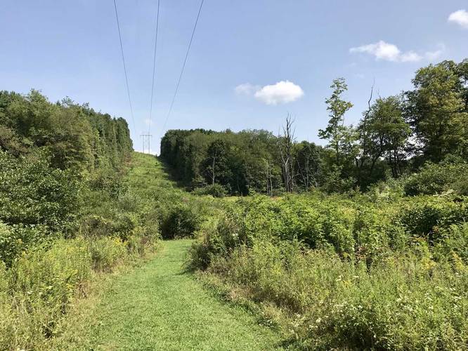
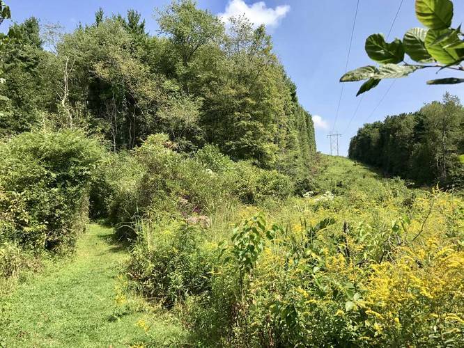
The best part about this trail is closest to the road where the power lines and McCune Run cuts through the trail with nice views of wildflowers and the surrounding hills.
Dogs allowed, but no biking on this trail.
Follow the yellow blazes, but note that most trails at Keystone State Park use yellow blazes, so check your map often at each intersection.
Know Before You Go
Interactive topographic map for Strawcutter Trail located in Derry, PA. Click the "View Map" button to load GPS coordinates and trail markers.
View map
Get directions
- Distance
- 0.9 mi
- Difficulty
- Easy
- Type
- Out-and-Back
- Est. Time
- 27 min
- Elev. Gain
- 132'
- Rating
- 0.0
- Added
- August 26, 2017
- Updated
- June 10, 2018
Weather Forecast
Don't let Google decide who you trust.


Loading...
<strong>Trail map and elevation chart not rendering in print mode?</strong> Simply scroll to the trail map section, then try printing again!
Total Change
127 ft.
39 m
39 m
Ascent
132 ft.
40 m
40 m
Descent
134 ft.
41 m
41 m
Loading...
Features
- Vista / Lookout Point
- Dogs
- Water Source
Points of interest
-
Parking
40.373495, -79.363658 -
Main Trailhead
40.37325, -79.364023 -
Below the hills and under the powerlines
40.373633, -79.364236 -
Wildflowers below the powerlines
40.373944, -79.364058
Safety information
For your own safety: plan ahead, let someone know where you'll be, and hike at your own risk.
Markers
Blaze Color
Yellow
e5e500
Availability
All seasons
Surface type
Dirt
Trip Reports (Reviews)
Ready to help fellow hikers? Add a trip report to share your experience!
No community routes found. To add your own hike as a Community Route for this Trail guide, leave a Trip Report with an attached GPX file.


You may also like

Explore
Pennsylvania's Grand Canyon
Explore Pennsylvania's Grand Canyon, officially named Pine Creek Gorge, including hiking trails, vistas, overlooks, waterfalls, backcountry campsites, backpacking trails.

Explore
New York's Best Waterfalls
Whether you're planning a day hike, roadside stop, or a leisurely short walk, this guide provides hikers, travelers, and locals alike with 63 different locations to over 100 scenic waterfalls to help plan your next adventure!

Explore
25 Best Day Hikes in West Virginia
Discover 25 of the best day hikes in West Virginia, from scenic overlooks to wilderness trails—perfect for every level of hiker.

Explore
Best of the Alps: Hiking, Adventure & Scenery
Plan your ultimate European Alps adventure! Discover the best hiking trails, epic scenery, and villages in the Swiss Alps, Dolomites, Chamonix, and Lake Como.
keystone state park

