Loading...

Distance:
0.4 Miles / 0.6 km
Type:
Out-and-Back
Difficulty:
Easy
Time to Hike:
~12 minutes
Features:
Surface Type:
Dirt
Park:
Kane Woods Nature Area
Town:
Scott Township, Pennsylvania
Directions:
40.38014, -80.08608
Added:
February 10, 2018
Updated:
June 10, 2018

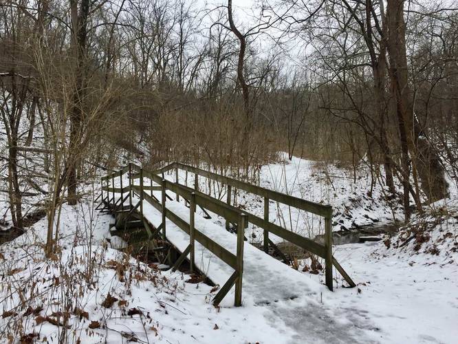
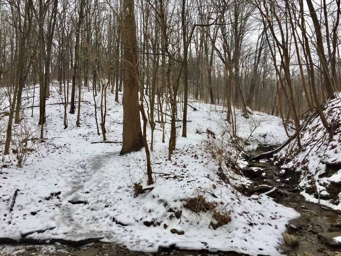
The Tom Tinker Trail at Kane Woods Nature Area in Scott Township, Pennsylvania is an easy 0.6 mile out-and-back trail that leads from the main parking area over to the eastern portion of the Liberty Trail. This trail is likely the most scenic trail at Kane Woods and runs directly along a creek with small slate rock waterfalls.

The trail is essentially flat, until you reach where two main creeks merge to form one creek - there's also a bench at this intersection. You'll cross the creek on a wooden bridge, but at the creek junction, there's no bridge - you may need to hike through a small amount of water depending on the time of year.

Dogs are allowed, but no biking.

Note: This trail is listed as 0.6 miles out-and-back; however, it's really just a 0.3 mile one-way trail. If you plan to hit each trail at Kane Woods in one day, you'll likely end up hiking one of the trails out-and-back since there's an odd number of trails to form a loop.

Explore 213 trails near Scott Township, PA
  1. Parking

    40.38014, -80.08608
  2. Main Trailhead

    40.379975, -80.085788
  3. Creek crossing with footbridge

    40.378808, -80.085022
    Creek crossing with footbridge
  4. Trail crosses the creek

    40.3775, -80.084175
    Trail crosses the creek
  5. Small 2 - 3 foot waterfall

    40.376611, -80.084519
    Small 2 - 3 foot waterfall
Explore other trail routes for this hike, added by the MyHikes Community via Trip Reports.
No community routes found. To add your own route as a Community Route for this Trail guide, please leave a Trip Report with a GPX file on this Trail.

Hazards

Ticks - Lyme Disease More Info (CDC)

Seasons

All
Loading...
Loading...
43 '

Total Change
80 '

Ascent
80 '

Descent

Photo Albums

3 Trip Reports

No Star-Ratings
Write-up by:
Admin user profile picture
0.4 miles / 0.6 km
Trail added
February 10, 2018
Hiked on
February 10, 2018
Updated on
June 10, 2018
0.4 miles / 0.6 km
February 19, 2021
Hiking
0.4 miles / 0.6 km
February 23, 2018
Hiking

Weather Forecast

In Scott Township, PA

Explore Hiking Trails

New Hikes

Almond-Hornell Overlook
0 Miles
0 km
Easy
Out-and-Back
Hike to Tamarack Falls
1.3 Miles
2.1 km
Easy
Out-and-Back
Double Run to Canyon Vista Loop
3.7 Miles
6 km
Moderate
Loop
Eternal Flame Falls via Eternal Flame Trail
1.2 Miles
1.9 km
Moderate
Out-and-Back

Before you leave...

MyHikes is an indie web platform aimed to make exploring public trails easier for everyone. The site has no investors and is owned and operated by one person, Dave Miller (Founder & Admin). As the Founder, main contributor, and doer-of-all-things for MyHikes, I share my trips with over-detailed write-ups for fun on a volunteer basis and I believe that public trail information should be available to everyone.

It takes a lot of time 🕦, money 💰, and effort (including espresso shots ☕) to run MyHikes, including hiking , mapping , writing , and publishing new trails with high-quality content... along with building new features, moderating, site maintainance, and app development for iOS and Android . I simply ask that if you find MyHikes' trail guides helpful to please consider becoming a Supporter to help keep the site, iOS, and Android apps available to everyone.

Supporters unlock website and in-app perks with a one-time payment of $25 (you renew) 😎👍. Or you can simply make a Donation of your choice without a MyHikes user account. Otherwise, telling your friends about MyHikes is the next-best thing - both quick and free 🎉

Thanks for visiting MyHikes and have a great hike!️

Admin user profile picture

Dave Miller
MyHikes Founder & Admin