Joe's Rock in Wrentham, Massachusetts is a moderate 0.6-mile loop hike that features pond views from a bedrock outcropping known as Joe's Rock.
Hike Description
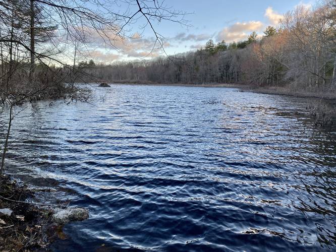
This hike begins at the main parking lot and trailhead for Joe's Rock at the coordinates provided and follows the trail as it heads north toward the pond. At the pond, hikers will take a right-hand turn to start heading up the nearby hill that features Joe's Rock. The uphill is fairly short, but on the steeper side, hence the moderate difficulty. On the way up, hikers will keep left at a fork in the trail. This left-hand turn leads directly to Joe's Rock.
Joe's Rock - Mile 0.2
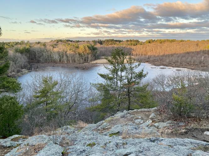
Around mile 0.2, hikers will reach the top of Joe's Rock which provides views of the surrounding area including the pond below your feet and some neighboring hilltops. The rock itself is a massive bedrock outcropping that sits on the side of the hill. Joe's Rock would be a great place for a sunset; however, I hiked this one right around sunrise which was also a really nice hike.
Hiking Out
After visiting Joe's Rock and taking in the views this track continues up the hill slightly, keeping right at all junctions, to reach the out-and-back trail that lead up to the loop. Then it heads down to the edge of the pond for another quick view and then reaches the parking lot for a ~0.6-mile hike.
Hours
This area is closed between sunset and sunrise every day. No trespassing between those hours.
Parking
Hikers will find a large parking lot at the coordinates provided along MA-121. The lot is large enough to fit a dozen cars or slightly more.
Pets
Dogs are allowed if leashed and must be cleaned up after.
Hike Description
This hike begins at the main parking lot and trailhead for Joe's Rock at the coordinates provided and follows the trail as it heads north toward the pond. At the pond, hikers will take a right-hand turn to start heading up the nearby hill that features Joe's Rock. The uphill is fairly short, but on the steeper side, hence the moderate difficulty. On the way up, hikers will keep left at a fork in the trail. This left-hand turn leads directly to Joe's Rock.
Joe's Rock - Mile 0.2
Around mile 0.2, hikers will reach the top of Joe's Rock which provides views of the surrounding area including the pond below your feet and some neighboring hilltops. The rock itself is a massive bedrock outcropping that sits on the side of the hill. Joe's Rock would be a great place for a sunset; however, I hiked this one right around sunrise which was also a really nice hike.
Hiking Out
After visiting Joe's Rock and taking in the views this track continues up the hill slightly, keeping right at all junctions, to reach the out-and-back trail that lead up to the loop. Then it heads down to the edge of the pond for another quick view and then reaches the parking lot for a ~0.6-mile hike.
Hours
This area is closed between sunset and sunrise every day. No trespassing between those hours.
Parking
Hikers will find a large parking lot at the coordinates provided along MA-121. The lot is large enough to fit a dozen cars or slightly more.
Pets
Dogs are allowed if leashed and must be cleaned up after.