Inspiration Point to Lower Falls at Letchworth State Park near Portageville, New York is a moderate 2.4-mile out-and-back hike that leads to one of the best viewpoints at the park and leads down to views of the scenic Lower Falls within the gorge.
Fast moving water: In addition to fall dangers, this trail runs along the scenic but deadly Genesee River. The shale banks of the gorge do not provide much safety for curious visitors who want to explore the river. In addition to drowning risks, if you get injured and swept downstream there are massive waterfalls with huge drops that are not survivable. Always stay on-trail here.
Trails
This hike follows two named trails: Gorge Trail (pink blazes), Lower Falls Footbridge Trail (orange blazes).Exploring Inspiration Point
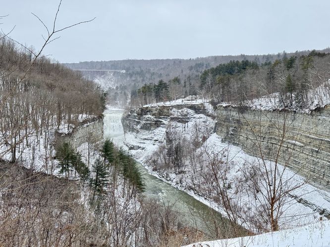
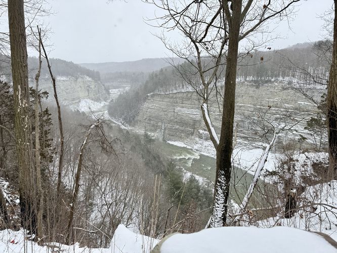
This hike begins just a stone's throw away from Inspiration Point, which is the first stop along the route. Hikers will head in from parking to reach the Gorge Trail and will find Inspiration Point within a few-hundred feet. Inspiration Point, one of Letchworth State Park's most-photographed views, sits high above the gorge with a view of Middle Falls with the Genesee Arch Bridge towering behind. From Inspiration Point, the hike is certainly not over as you have over 2.3-miles left to explore along the Letchworth gorge.Hiking to Letchworth's Lower Falls
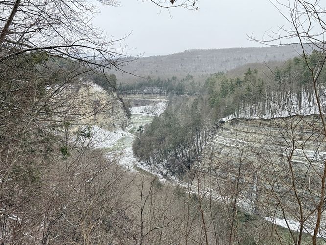
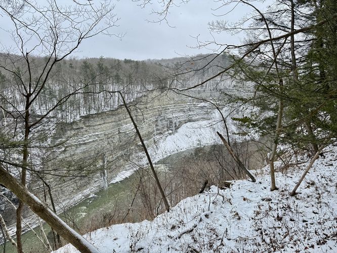
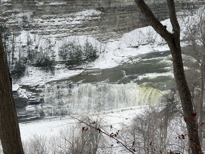
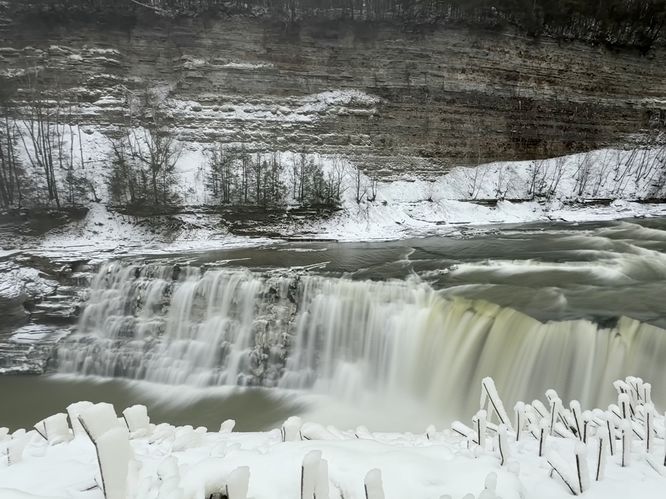
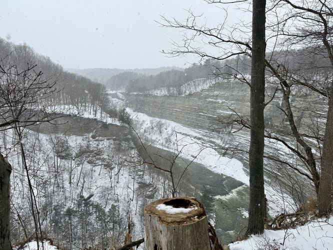
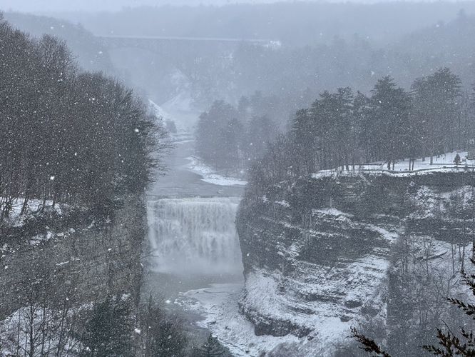
The hike from Inspiration Point down to Lower Falls is fairly straight forward. After leaving Inspiration Point, you'll follow the pink blazes of the Gorge Trail as it leads out to an open area with different viewpoints of the gorge and the Genesee River, located around mile 0.1 in the route provided. If you skip these views, you'll have another chance to explore them on the hike out. The Gorge Trail passes through groves of eastern hemlock trees, which during the winter, makes for additional scenery if snow is sitting in these tree's boughs. Eventually, the trail will lead downhill for a ways before leveling out near the Easy View of Lower Falls viewpoint, located around mile 0.85. After exploring Lower Falls from high above the gorge, you'll want to see it up close. Follow the orange blazes of the Lower Falls Footbridge Trail down to reach the best view of Lower Falls from directly above it. Hikers will reach Lower Falls around mile 0.97 where you'll find this scenic waterfall. Lower Falls cascades down the bedrock at approximately 15 to 20-feet tall, but spans the width of the Genesee River, creating a spectacular sight.Waterfall Views & Stone Footbridge - Mile 1.1 to 1.3
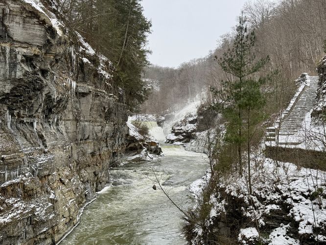
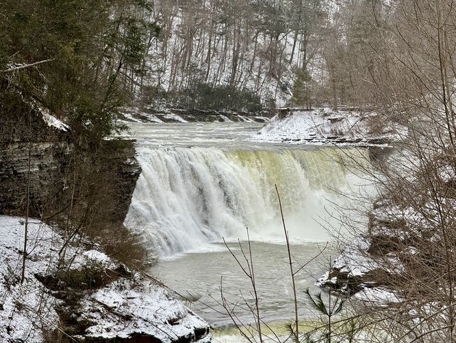
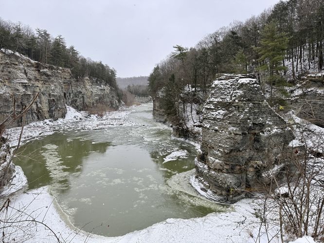
After exploring Lower Falls, this route leads hikers further northeast along the trail as it leads directly into the gorge to reach a scenic stone footbridge that spans the Genesee River. Around mile 1.1, you'll locate the stone staircase where you'll find some of the best downstream views of Lower Falls without being right on top of the waterfall. Further down the trail lies the stone footbridge that spans Letchworth Gorge and connects to East Park Road, if you follow the trail all the way out. This route stops at the top of the footbridge where we enjoyed views in both directions — southward to view Lower Falls and northward to view the Genesee River as it cuts through the bedrock of the gorge. We even found massive icicles clinging to the gorge walls. After exploring the footbridge, the route leads back up the staircase and out to one last view from this section of the gorge — that of the Genesee River where it bends around the bedrock to had northbound.Hiking Out - Mile 1.3 to 2.4
After exploring the views near Lower Falls, the trail loops back up to the Easy View of Lower Falls viewing platform before it follows the pink blazes of the Gorge Trail back to parking. Along the way are at least one semi-obstructed view of Letchworth Gorge, but don't forget to explore the north and south-facing views near Inspiration Point. Last, this route stops at Inspiration Point one more time before wrapping up the hike. Inspiration Point, despite being next to the parking lot, is a great place to take-in the best views of Letchworth Gorge, so it's worth exploring one last time. During our hike here, we began with beautiful views into the gorge from Inspiration Point, but wrapped up with snow squalls obstructing the view, at least of the Genesee Arch Bridge. The hike ends at parking at mile 2.4 for an easy-to-moderate hike.Parking & Fees
Visitors will find a large parking lot at the coordinates provided, located at the main lot for Inspiration Point in the park. The lot is large enough to fit about two dozen of vehicles as of January 2025. To enter Letchworth State Park, during seasonal ticketing, as of 2024 the entry fee is $10 per vehicle.Pets
Dogs are allowed only if leashed and must be cleaned up after.Warnings
Steep cliffs: Always stay on-trail for this walk to ensure your own safety. Some of the cliffs at Letchworth are sheer drops of over 100-feet.Fast moving water: In addition to fall dangers, this trail runs along the scenic but deadly Genesee River. The shale banks of the gorge do not provide much safety for curious visitors who want to explore the river. In addition to drowning risks, if you get injured and swept downstream there are massive waterfalls with huge drops that are not survivable. Always stay on-trail here.