The Iliau Trail at Waimea Canyon State Park in Waimea, Hawaii (Kauai) is an easy 0.3-mile loop trail that features stunning views of Waimea Canyon, but also features the rare and beautiful plant iliau, which only grows on the island of Kauai.
Hike Description
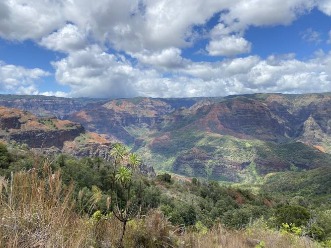
This trail begins along Kokee Road where initially hikers are greeted with a stunning view of Waimea Canyon along with a bench for sitting and enjoying the view. The trail splits at the bench and this track heads in a clockwise direction for an easy hike.
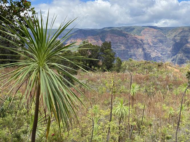
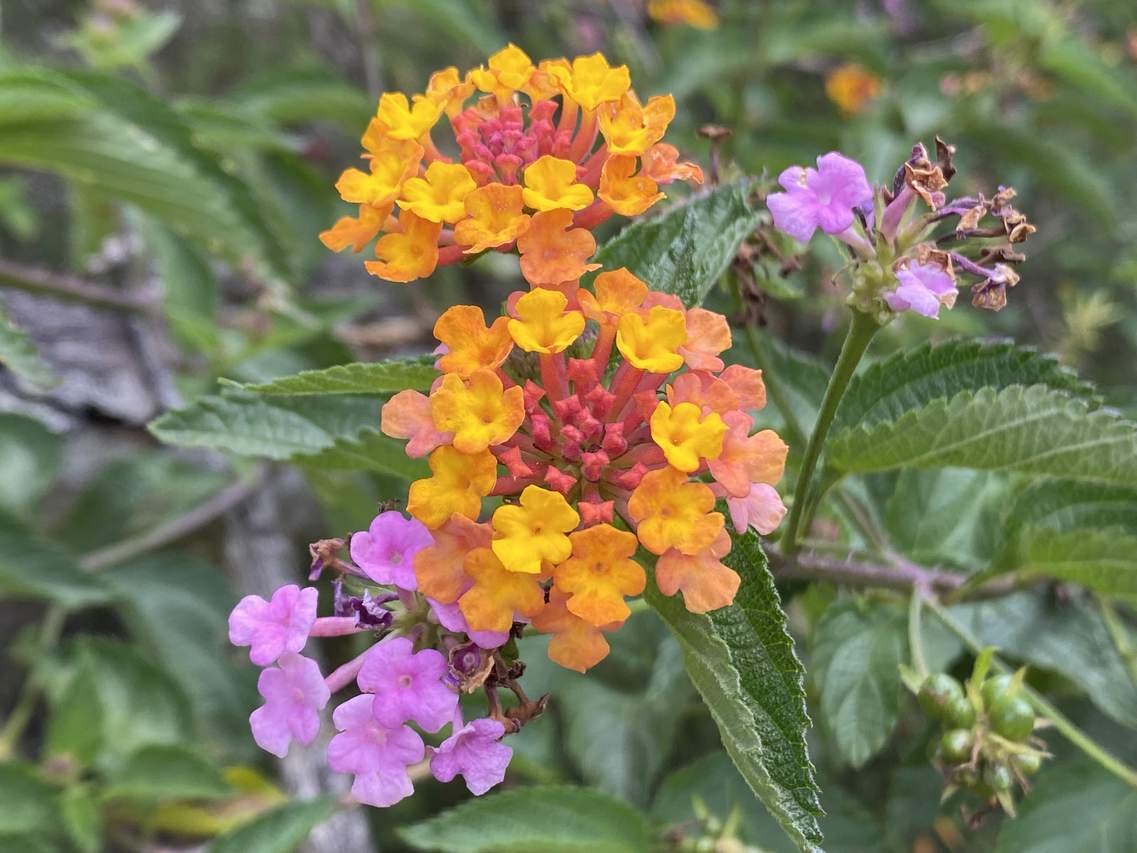
Along the way, hikers will find interpretive signs for a self-guided tour of Kauai's native plant species. The most important plant along this trail is the Iliau - a tall plant with spiky leaves at the top. This plant only grows on the island of Kauai - similar to the Silversword plant that only grows in Maui's Haleakala Crater. The Iliau may remind some hikers of scenes from Jurassic Park, since a large portion of the movie was filmed on Kauai. Another popular species of plant that grows here is the colorful Lantana, which grows like a tree in Hawaii and less like ground cover in places where this plant is an annual for landscape decor.
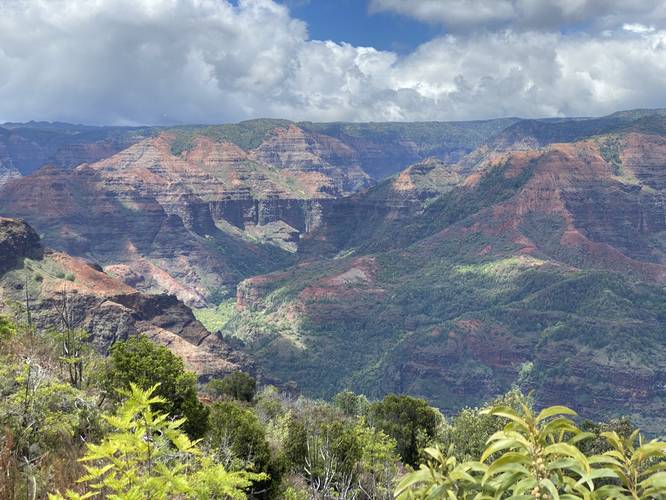
On the eastern side of the loop, hikers will find breathtaking views of Waimea Canyon, with some iliau in the foreground. Within the canyon, hikers can spot a massive waterfall spilling down about 1,000-feet or more into the canyon below.
Eventually the trail will reach a junction - if headed clockwise, stay right here to head back to parking.
Parking
Hikers will find parking turnouts by the trailhead, but there's no defined parking lot. There's enough room for about 8 vehicles or less and folks can park down the road a bit if needed.
Warning
Cliff edge: Along the northeast section of the loop is a great vista opportunity; however, there's also a steep ledge here. Watch your step and wear appropriate footwear.
Respecting the Land
Hawaiian land is considered sacred to native Hawaiians and many locals, so please stay on-trail, take nothing but photos, and leave nothing but footprints. Respect the locals - don't stay for long and have a backup hike planned in case the parking lot is full.
Hike Description
This trail begins along Kokee Road where initially hikers are greeted with a stunning view of Waimea Canyon along with a bench for sitting and enjoying the view. The trail splits at the bench and this track heads in a clockwise direction for an easy hike.
Along the way, hikers will find interpretive signs for a self-guided tour of Kauai's native plant species. The most important plant along this trail is the Iliau - a tall plant with spiky leaves at the top. This plant only grows on the island of Kauai - similar to the Silversword plant that only grows in Maui's Haleakala Crater. The Iliau may remind some hikers of scenes from Jurassic Park, since a large portion of the movie was filmed on Kauai. Another popular species of plant that grows here is the colorful Lantana, which grows like a tree in Hawaii and less like ground cover in places where this plant is an annual for landscape decor.
On the eastern side of the loop, hikers will find breathtaking views of Waimea Canyon, with some iliau in the foreground. Within the canyon, hikers can spot a massive waterfall spilling down about 1,000-feet or more into the canyon below.
Eventually the trail will reach a junction - if headed clockwise, stay right here to head back to parking.
Parking
Hikers will find parking turnouts by the trailhead, but there's no defined parking lot. There's enough room for about 8 vehicles or less and folks can park down the road a bit if needed.
Warning
Cliff edge: Along the northeast section of the loop is a great vista opportunity; however, there's also a steep ledge here. Watch your step and wear appropriate footwear.
Respecting the Land
Hawaiian land is considered sacred to native Hawaiians and many locals, so please stay on-trail, take nothing but photos, and leave nothing but footprints. Respect the locals - don't stay for long and have a backup hike planned in case the parking lot is full.


%20Trail%2FIMGP6744_edited%20(1)_20180903223800UTC.jpg)