The Honolua Bay Trail near Kapalua, Hawaii (Maui) is an easy 0.6-mile out-and-back hike that leads through a lush rainforest jungle and out to Honolua Bay, a popular snorkel spot, that features views of the island of Molokai.
Hike Description
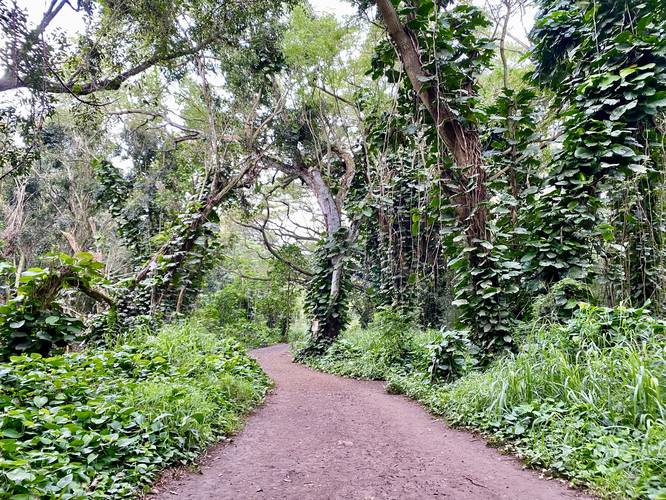
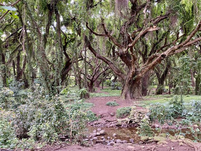
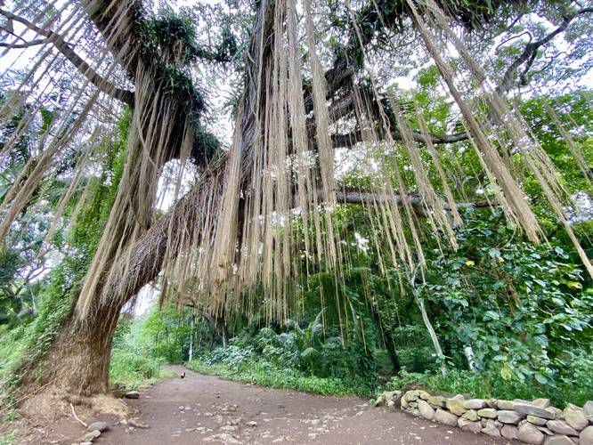
This hike begins at the main parking area for the "Honolua Park" and follows the main trail heading west, which is all technically private property. The trail starts off by following a stream as it passes through a lush rainforest jungle with myriad shades of green and blooming trees.
Just before reaching the beach, hikers will reach a trail junction turn that crosses the stream, if you wish to follow it. If you cross the stream, you can hike up a short spur trail to reach the road once again, before hiking back down through additional rainforest landscapes; however, this GPS track skips that crossing and continues down to the rocky beach.
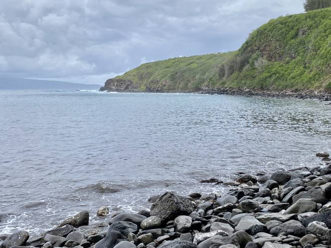
Upon reaching the end of the trail, the hiker is presented with views of Molokai in the distance at the rocky beach of Honolua Bay. On a good day surfers might be catching a wave to the north, Molokai might be fully sun-lit on the horizon, or you might spot a humpback whale (during Winter) or a pod of dolphins.
Pets
Dogs are not allowed.
Parking
Hikers will find a small parking lot at the coordinates provided, which is large enough to fit less than a dozen vehicles. As of February, 2023, this is the only legal parking lot for this hike.
Popularity
This trail is quite popular and thus the parking lot fills up quickly. In order to get a parking spot, showing up earlier in the day is your best bet.
Warning
Falling branches / trees / coconuts: As the signs state, this area is known for its random falling branches, trees, and coconuts. Hike at your own risk.
Private property: This trail follows private property that the land owner has graciously given the public access to. Please follow and abide by their written rules. According to signs, they monitor the trail likely with trail/game cameras, so be respectful.
Respecting the Land
Hawaiian land is considered sacred to native Hawaiians and many locals, so please stay on-trail, take nothing but photos, and leave nothing but footprints. Respect the locals - don't stay for long and have a backup hike planned in case the parking lot is full.
Hike Description
This hike begins at the main parking area for the "Honolua Park" and follows the main trail heading west, which is all technically private property. The trail starts off by following a stream as it passes through a lush rainforest jungle with myriad shades of green and blooming trees.
Just before reaching the beach, hikers will reach a trail junction turn that crosses the stream, if you wish to follow it. If you cross the stream, you can hike up a short spur trail to reach the road once again, before hiking back down through additional rainforest landscapes; however, this GPS track skips that crossing and continues down to the rocky beach.
Upon reaching the end of the trail, the hiker is presented with views of Molokai in the distance at the rocky beach of Honolua Bay. On a good day surfers might be catching a wave to the north, Molokai might be fully sun-lit on the horizon, or you might spot a humpback whale (during Winter) or a pod of dolphins.
Pets
Dogs are not allowed.
Parking
Hikers will find a small parking lot at the coordinates provided, which is large enough to fit less than a dozen vehicles. As of February, 2023, this is the only legal parking lot for this hike.
Popularity
This trail is quite popular and thus the parking lot fills up quickly. In order to get a parking spot, showing up earlier in the day is your best bet.
Warning
Falling branches / trees / coconuts: As the signs state, this area is known for its random falling branches, trees, and coconuts. Hike at your own risk.
Private property: This trail follows private property that the land owner has graciously given the public access to. Please follow and abide by their written rules. According to signs, they monitor the trail likely with trail/game cameras, so be respectful.
Respecting the Land
Hawaiian land is considered sacred to native Hawaiians and many locals, so please stay on-trail, take nothing but photos, and leave nothing but footprints. Respect the locals - don't stay for long and have a backup hike planned in case the parking lot is full.