The Honey Creek Dam Ruins at Reeds Gap State Park is an easy 1.2-mile out-and-back hike that features native wildflowers, views of Honey Creek, and leads to old dam ruins.
Exploring the Honey Creek Dam Ruins
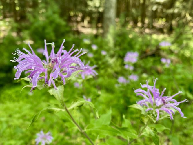
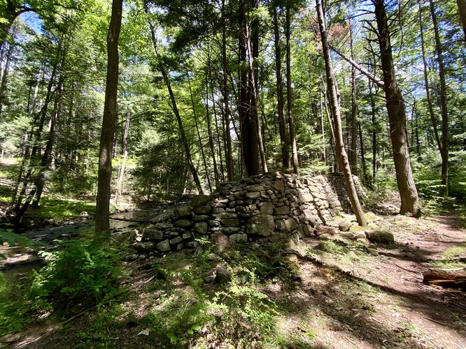
This hike begins at the very end of Campground Road at the park where hikers will find an extremely-large parking lot with a dead-end and a yellow service road gate. The trailhead is the service road gate -- hike down the service road to head toward Honey Creek. This hike accidentally, but happily lead us to the dead-end of the service road as we were looking for a connecting trail where we found an abundance of native wildflowers like pink Bee Balm, black-eyed susans and others during our hike here in July (2024). We then backtracked a few-hundred feet up the service road to reach the connector trail that lead over to Honey Creek. At Honey Creek, hikers will find the trail that runs westward along the creek with scenic views of the water along the way. Finally, hikers will pass the old dam ruins, located around mile 0.7 in this route's data. If you skip the wildflower field, you'll obviously reach the old dam ruins a bit sooner with less walking. After exploring the dam ruins, the hike leads right back to parking for a short and easy 1.2-mile out-and-back hike.
Parking
Hikers will find a massive parking lot along Campground Road at the park. The fastest way to reach the trailhead is to drive to the coordinates provided (40.72069, -77.47324) and drive to the end of the road.
Pets
Dogs are allowed if leashed and must be cleaned up after.
Warning
Buggy: During warm months, this trail can be very buggy especially along Honey Creek.
Exploring the Honey Creek Dam Ruins
This hike begins at the very end of Campground Road at the park where hikers will find an extremely-large parking lot with a dead-end and a yellow service road gate. The trailhead is the service road gate -- hike down the service road to head toward Honey Creek. This hike accidentally, but happily lead us to the dead-end of the service road as we were looking for a connecting trail where we found an abundance of native wildflowers like pink Bee Balm, black-eyed susans and others during our hike here in July (2024). We then backtracked a few-hundred feet up the service road to reach the connector trail that lead over to Honey Creek. At Honey Creek, hikers will find the trail that runs westward along the creek with scenic views of the water along the way. Finally, hikers will pass the old dam ruins, located around mile 0.7 in this route's data. If you skip the wildflower field, you'll obviously reach the old dam ruins a bit sooner with less walking. After exploring the dam ruins, the hike leads right back to parking for a short and easy 1.2-mile out-and-back hike.
Parking
Hikers will find a massive parking lot along Campground Road at the park. The fastest way to reach the trailhead is to drive to the coordinates provided (40.72069, -77.47324) and drive to the end of the road.
Pets
Dogs are allowed if leashed and must be cleaned up after.
Warning
Buggy: During warm months, this trail can be very buggy especially along Honey Creek.