This short hike at the Hofma Preserve in Grand Haven, Michigan is an easy 0.7-mile loop trail that features a peaceful walk through the woods.
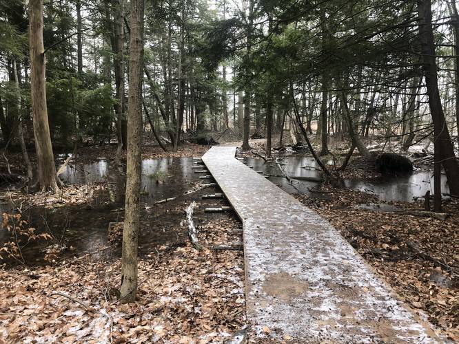
This hike was completed in winter 2020 and during this time, the trails were flooded out and hence, the recording stopped short of exploring more of Hofma Preserve. This trail is short and loops just south of the northern parking lot at Hofma Preserve.
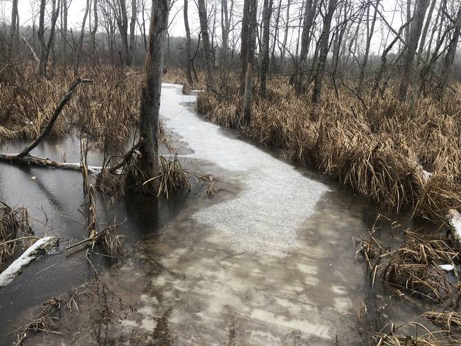
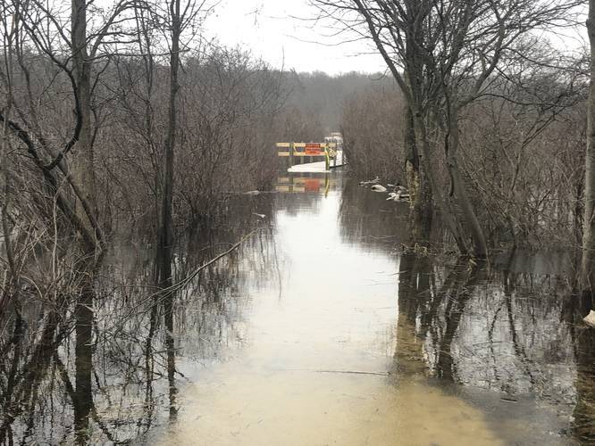
The trail begins by heading due south along the western edge of the property before taking a left-hand turn. Just after the first left-hand turn in the trail, this recording heads southeast toward an observation deck. Because of the flooding, the hiker was not able to reach the observation deck and continued the trail onward north heading toward another connector trail.
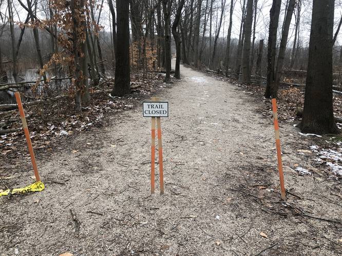
After visiting the observation deck spur trail, this recording attempts heading down the connector trail that leads further into the Hofma Preserve; however, because of seasonal flooding, the hiker turned around and continued north back to the parking lot.
This is not the most ideal track for hiking Hofma Preserve, but it's a perfectly short hike to include into a list of day hikes at Hofma Preserve. If planning to hike this trail, consider hiking the Hofma Preserve North Loop as well.
Pets
Dogs are allowed if leashed and their waste must be carried out by the hiker.
Parking
Hikers can find parking at the coordinates provided. The parking lot is small and only holds about a half-dozen vehicles. The parking area also has restrooms, picnic tables, and a playground.
This hike was completed in winter 2020 and during this time, the trails were flooded out and hence, the recording stopped short of exploring more of Hofma Preserve. This trail is short and loops just south of the northern parking lot at Hofma Preserve.
The trail begins by heading due south along the western edge of the property before taking a left-hand turn. Just after the first left-hand turn in the trail, this recording heads southeast toward an observation deck. Because of the flooding, the hiker was not able to reach the observation deck and continued the trail onward north heading toward another connector trail.
After visiting the observation deck spur trail, this recording attempts heading down the connector trail that leads further into the Hofma Preserve; however, because of seasonal flooding, the hiker turned around and continued north back to the parking lot.
This is not the most ideal track for hiking Hofma Preserve, but it's a perfectly short hike to include into a list of day hikes at Hofma Preserve. If planning to hike this trail, consider hiking the Hofma Preserve North Loop as well.
Pets
Dogs are allowed if leashed and their waste must be carried out by the hiker.
Parking
Hikers can find parking at the coordinates provided. The parking lot is small and only holds about a half-dozen vehicles. The parking area also has restrooms, picnic tables, and a playground.