The Hike to Right Angle and Ketchum Run Falls in Loyalsock State Forest near Forksville, Pennsylvania is an easy hike to a couple waterfalls along Ketchum Run. This area has many trails and options to lengthen the hike in various routes as out-and-backs or loops.
Hike:
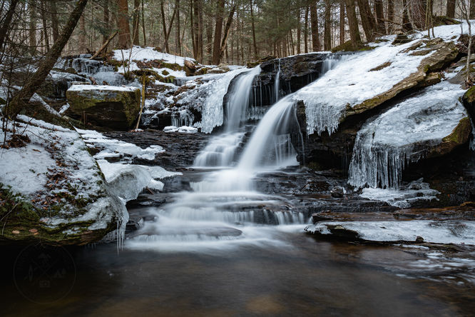
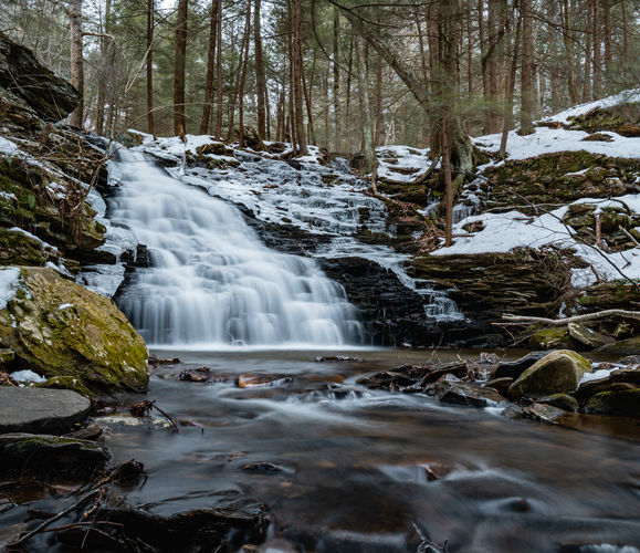
From the parking follow the trail on an old grade through the woods. This is a shared use trail and during my latest hike, we could see horse tracks in the mud. At about 0.3 of a mile, you will come to Fern Rock Nature Trail (FRNT) with yellow blazes with blue ferns painted in them. The trail continues straight but to add a little interest we turned left onto FRNT for about 0.2 of mile and it then crosses Ketchum Run Trail again. Once back on Ketchum Run Trail, it will be a short distance and the trail will connect with a trail blazed red and crosses Ketchum Run. This is roughly 0.6 of mile into the hike, do not cross the run, leave the blazed trail and follow an obvious but unblazed trail down the right side of the run. The first waterfall you come to will be Right Angle Falls and a short distance below is Ketchum Run Falls. There is also a stone fire ring near the top of Ketchum Run Falls.
Once you are done enjoying the area you can retrace your steps back to the car or extend your hike and continue following the run down to the Loyalsock Trail and follow the LT to Lee and Rode Falls if you want to check off a couple more waterfalls!
Parking:
There is a small pull off along High Knob Road with a Trailhead sign for Ketchum Run Trail at 41.439538, -76.625294.
Pets:
Dogs are allowed if leashed and should be cleaned up after.
Warning:
Timber Rattlesnakes: This area is home to the Timber Rattlesnake which can be found roaming the forest floor between the end of April and early October each year. Be on the lookout and give any rattlers you find plenty of space.
Hike:
From the parking follow the trail on an old grade through the woods. This is a shared use trail and during my latest hike, we could see horse tracks in the mud. At about 0.3 of a mile, you will come to Fern Rock Nature Trail (FRNT) with yellow blazes with blue ferns painted in them. The trail continues straight but to add a little interest we turned left onto FRNT for about 0.2 of mile and it then crosses Ketchum Run Trail again. Once back on Ketchum Run Trail, it will be a short distance and the trail will connect with a trail blazed red and crosses Ketchum Run. This is roughly 0.6 of mile into the hike, do not cross the run, leave the blazed trail and follow an obvious but unblazed trail down the right side of the run. The first waterfall you come to will be Right Angle Falls and a short distance below is Ketchum Run Falls. There is also a stone fire ring near the top of Ketchum Run Falls.
Once you are done enjoying the area you can retrace your steps back to the car or extend your hike and continue following the run down to the Loyalsock Trail and follow the LT to Lee and Rode Falls if you want to check off a couple more waterfalls!
Parking:
There is a small pull off along High Knob Road with a Trailhead sign for Ketchum Run Trail at 41.439538, -76.625294.
Pets:
Dogs are allowed if leashed and should be cleaned up after.
Warning:
Timber Rattlesnakes: This area is home to the Timber Rattlesnake which can be found roaming the forest floor between the end of April and early October each year. Be on the lookout and give any rattlers you find plenty of space.