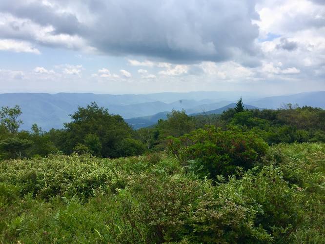
The Hidden Passage and Pipeline Lookout Trail is a moderate 5 mile out-and-back hike in the Roaring Plains Wilderness in Tucker County, West Virginia that leads to some of the best secluded views West Virginia has to offer, including a view down upon Seneca Rocks. This trail leads out to the pipeline at Roaring Plains and the Canyon Rim Trail, which has additional campsites and more views as well.
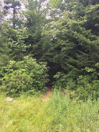
The trailhead for the Hidden Passage Trail starts just 100 feet east of the campsite along the Roaring Plains South Prong Trail. Please note: to start this hike you need to hike in at least 2.4 miles from the parking lot.
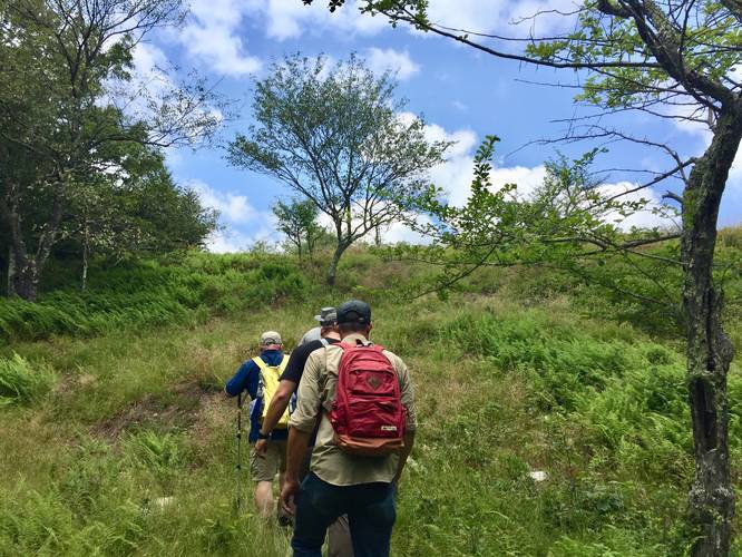
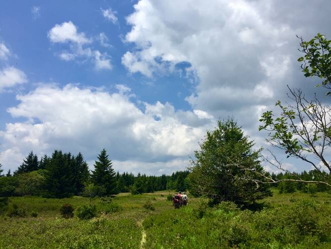
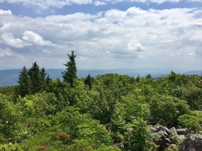
The trail first passes another small campsite just a few hundred feet in. Just beyond that campsite, the trail makes a sharp left-hand turn and heads up a small hill - this is important to note as you could easily miss this turn. Just beyond the sharp left-hand turn the trail will ascend a steeper hill to the top of Roaring Plains. From here the hike is easy as you walk through open fields of blueberry bushes and eventually to an amazing campsite along the Allegheny Front and Roaring Plains itself at mile 1.3 - with sweeping views of West Virginian mountain ranges.
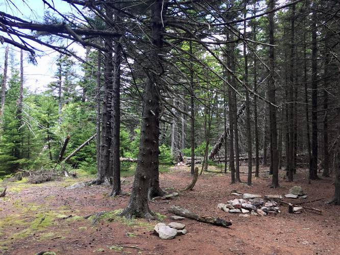
Hiking beyond the campsite, you'll find even better views and from here you can spot Seneca Rocks on a clear day far below. At mile 1.1 you'll reach another short trail on your right-hand side that leads to a conifer grove a large area for camping that could fit at least a few tents, but be careful as most of the trees surrounding the site don't look very alive.
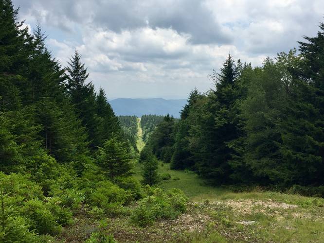
Hiking beyond these lookout points, the trail will eventually hit the pipeline trail at mile 1.8 - take a left-hand turn here to head down the pipeline hill and toward the crest of the ridge of the pipeline.
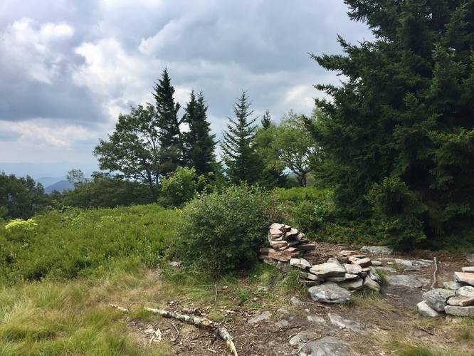
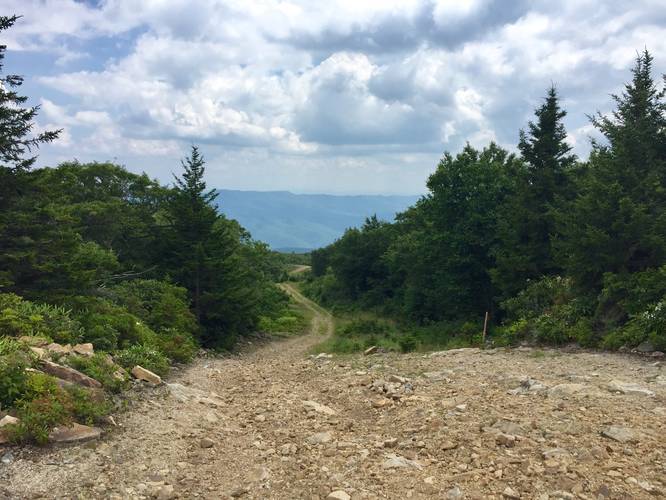
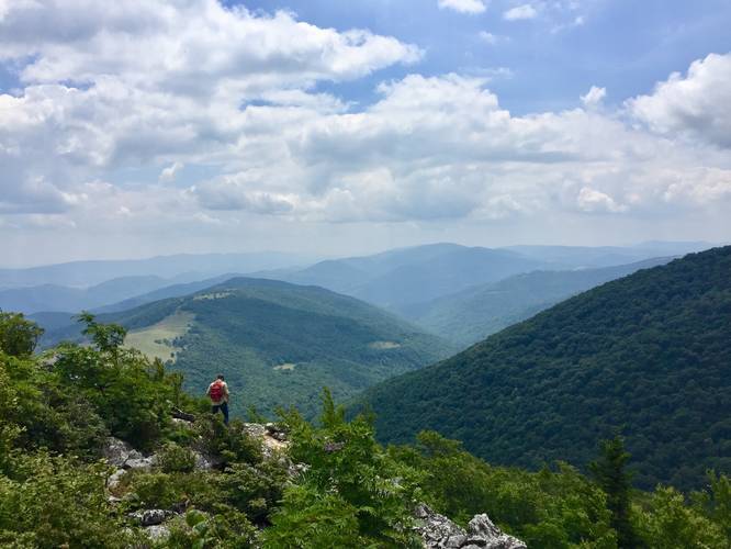
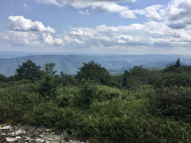
Pipeline Lookouts: From the crest of the far hill on the pipeline (about 0.6 miles from turning onto the pipeline), you'll reach a nice viewpoint on the pipeline itself just before the pipeline heads downhill again. From here you have two options - to each side of the trail are two small deer trails - these are the lookout trails. The deer trail on the right-hand side (heading southwest) is extremely difficult to navigate at 0.1 miles one-way - this is essentially bushwhacking, but the views are well worth it. Push your way through the brush and follow the narrow trail until you reach the rocky lookout point to the southwest. You'll know you've reached the lookout point when you're standing on solid rock without any blueberry bushes to wade through anymore. From here you can walk north and south along the rocks to get better views of the mountains and Seneca Rocks below. Heading back from the first trail, you can head across the pipeline again to a shorter trail that leads out to another rock pile and lookout, but the views aren't as good.
Heading back is not as easy on the pipeline since you have to hike up a steep grade to reach the Hidden Passage Trail again, but for the most part, the entire hike isn't difficult. Make sure to make a quick 0.6 mile out-and-back trip down the Canyon Rim Trail to see a similar view of the mountains and to also get a view of the pipeline lookout points.
Campsites: Mile 0.1 - right by the trailhead. Mile 1.1 - tucked away in the woods on a small trail. Mile 1.3 - campsite with a view along the ridge of Roaring Plains. Mile 2.2 - along the flatter parts of the pipeline could be some accessible camping if needed (no fires). Mile 2.2 - on the Canyon Rim Trail (add 0.3 miles one-way to get to the campsite from here).
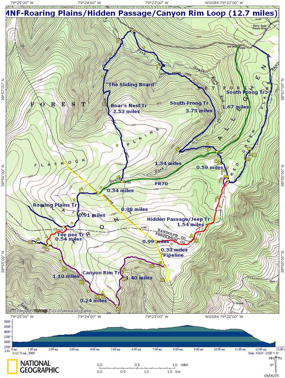
Be sure to checkout MidAtlanticHikes Roaring Plains trail map PDF.
Credit
This hike was originally shown to me by Tony Van Vugt who owns and runs HikingUpward.com in 2018, all credit goes to him.
The trailhead for the Hidden Passage Trail starts just 100 feet east of the campsite along the Roaring Plains South Prong Trail. Please note: to start this hike you need to hike in at least 2.4 miles from the parking lot.
The trail first passes another small campsite just a few hundred feet in. Just beyond that campsite, the trail makes a sharp left-hand turn and heads up a small hill - this is important to note as you could easily miss this turn. Just beyond the sharp left-hand turn the trail will ascend a steeper hill to the top of Roaring Plains. From here the hike is easy as you walk through open fields of blueberry bushes and eventually to an amazing campsite along the Allegheny Front and Roaring Plains itself at mile 1.3 - with sweeping views of West Virginian mountain ranges.
Hiking beyond the campsite, you'll find even better views and from here you can spot Seneca Rocks on a clear day far below. At mile 1.1 you'll reach another short trail on your right-hand side that leads to a conifer grove a large area for camping that could fit at least a few tents, but be careful as most of the trees surrounding the site don't look very alive.
Hiking beyond these lookout points, the trail will eventually hit the pipeline trail at mile 1.8 - take a left-hand turn here to head down the pipeline hill and toward the crest of the ridge of the pipeline.
Pipeline Lookouts: From the crest of the far hill on the pipeline (about 0.6 miles from turning onto the pipeline), you'll reach a nice viewpoint on the pipeline itself just before the pipeline heads downhill again. From here you have two options - to each side of the trail are two small deer trails - these are the lookout trails. The deer trail on the right-hand side (heading southwest) is extremely difficult to navigate at 0.1 miles one-way - this is essentially bushwhacking, but the views are well worth it. Push your way through the brush and follow the narrow trail until you reach the rocky lookout point to the southwest. You'll know you've reached the lookout point when you're standing on solid rock without any blueberry bushes to wade through anymore. From here you can walk north and south along the rocks to get better views of the mountains and Seneca Rocks below. Heading back from the first trail, you can head across the pipeline again to a shorter trail that leads out to another rock pile and lookout, but the views aren't as good.
Heading back is not as easy on the pipeline since you have to hike up a steep grade to reach the Hidden Passage Trail again, but for the most part, the entire hike isn't difficult. Make sure to make a quick 0.6 mile out-and-back trip down the Canyon Rim Trail to see a similar view of the mountains and to also get a view of the pipeline lookout points.
Campsites: Mile 0.1 - right by the trailhead. Mile 1.1 - tucked away in the woods on a small trail. Mile 1.3 - campsite with a view along the ridge of Roaring Plains. Mile 2.2 - along the flatter parts of the pipeline could be some accessible camping if needed (no fires). Mile 2.2 - on the Canyon Rim Trail (add 0.3 miles one-way to get to the campsite from here).
Be sure to checkout MidAtlanticHikes Roaring Plains trail map PDF.
Credit
This hike was originally shown to me by Tony Van Vugt who owns and runs HikingUpward.com in 2018, all credit goes to him.


