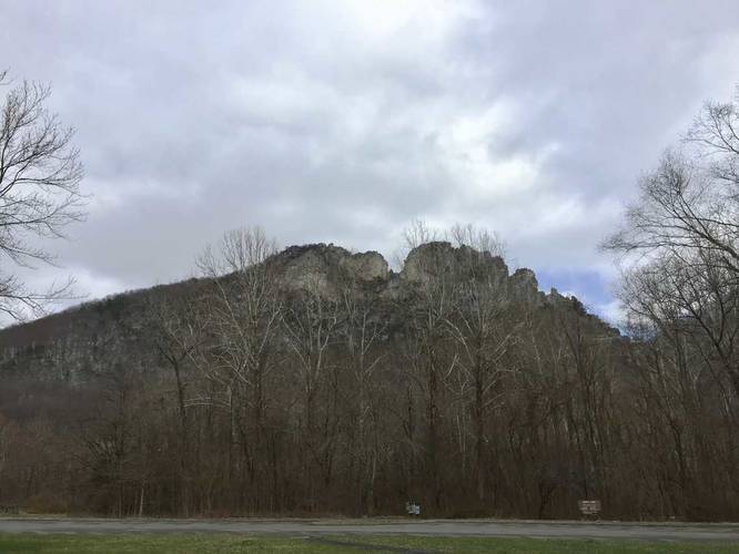
The Seneca Rocks Trail at the Monongahela National Forest in Seneca Rocks, West Virginia is a moderate 3.2 mile out-and-back hike that leads up to the top of Seneca Rocks and an amazing 360-degree views of West Virginia's mountains and the valley below.
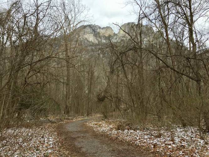
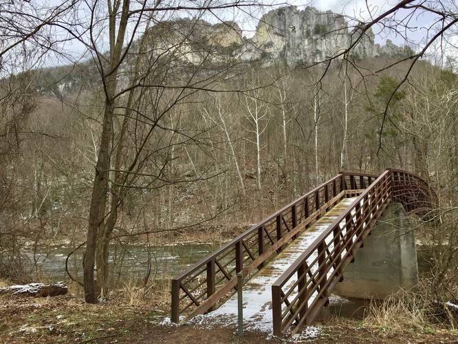
The trail starts off at the back of the main parking lot for Seneca Rocks as a flat gravel trail before crossing a bridge over the North Fork South Branch Potomac River. Seneca Rocks hang overhead throughout the entire hike, but it's easier to see it through the trees when there are no leaves.
The trail starts the ascent up to Seneca Rocks shortly after you cross the river - the trail is gravel the entire way up, but it has a gradual grade for the majority of the hike. While climbing up to Seneca Rocks, you'll get various lookout points along the way. The views will be much better from the top, but they're nice for taking short breaks at.
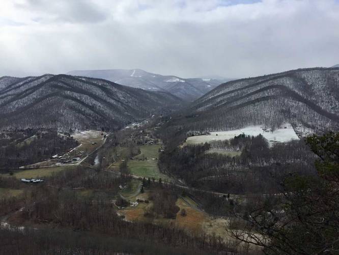
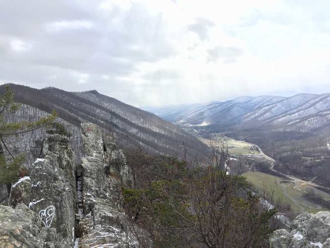
Upon reaching the top of the trail, you'll find a lookout platform that gives you great views of the valley below and mountains surrounding the area. From here you can climb up to the top of Seneca Rocks for the sweeping 360-degree view.
Dogs are allowed on this trail as there were no signs saying dogs were not allowed; however, it's probably best to keep your pups below the rock climb to ensure both your safety and your dog's.
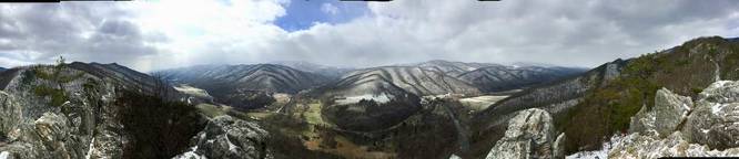
Climbing/hiking up Seneca Rocks: The hike up the rocks is not difficult, but it's not fun if you're afraid of heights. Going up the rocks is likely harder than going down; however, this is all dependent on how many people are on the trail that day. Once you're on the first ridge point on the rocks, you get the 360-degree view and the rock face levels out more so you have more room to walk than the initial climb up.
Popularity: This is one of the most popular day-hike spots in West Virginia. The parking lot for Seneca Rocks is very large, but we were fortunate enough to hike this trail during early-March when no one was on the trail. Climbing to the tops of Seneca Rocks may be more challenging when more people are on the trail.
Warning: Climbing Seneca Rocks is very dangerous and 15 people have died there since 1975. There are many warning signs telling hikers to not risk the climb to the top of Seneca Rocks. The hiker is the only one responsible for climbing to the top of Seneca Rocks, so watch your step!
The trail starts off at the back of the main parking lot for Seneca Rocks as a flat gravel trail before crossing a bridge over the North Fork South Branch Potomac River. Seneca Rocks hang overhead throughout the entire hike, but it's easier to see it through the trees when there are no leaves.
The trail starts the ascent up to Seneca Rocks shortly after you cross the river - the trail is gravel the entire way up, but it has a gradual grade for the majority of the hike. While climbing up to Seneca Rocks, you'll get various lookout points along the way. The views will be much better from the top, but they're nice for taking short breaks at.
Upon reaching the top of the trail, you'll find a lookout platform that gives you great views of the valley below and mountains surrounding the area. From here you can climb up to the top of Seneca Rocks for the sweeping 360-degree view.
Dogs are allowed on this trail as there were no signs saying dogs were not allowed; however, it's probably best to keep your pups below the rock climb to ensure both your safety and your dog's.
Climbing/hiking up Seneca Rocks: The hike up the rocks is not difficult, but it's not fun if you're afraid of heights. Going up the rocks is likely harder than going down; however, this is all dependent on how many people are on the trail that day. Once you're on the first ridge point on the rocks, you get the 360-degree view and the rock face levels out more so you have more room to walk than the initial climb up.
Popularity: This is one of the most popular day-hike spots in West Virginia. The parking lot for Seneca Rocks is very large, but we were fortunate enough to hike this trail during early-March when no one was on the trail. Climbing to the tops of Seneca Rocks may be more challenging when more people are on the trail.
Warning: Climbing Seneca Rocks is very dangerous and 15 people have died there since 1975. There are many warning signs telling hikers to not risk the climb to the top of Seneca Rocks. The hiker is the only one responsible for climbing to the top of Seneca Rocks, so watch your step!