The Hickory Ridge Trail at Tioga State Forest in Morris, Pennsylvania is a 3.2-mile out-and-back hike that leads up to the top of Hickory Ridge and features seasonal views of the mountains surrounding Morris, PA like Blacks Hill, Bald Hill, and Lost Hill in the distance.
Trails
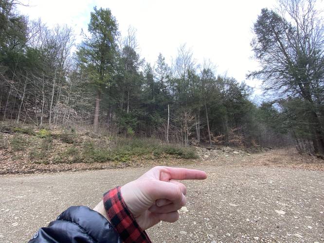
Note that this hike follows one officially-named trail, Williams Trail, until the first switchback. At this switchback, the hike follows an unnamed service road that leads to the top of Hickory Ridge; hence the trail name - Hickory Ridge Trail.
Hike Description
This hike begins at the service road that leads up the mountain near the coordinates provided at the trailhead for the Williams Trail. Note that as of April 2022, there were no trailhead signs for the Williams Trail.
The trail follows this service road for about 0.45 miles before reaching two switchbacks in the road - skip the first turn (which is covered in grassy overgrowth) and continue on to the 2nd where the service road continues to climb the mountain. Simply look for gravel to follow instead of grass around mile 0.45. Here, the Williams Trail stays off to the left-hand side.
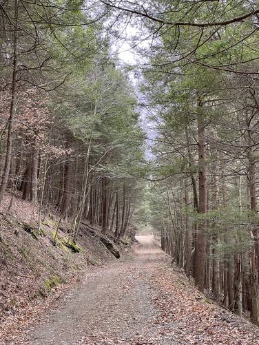
Hemlock Tree Tunnel - Mile 0.85
Around mile 0.85 on the service road, hikers will reach a beautiful hemlock forest where the trees cover the road. This part of the hike is probably the most-scenic.
2nd Turn - Mile 1
Around mile 1, hikers will reach another switchback in the service road, just beyond the hemlock forest. Here, stay to the right-hand side.
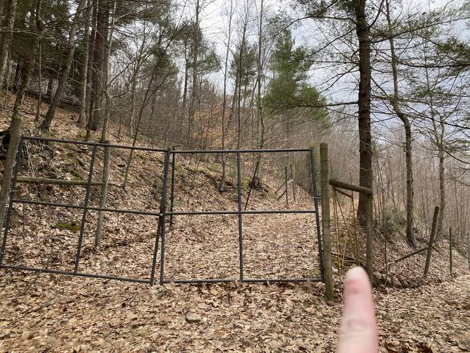
Deer Fence - Mile 1.25
At mile 1.25, hikers will reach a deer fence. Use the yellow metal gate to let yourself in to continue climbing up to Hickory Ridge.
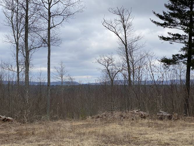
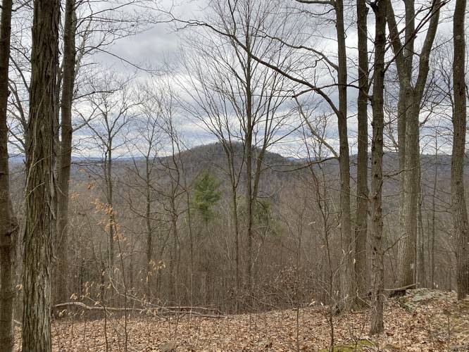
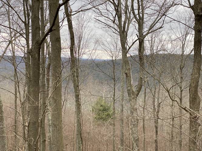
Obstructed Views of Morris, PA - Mile 1.35 to 1.45
After passing the deer fence, hikers will come around a bend in the trail where, during colder months, hikers get a view of the mountains that surround Morris, Pennsylvania. While the view is obstructed by the trees, it's nice scenery regardless. To the north, hikers will find two official USGS summits through the trees here. To the south is Blacks Hill and to the north is Bald Hill. Around this turn is where hikers will start to find rocky outcroppings of Hickory Ridge as well.
After passing the obstructed view of the mountains surrounding Morris, PA, the trail will continue to climb to the top of Hickory Ridge as it passes some old pine trees and overgrown grassy areas.
Hickory Ridge View - Mile 1.6
At the end of this GPS recording is a rocky unofficial "summit", noted by the small sections of exposed bedrock. Here is where hikers will find an open space along with a logging path that sort-of continues along Hickory Ridge, which is super obstructed, overgrown, not worth your time as of April 2022. To the north are two mountain slopes that can be seen during colder months through the trees. It appears as though the mountain on the left-hand side is likely Lost Hill in Wellsboro, PA. Note that this view is likely filled in and not noticeable during warmer months.
Parking
Hikers will find a large parking turnout on the north side of Landrus Road in Morris, PA. The parking lot is large enough to fit about 8 vehicles.
Pets
Dogs are allowed if leashed and their waste should be carried out by the hiker.
Camping and Backpacking
While there were no pre-defined campsites along this trail, dispersed / primitive / backcountry camping is allowed in Tioga State Forest. Please follow all rules and regulations when camping.
Warnings
Steep terrain: This service road follows some insanely-steep terrain in certain areas. Watch your step.
Rattlesnakes: At the top of Hickory Ridge are some rocky outcroppings that are likely home to the Timber Rattlesnake. It's smart to hike this trail during colder months and avoid late April - early October if you want to avoid rattlesnakes.
Trails
Note that this hike follows one officially-named trail, Williams Trail, until the first switchback. At this switchback, the hike follows an unnamed service road that leads to the top of Hickory Ridge; hence the trail name - Hickory Ridge Trail.
Hike Description
This hike begins at the service road that leads up the mountain near the coordinates provided at the trailhead for the Williams Trail. Note that as of April 2022, there were no trailhead signs for the Williams Trail.
The trail follows this service road for about 0.45 miles before reaching two switchbacks in the road - skip the first turn (which is covered in grassy overgrowth) and continue on to the 2nd where the service road continues to climb the mountain. Simply look for gravel to follow instead of grass around mile 0.45. Here, the Williams Trail stays off to the left-hand side.
Hemlock Tree Tunnel - Mile 0.85
Around mile 0.85 on the service road, hikers will reach a beautiful hemlock forest where the trees cover the road. This part of the hike is probably the most-scenic.
2nd Turn - Mile 1
Around mile 1, hikers will reach another switchback in the service road, just beyond the hemlock forest. Here, stay to the right-hand side.
Deer Fence - Mile 1.25
At mile 1.25, hikers will reach a deer fence. Use the yellow metal gate to let yourself in to continue climbing up to Hickory Ridge.
Obstructed Views of Morris, PA - Mile 1.35 to 1.45
After passing the deer fence, hikers will come around a bend in the trail where, during colder months, hikers get a view of the mountains that surround Morris, Pennsylvania. While the view is obstructed by the trees, it's nice scenery regardless. To the north, hikers will find two official USGS summits through the trees here. To the south is Blacks Hill and to the north is Bald Hill. Around this turn is where hikers will start to find rocky outcroppings of Hickory Ridge as well.
After passing the obstructed view of the mountains surrounding Morris, PA, the trail will continue to climb to the top of Hickory Ridge as it passes some old pine trees and overgrown grassy areas.
Hickory Ridge View - Mile 1.6
At the end of this GPS recording is a rocky unofficial "summit", noted by the small sections of exposed bedrock. Here is where hikers will find an open space along with a logging path that sort-of continues along Hickory Ridge, which is super obstructed, overgrown, not worth your time as of April 2022. To the north are two mountain slopes that can be seen during colder months through the trees. It appears as though the mountain on the left-hand side is likely Lost Hill in Wellsboro, PA. Note that this view is likely filled in and not noticeable during warmer months.
Parking
Hikers will find a large parking turnout on the north side of Landrus Road in Morris, PA. The parking lot is large enough to fit about 8 vehicles.
Pets
Dogs are allowed if leashed and their waste should be carried out by the hiker.
Camping and Backpacking
While there were no pre-defined campsites along this trail, dispersed / primitive / backcountry camping is allowed in Tioga State Forest. Please follow all rules and regulations when camping.
Warnings
Steep terrain: This service road follows some insanely-steep terrain in certain areas. Watch your step.
Rattlesnakes: At the top of Hickory Ridge are some rocky outcroppings that are likely home to the Timber Rattlesnake. It's smart to hike this trail during colder months and avoid late April - early October if you want to avoid rattlesnakes.