Loading...

WINTER SALE! 50% OFF Supporter Accounts — now through January 31st. Learn More.

Purple Loop

The Purple Loop Trail at Hartwood Acres Park in Indiana Township, Pennsylvania is a moderate and really nice 2.3-mile trail through the southeast section of the park with a lookout point.

The trailhead can be found in two locations along Hartwood Acres Drive - both visible from the road next to the parking area. Head to the western trailhead to follow the trail in the same direction of this trek.

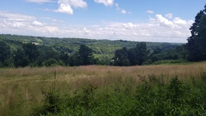
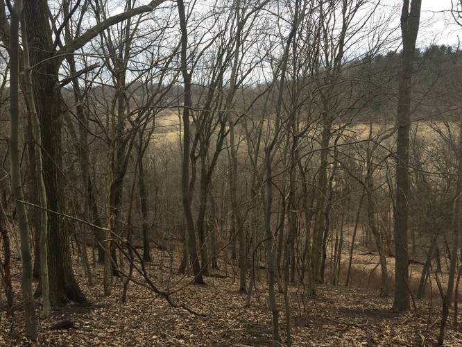
Lookout Point: Just after hiking the switchbacks during the first 1.5 miles of the hike, you'll reach a lookout point at the top of the natural gas line around mile 1.7 (while following the same route here). This lookout point faces southeast from Hartwood Acres Park looking down toward Saxonburg Blvd and the surrounding neighborhoods.

When you get to the southeastern part of the loop (in this GPS data), you can keep right or keep left to avoid looping depending on which direction you're traveling. That section was a bit confusing on the trail.

Parking: You can find parking at the main lot for the Hartwood Acres Mansion.

Explore 222 trails near Indiana Township, PA

Know Before You Go

  • The Purple Loop Trail in Hartwood Acres Park (Indiana Township, PA) is a 2.3-mile moderate hike through the park's southeast section.
  • The trail features a lookout point around mile 1.7, offering southeast views towards Saxonburg Blvd.
  • Navigational caution is advised at the southeastern part of the loop where it can be confusing to avoid unintentional looping.
Interactive topographic map for Purple Loop located in Indiana Township, PA. Click the "View Map" button to load GPS coordinates and trail markers.
Get directions
Distance
2.3 mi
Difficulty
Moderate
Type
Loop
Est. Time
1.2 hrs
Elev. Gain
394'
Rating
0.0
Added
December 22, 2016
Updated
April 03, 2019

Weather Forecast

Loading...
Total Change
167'
Ascent
394'
Descent
459'
Loading...

Download the GPX Data for Offline Use

Supporters get exclusive access to download trail routes to the MyHikes app for offline use. Stay prepared on your adventure, even without an internet connection! Become a Supporter today to unlock this feature and hike with confidence.

Download Purple Loop GPX Data to the MyHikes Mobile App

Features

Vista / Lookout Point
Dogs
Water Source
Biking

Points of interest

  1. Parking

    40.568451, -79.909292
  2. Main Trailhead

    40.568098, -79.91024

Safety information

For your own safety: plan ahead, let someone know where you'll be, and hike at your own risk.

Markers

Blaze Color

Purple

Availability

Winter

Surface type

Dirt

Trip Reports (Reviews)

Your opinion matters! Be the first to rate this trail.

Ready to help fellow hikers? Add a trip report to share your experience and provide valuable insights for other hikers!

2.3 miles / 3.7 km
September 19, 2020
Hiking
2.3 miles / 3.7 km
September 04, 2020
Hiking
2.3 miles / 3.7 km
July 22, 2020
Hiking
No community routes found. To add your own hike as a Community Route for this Trail guide, leave a Trip Report with an attached GPX file.

Popular categories

Scenic mountain view representing vista trails
Vista trails
Scenic gorge of cascades representing waterfall trails
Waterfall hikes
Rugged mountain terrain representing summit trails
Summit trails
Scenic mountain view representing dog-friendly trails
Dog-friendly
Scenic campsite with a view representing camping trails
Camping trails
Appalachian Trail logo representing A.T. hikes
A.T. hikes

You May Also Like

New York's Best Waterfalls - Whether you're planning a day hike, roadside stop, or a leisurely short walk, this guide provides hikers, travelers, and locals alike with 63 different locations to over 100 scenic waterfalls to help plan your next adventure!
Explore

New York's Best Waterfalls

Whether you're planning a day hike, roadside stop, or a leisurely short walk, this guide provides hikers, travelers, and locals alike with 63 different locations to over 100 scenic waterfalls to help plan your next adventure!

Read
🍪 We use cookies to learn about site usage and to serve map tiles. You may block cookies manually in the browser. By continuing you agree. Learn more