Loading...

Distance:
0.2 Miles / 0.3 km
Type:
Out-and-Back
Difficulty:
Easy
Time to Hike:
~6 minutes
Features:
Surface Type:
Universal Access
Town:
Hanalei, Hawaii
Directions:
22.213126, -159.496179
Added:
July 03, 2022
Updated:
July 20, 2022
Please consider making a donation to the Maui Strong Fund to help the victims of Hawaii's recent wildfires.
Loading...
Loading...
2 '

Total Change
2 '

Ascent
2 '

Descent

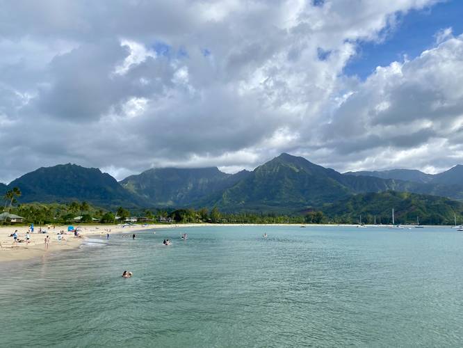
Hanalei Pier in Hanalei, Hawaii (Kauai) is an easy 0.2-mile out-and-back universal access walk that leads down the historic Hanalei Pier, featuring stunning views of Hanalei Bay and the surrounding mountain ranges.

This is not a hike, but rather a nice scenic walk that features some of the best views on Kauai. Views from the pier include docked boats in Hanalei Bay, a 2,800-foot waterfall cascading down a mountain in the distance, and often paddleboarders cruising around in the calm waters of the bay.

Parking
Visitors will find parking at the Black Pot Beach Park parking lot at the coordinates provided. There are two main lots which both hold a couple dozen vehicles each; however, parking fills up quickly, so show up early to claim a spot.

Respecting the Land
Hawaiian land is considered sacred to native Hawaiians and many locals, so please stay on-trail, take nothing but photos, and leave nothing but footprints. Respect the locals - don't stay for long and have a backup hike planned in case the parking lot is full.

Explore 51 trails near Hanalei, HI
  1. Parking

    22.213126, -159.496179
  2. Main Trailhead

    22.212855, -159.496463
  3. View of Hanalei Bay, docked boats, and surrounding mountains with a 2,800-foot waterfall cascading

    22.212692, -159.497636
    View of Hanalei Bay, docked boats, and surrounding mountains with a 2,800-foot waterfall cascading
No community routes found. To add your own hike as a Community Route for this Trail guide, leave a Trip Report with an attached GPX file.

Seasons

All

Photo Albums

2 Trip Reports

No Star-Ratings
Write-up by:
Admin user profile picture
0.2 miles / 0.3 km
Trail added
July 03, 2022
Hiked on
July 02, 2022
Updated on
July 20, 2022
0.2 miles / 0.3 km
July 02, 2022
Hiking

Weather Forecast

In Hanalei, HI

Explore Hiking Trails

New Hikes

Sandford Lake Trail
1.3 Miles
2.1 km
Easy
Out-and-Back
Sugar Hill Pond and Twin Lean-Tos Hike
2.3 Miles
3.7 km
Moderate
Out-and-Back
Weston Lake Loop
3.2 Miles
5.1 km
Easy
Loop
Battery Warren Trail
1 Mile
1.6 km
Easy
Out-and-Back

Before you leave...

MyHikes is an indie web platform aimed to make exploring public trails easier for everyone. The site has no investors and is owned and operated by one person, Dave Miller (Founder & Admin). As the Founder, main contributor, and doer-of-all-things for MyHikes, I share my trips with over-detailed write-ups for fun on a volunteer basis and I believe that public trail information should be available to everyone.

It takes a lot of time 🕦, money 💰, and effort (including espresso shots ☕) to run MyHikes, including hiking , mapping , writing , and publishing new trails with high-quality content... along with building new features, moderating, site maintainance, and app development for iOS and Android . I simply ask that if you find MyHikes' trail guides helpful to please consider becoming a Supporter to help keep the site, iOS, and Android apps available to everyone.

Supporters unlock website and in-app perks with a one-time payment of $25 (you renew) 😎👍. Or you can simply make a Donation of your choice without a MyHikes user account. Otherwise, telling your friends about MyHikes is the next-best thing - both quick and free 🎉

Thanks for visiting MyHikes and have a great hike!️

Admin user profile picture

Dave Miller
MyHikes Founder & Admin