Hamilton Falls is located on Hamilton Falls Rd in Jamaica, VT and is an easy 0.2-mile one-way trail that leads to one of Vermont's tallest waterfalls - Hamilton Falls. Parking is available on the road.
There are a couple ways of accessing Hamilton Falls. The shortest seems to be from Hamilton Falls Rd, since it is roughly a 0.25 mile hike down to the bottom. However, this trail should be considered difficult or 'hard' for all skill levels. The trail is very steep and is almost straight down over roots and open rock face, with some low hanging branches. During the fall there are lots of leaves on the ground providing many opportunities to slip and get seriously injured, so hike at your own risk. There appears to be another trail leading down to the falls nearby but I did not locate it.
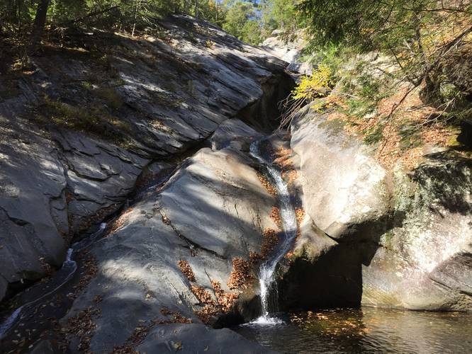
Hamilton Falls is one of Vermont's largest waterfalls, cascading down about 125 feet and has several tiers or levels to it. One tier of the falls has a large pool and ladder access. When the falls are not raging this area is safe for swimming but proceed with caution and always watch the weather to avoid flash flooding.
You may also approach from Ball Mountain State Park by the dam - there is a trail that leads to Hamilton Falls there and one from below the dam as well. Both of these routes are roughly 2.5 miles.
There are a couple ways of accessing Hamilton Falls. The shortest seems to be from Hamilton Falls Rd, since it is roughly a 0.25 mile hike down to the bottom. However, this trail should be considered difficult or 'hard' for all skill levels. The trail is very steep and is almost straight down over roots and open rock face, with some low hanging branches. During the fall there are lots of leaves on the ground providing many opportunities to slip and get seriously injured, so hike at your own risk. There appears to be another trail leading down to the falls nearby but I did not locate it.
Hamilton Falls is one of Vermont's largest waterfalls, cascading down about 125 feet and has several tiers or levels to it. One tier of the falls has a large pool and ladder access. When the falls are not raging this area is safe for swimming but proceed with caution and always watch the weather to avoid flash flooding.
You may also approach from Ball Mountain State Park by the dam - there is a trail that leads to Hamilton Falls there and one from below the dam as well. Both of these routes are roughly 2.5 miles.