The Greenbush Kettle Pond Trail at Kettle Moraine State Forest near Plymouth, Wisconsin is a moderate 0.2-mile out-and-back trail that leads to views of the glacially-formed Greenbush Kettle Pond.
Hike Description
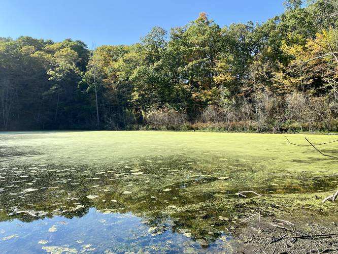
This is less of a hike and more of a moderate walk to and from the Greenbush Kettle Pond; however, this trail does include a self-guided interactive tour along the way with some information about kettle ponds and how they're formed. At the end of this trail is a nice view of the kettle pond and the hike back uphill is a moderate, but short, walk back to parking.
What's a kettle pond?
Thousands of years ago, when the glaciers receded from this area, large chunks of ice would break off and submerge themselves in the ground. Over time the ice would melt and leave behind a depression in the ground to where water would fill it, creating ponds. Greenbush Kettle Pond was formed exactly the same way.
Parking
Visitors will find parking at the coordinates provided. The lot is large enough to fit about a dozen vehicles.
Pets
Dogs are allowed if leashed and their waste should be carried out by the hiker.
Hike Description
This is less of a hike and more of a moderate walk to and from the Greenbush Kettle Pond; however, this trail does include a self-guided interactive tour along the way with some information about kettle ponds and how they're formed. At the end of this trail is a nice view of the kettle pond and the hike back uphill is a moderate, but short, walk back to parking.
What's a kettle pond?
Thousands of years ago, when the glaciers receded from this area, large chunks of ice would break off and submerge themselves in the ground. Over time the ice would melt and leave behind a depression in the ground to where water would fill it, creating ponds. Greenbush Kettle Pond was formed exactly the same way.
Parking
Visitors will find parking at the coordinates provided. The lot is large enough to fit about a dozen vehicles.
Pets
Dogs are allowed if leashed and their waste should be carried out by the hiker.