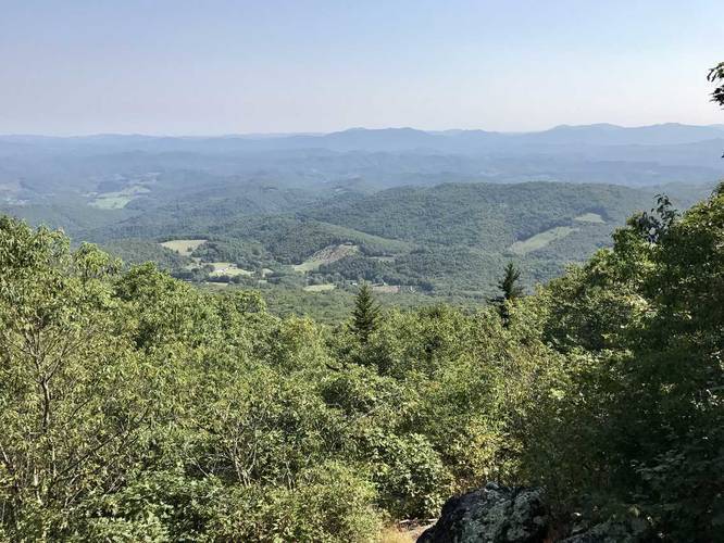
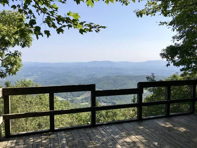
Grayson Highlands Overlook Trail
The views from the overlook are worth the trip to the end of the park with continuous mountain views and Christmas tree farms in the valley below. Parking is just beyond the trailhead.
Know Before You Go
Interactive topographic map for Grayson Highlands Overlook Trail located in Mouth of Wilson, VA. Click the "View Map" button to load GPS coordinates and trail markers.
View map
Get directions
- Distance
- 0.1 mi
- Difficulty
- Easy
- Type
- Out-and-Back
- Est. Time
- 5 min
- Elev. Gain
- 0'
- Rating
- 4.0
- Added
- September 06, 2017
- Updated
- November 27, 2017
Weather Forecast
Don't let Google decide who you trust.


Loading...
<strong>Trail map and elevation chart not rendering in print mode?</strong> Simply scroll to the trail map section, then try printing again!
Total Change
7 ft.
2 m
2 m
Ascent
0 ft.
0 m
0 m
Descent
0 ft.
0 m
0 m
Loading...
Features
- Vista / Lookout Point
- Dogs
Points of interest
-
Parking
36.623421, -81.501053 -
Main Trailhead
36.623192, -81.50124 -
Vista point
36.622444, -81.5011 -
Vista point
36.622606, -81.501144
Safety information
For your own safety: plan ahead, let someone know where you'll be, and hike at your own risk.
Availability
Summer
Surface type
Dirt
Trip Reports (Reviews)
Ready to help fellow hikers? Add a trip report to share your experience!
No community routes found. To add your own hike as a Community Route for this Trail guide, leave a Trip Report with an attached GPX file.


You may also like

Explore
25 Best Day Hikes in Virginia
Explore the top hikes in Virginia, from iconic trails in Shenandoah National Park to hidden gems in the Blue Ridge Mountains. Find your next unforgettable outdoor adventure.

Explore
25 Best Day Hikes in West Virginia
Discover 25 of the best day hikes in West Virginia, from scenic overlooks to wilderness trails—perfect for every level of hiker.

Explore
25 Best Day Hikes in North Carolina
Discover the top 25 best day hikes in North Carolina, from breathtaking waterfalls to mountain peaks. Explore hidden gems, scenic views, and trails suitable for all skill levels, perfect for your next outdoor adventure.

Explore
Best of the Alps: Hiking, Adventure & Scenery
Plan your ultimate European Alps adventure! Discover the best hiking trails, epic scenery, and villages in the Swiss Alps, Dolomites, Chamonix, and Lake Como.
grayson highlands state park

