The Goat Rock Trail to Hampden Overlook at the Goat Rock Conservation Land in Hampden, Massachusetts is a difficult 1.8-mile out-and-back trail that leads up to Goat Rock and a stunning vista point with views of Hampden and the surrounding hills.
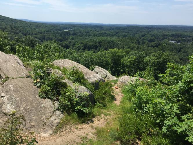
Goat Rock is located roughly 0.2-miles from the parking area at the end of Country Club Drive in Hampden, MA. The first climb is steep and rocky but there appears to be a more gentle ascent available. The trail opens up to several trails just after the sign, this recording covers the first right-hand side, marked by white blazes. From Goat Rock, Hampden Overlook is roughly 1.25 miles beyond according to the sign, this recorded track puts it at 1 mile, so the signage is slightly off.
Beyond Goat Rock, the trail is somewhat overgrown in places and does not appeared to be used frequently. The white and blue blazes cross over each other as you head towards Hampden Overlook. The trail opens up at roughly 1-mile from Goat Rock and heads downhill towards Hampden Memorial park. From there you can see a barely noticeable cutoff trail to your right, just as you start to descend, that links back to the blue blazes a short distance from the overlook.
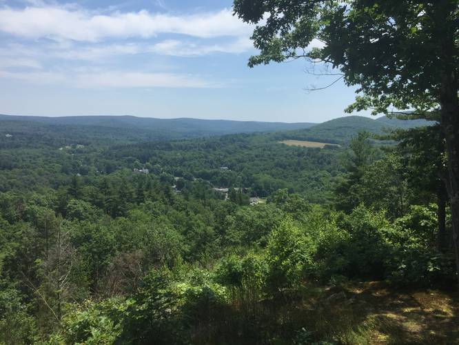
The view from the overlook is very nice, with a glimpse of historic Hampden and Peaked Mountain in the distance. However this trail system can be confusing and overgrown which adds a challenge.
History: Originally named “Goat Rocks”, this site received its name in the late 1700’s after one of William King’s Goats became caught in the rocks and died. For centuries, Goat Rock has been a favorite destination for its scenic views.
Pets: Dogs are allowed if leashed and their waste must be carried out with the hiker.
Goat Rock is located roughly 0.2-miles from the parking area at the end of Country Club Drive in Hampden, MA. The first climb is steep and rocky but there appears to be a more gentle ascent available. The trail opens up to several trails just after the sign, this recording covers the first right-hand side, marked by white blazes. From Goat Rock, Hampden Overlook is roughly 1.25 miles beyond according to the sign, this recorded track puts it at 1 mile, so the signage is slightly off.
Beyond Goat Rock, the trail is somewhat overgrown in places and does not appeared to be used frequently. The white and blue blazes cross over each other as you head towards Hampden Overlook. The trail opens up at roughly 1-mile from Goat Rock and heads downhill towards Hampden Memorial park. From there you can see a barely noticeable cutoff trail to your right, just as you start to descend, that links back to the blue blazes a short distance from the overlook.
The view from the overlook is very nice, with a glimpse of historic Hampden and Peaked Mountain in the distance. However this trail system can be confusing and overgrown which adds a challenge.
History: Originally named “Goat Rocks”, this site received its name in the late 1700’s after one of William King’s Goats became caught in the rocks and died. For centuries, Goat Rock has been a favorite destination for its scenic views.
Pets: Dogs are allowed if leashed and their waste must be carried out with the hiker.