Loading...

๐ŸŽ‰ Enjoy a Free 7-Day Supporter Trial and Unlock Exclusive Perks โ€” No Credit Card Required. Learn more.

Goat Lick Overlook

Directions
Map
Pictures
Send to App
Distance:
0.2 Miles / 0.3 km
Type:
Loop
Difficulty:
Easy
Time to Hike:
~6 minutes
Features:
Surface Type:
Universal Access
Park:
Glacier National Park
Town:
Essex, Montana
Directions:
48.258758, -113.574814
Added:
September 18, 2024
Updated:
September 30, 2024
Copy Trail Link Hiking this trail? Send a friend or family member a link to this trail guide for your own safety. Hike at your own risk (disclaimer)
Loading...
Loading...
41'

Total Change
42'

Ascent
42'

Descent

Download the Trail Route for Offline Use

Supporters get exclusive access to download trail routes to the MyHikes app for offline use. Stay prepared on your adventure, even without an internet connection! Become a Supporter today to unlock this feature and hike with confidence.

Send to App

Goat Lick Overlook

The Goat Lick Overlook at Glacier National Park near Essex, Montana is a universally-accessible 0.2-mile loop trail that leads to several overlook points where visitors can usually find mountain goats during springtime.

Exploring the Goat Lick Overlook

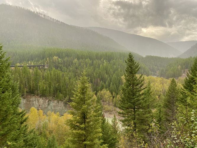
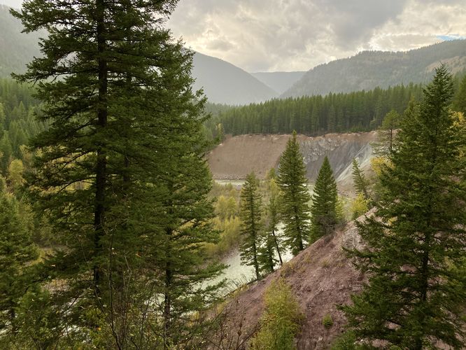
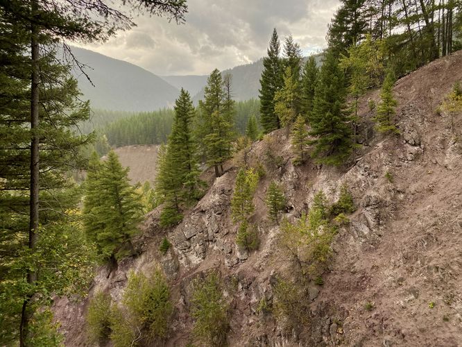
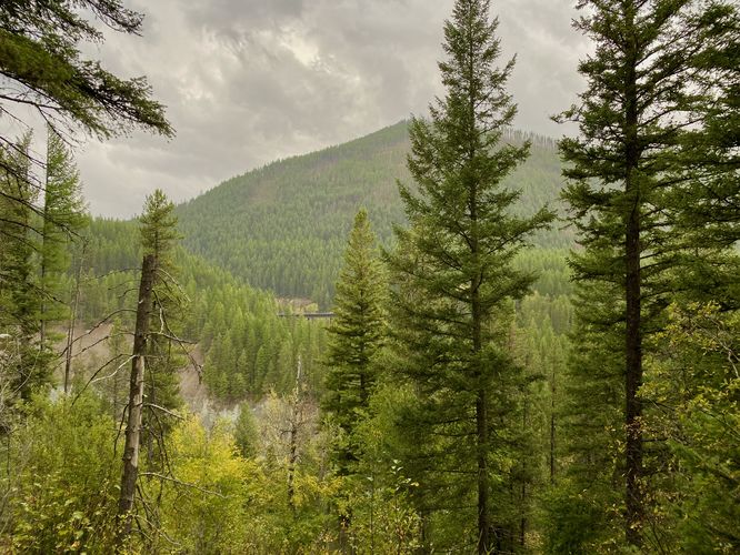
This very short trail provides visitors with viewpoints high above the Middle Fork Flathead River where you can spot mountain goats licking the steep rocky terrain for salt and minerals. During Spring, mountain goats descend from higher elevations down to the Goat Lick Overlook area to literally lick the rocks, which provide the animals with necessary nutrients to live. The goats focus their attention on wet seeps in the rock where more minerals are carried in solution.

The trail itself is paved and universally-accessible in either direction; however, the far north section of the trail follows a series of staircases that connect the two overlooks. If you hike the trail in a loop, you can hit all of the four viewpoints (as of September 2024) with two of the viewpoints located across a steep rocky gorge from where the goats generally show-up each Spring to collect their nutrients. The trail ends back at parking for a short 0.2-mile jaunt.

When we visited in September, unfortunately the mountain goats no longer needed the salt and nutrients from the area, so we saw 0 goats, but we also saw 0 people -- which made for a really nice stop along a very-long day drive back from the East Glacier area.

Universal Accessibility

Note that this trail is universally-accessible but is not fully accessible. The trailhead leads to a split in the loop where both portions of the loop are accessible; however, the northern part of the loop follows a series of staircases that connect the two overlook areas which is not accessible.

Parking

Hikers will find a very-large parking lot at the coordinates provided. The lot is large enough to fit a couple dozen vehicles as of September 2024.

Pets

Dogs are not allowed on any trails at Glacier National Park.

Warning

Grizzly bears: This trail is frequented often by grizzly bears, especially in late Summer and early Fall as they scrounge for 20 hours/day bulking for the winter. Always give wild animals plenty of space, including several hundred feet for grizzlies. It's best to bring bear spray on this hike as a last defense just in case a grizzly were to charge at you. Always make plenty of noise while hiking to alert animals to your presence long before you see them. It's also smart to hike with another person.
Explore 15 trails near Essex, MT
  1. Parking

    48.258758, -113.574814
  2. Main Trailhead

    48.258913, -113.575386
  3. View above the Middle Fork Flathead River and surrounding mountains

    48.258942, -113.575522
    View above the Middle Fork Flathead River and surrounding mountains
  4. View of Middle Fork Flathead River and Goat Lick area

    48.259808, -113.575744
    View of Middle Fork Flathead River and Goat Lick area
  5. View of the steep rocky terrain at the Goat Lick Overlook

    48.260086, -113.575456
    View of the steep rocky terrain at the Goat Lick Overlook
  6. View of mountains above the Middle Fork Flathead River

    48.259744, -113.575514
    View of mountains above the Middle Fork Flathead River
No community routes found. To add your own hike as a Community Route for this Trail guide, leave a Trip Report with an attached GPX file.

Hazards

Rockfalls / Ledges / or Scrambles

Seasons

All

Photo Albums

Trip Reports

Trail Guide By:
Admin user profile picture
0.2 miles / 0.3 km
0.2 miles / 0.3 km
September 18, 2024
No goats :(
Hiking

Weather Forecast

In Essex, MT

Explore Hiking Trails

You May Also Like

Colorado's Million Dollar Highway - Plan a day's drive adventure along the iconic Million Dollar Highway in Colorado. Explore the best short trails, roadside stops, waterfalls, vistas, ghost towns, and hot springs within a ~6 hour road trip.
Explore

Colorado's Million Dollar Highway

Plan a day's drive adventure along the iconic Million Dollar Highway in Colorado. Explore the best short trails, roadside stops, waterfalls, vistas, ghost towns, and hot springs within a ~6 hour road trip.

Read
Glacier's Going-to-the-Sun Road - Discover the breathtaking beauty of Glacier National Park along the iconic Going-to-the-Sun Road. From stunning roadside stops to picturesque waterfalls and vistas, this engineering marvel offers endless opportunities for exploration.
Explore

Glacier's Going-to-the-Sun Road

Discover the breathtaking beauty of Glacier National Park along the iconic Going-to-the-Sun Road. From stunning roadside stops to picturesque waterfalls and vistas, this engineering marvel offers endless opportunities for exploration.

Read
New York's Best Waterfalls - Whether you're planning a day hike, roadside stop, or a leisurely short walk, this guide provides hikers, travelers, and locals alike with 63 different locations to over 100 scenic waterfalls to help plan your next adventure!
Explore

New York's Best Waterfalls

Whether you're planning a day hike, roadside stop, or a leisurely short walk, this guide provides hikers, travelers, and locals alike with 63 different locations to over 100 scenic waterfalls to help plan your next adventure!

Read

Before you boogie...

Find our trail guides useful? Consider becoming a Supporter to unlock perks!

MyHikes is an indie platform that makes exploring public trails easier for everyone. The platform has no investors, no ads, and is owned and operated by one person, Dave Miller. Dave has personally mapped and written over 1,800 trail guides on MyHikes for the public to explore. MyHikes has helped millions outdoor enthusiasts plan their next adventure.

But it takes a lot of time ๐Ÿ•ฆ, money ๐Ÿ’ฐ, work, and espresso shots โ˜• to run MyHikes, including hiking , mapping , writing , and publishing new trails with high-quality (accurate) information... along with software engineering (coding) the platform like building new features, website and mobile app development (iOS and Android), site maintainance . and much much more.

Supporters unlock website and mobile app perks with an annual one-time payment of $25 (you renew) ๐Ÿ˜Ž๐Ÿ‘. Or you can simply make a Donation of your choice. Otherwise, you can support us by telling your friends about MyHikes - both quick and free ๐ŸŽ‰

Admin user profile picture

Dave Miller
MyHikes Founder