The Georgetown Lake Trail in Georgetown, Colorado is an easy 0.7-mile out-and-back hike that features views of Georgetown Lake, the Clear Creek Spillway, and leads to the Georgetown Bighorn Sheep Viewing Area.
Hike
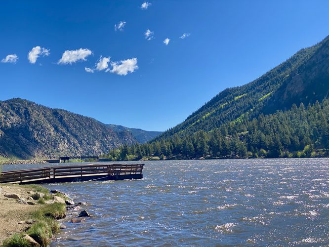
This short hike begins at the middle parking lot on the west side of Georgetown Lake and follows the trail as it leads northward along its shores. This route first brings hikers out to the shore to take-in views of the lake where you'll find the surrounding mountains towering over the water. To the north is a pier that juts out into the water -- great for fishermen or visitors alike.
Bighorn Sheep Viewing Area - Mile 0.1
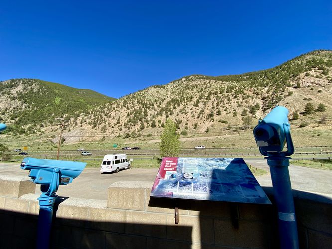
The trail then leads north to reach the Georgetown Bighorn Sheep Viewing Area. The viewing area is a concrete structure that you can walk up, following an accessible pathway, to reach telescopic viewfinders that point at the cliffs to the west. Bighorn sheep are best known to traverse the steep and rocky mountain cliffs of the neighboring mountains, so this wildlife viewing area is perfect to try and spot them. Unfortunately during our hike here, we did not see any bighorns.
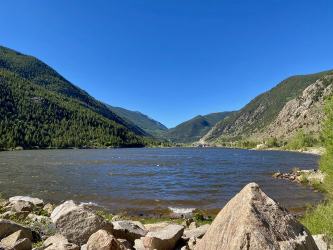
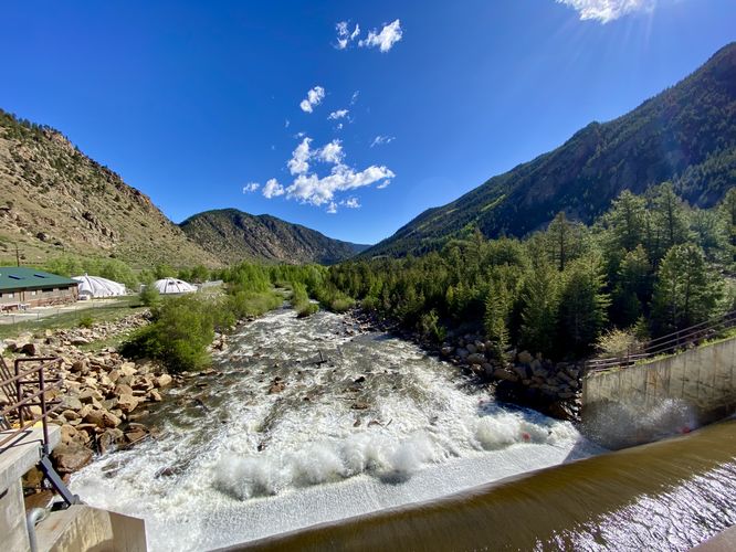
The trail then leads north as it runs along the west side of Georgetown Lake before it reaches a right-hand turn that runs along the northern dam for the lake. This part of the hike provides hikers with a view of Clear Creek and its human-made spillway waterfall that cascades down from Georgetown Lake. The dam also provides hikers with a beautiful view of the lake facing south.
After exploring the dam and spillway views, hikers will head back to parking for a short 0.7-mile out-and-back hike.
Parking
Hikers will find several parking lots along Georgetown Lake. The coordinates for this route bring you to the middle parking lot at the lake, which is large enough to fit a couple dozen vehicles as of June 2024.
Pets
Dogs are allowed if leashed and should be cleaned up after.
Hike
This short hike begins at the middle parking lot on the west side of Georgetown Lake and follows the trail as it leads northward along its shores. This route first brings hikers out to the shore to take-in views of the lake where you'll find the surrounding mountains towering over the water. To the north is a pier that juts out into the water -- great for fishermen or visitors alike.
Bighorn Sheep Viewing Area - Mile 0.1
The trail then leads north to reach the Georgetown Bighorn Sheep Viewing Area. The viewing area is a concrete structure that you can walk up, following an accessible pathway, to reach telescopic viewfinders that point at the cliffs to the west. Bighorn sheep are best known to traverse the steep and rocky mountain cliffs of the neighboring mountains, so this wildlife viewing area is perfect to try and spot them. Unfortunately during our hike here, we did not see any bighorns.
The trail then leads north as it runs along the west side of Georgetown Lake before it reaches a right-hand turn that runs along the northern dam for the lake. This part of the hike provides hikers with a view of Clear Creek and its human-made spillway waterfall that cascades down from Georgetown Lake. The dam also provides hikers with a beautiful view of the lake facing south.
After exploring the dam and spillway views, hikers will head back to parking for a short 0.7-mile out-and-back hike.
Parking
Hikers will find several parking lots along Georgetown Lake. The coordinates for this route bring you to the middle parking lot at the lake, which is large enough to fit a couple dozen vehicles as of June 2024.
Pets
Dogs are allowed if leashed and should be cleaned up after.