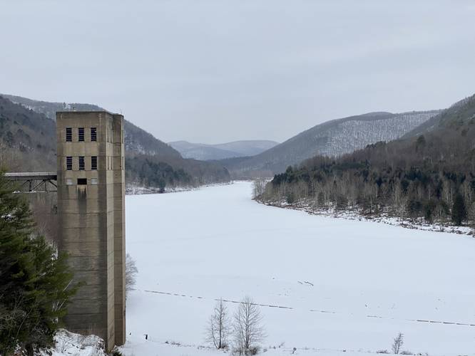
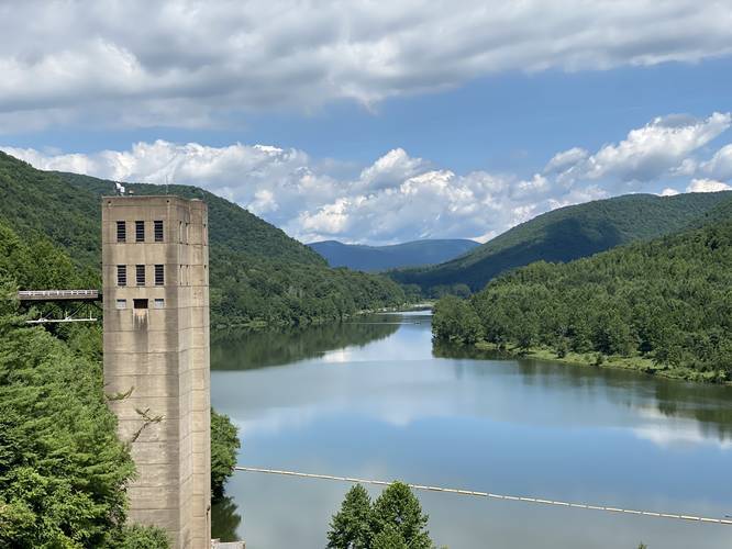
The George B. Stevenson Dam Trail at Sinnemahoning State Park near Austin, Pennsylvania is an easy 0.7-mile out-and-back trail that features beautiful views of the George B. Stevenson Reservoir, First Fork Sinnemahoning Creek, and the surrounding mountains.
This trail is a universal access trail made of mostly gravel that runs along the top of the George B. Stevenson Dam and has a very flat elevation grade. The trail has views to both sides - facing north is the George B. Stevenson Reservoir and the First Fork Sinnemahoning Creek. To the south is the dam spillway where the First Fork Sinnemahoning Creek continues south.
This trail is perfect for families, walkers, and day hikers on road trips since this is a great stopping point on a long drive.
Warning
Hikers should not leave the trail area because signs posted along the trail as visitors to stay out.
Parking
Hikers can find parking at the coordinates provided. The lot is large enough to accommodate several dozen vehicles.
Pets
Dogs are allowed if leashed and their waste must be carried out by the hiker.
Wild Elk
This area is known to have wild elk grazing from time to time. Upon our visit, some wild elk were grazing at the recreation area just south of the dam; however, we did not drive down the road to see them. The slopes of the back of the dike provide plenty of food for deer and elk, so you may find some wildlife just by walking this short and easy trail.