The Gate BL4 Trail at Quabbin Reservoir in Belchertown, Massachusetts is a moderate 1.2-mile out-and-back slightly-overgrown and very underused logging trail that features a peaceful walk through the woods.
Hikers should be aware that as of Autumn 2020, this unmaintained service road appears to be used for logging, but is nonetheless a quiet gate to hike at Quabbin if you don't mind overgrowth. This trail was tracked during COVID-19 when literally every trailhead at Quabbin was bursting at the seems, so I came to Gate BL4 to hike in the woods away from the crowds of people.
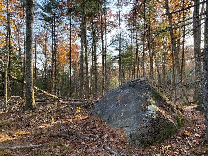
I followed the service road up the hill to where there was a large cutout. From here, I followed a much skinnier, and overgrown, trail that lead further up the hill along a more gradual elevation gain. Near the top of the hill I noticed a large set of boulders and some hills through the trees. I hiked to the top of this hill in hopes of getting a glimpse of a view between the trees, but there really wasn't much up there other than the large boulders.
The trail continued onward, but I had already found 5 ticks on me by this point, just 0.7-miles in from the road so I decided to turn back.
Parking
Hikers will find a small parking turnout in front of the gate. Do not block the gate. The parking turnout is large enough to fit about 2 vehicles.
Pets
Dogs are not allowed on any trails at Quabbin.
Biking
Mountain biking is permitted along this trail; however, it may not be easy to ride as of 2021.
Hikers should be aware that as of Autumn 2020, this unmaintained service road appears to be used for logging, but is nonetheless a quiet gate to hike at Quabbin if you don't mind overgrowth. This trail was tracked during COVID-19 when literally every trailhead at Quabbin was bursting at the seems, so I came to Gate BL4 to hike in the woods away from the crowds of people.
I followed the service road up the hill to where there was a large cutout. From here, I followed a much skinnier, and overgrown, trail that lead further up the hill along a more gradual elevation gain. Near the top of the hill I noticed a large set of boulders and some hills through the trees. I hiked to the top of this hill in hopes of getting a glimpse of a view between the trees, but there really wasn't much up there other than the large boulders.
The trail continued onward, but I had already found 5 ticks on me by this point, just 0.7-miles in from the road so I decided to turn back.
Parking
Hikers will find a small parking turnout in front of the gate. Do not block the gate. The parking turnout is large enough to fit about 2 vehicles.
Pets
Dogs are not allowed on any trails at Quabbin.
Biking
Mountain biking is permitted along this trail; however, it may not be easy to ride as of 2021.