Loading...

Distance:
2.5 Miles / 4.0 km
Type:
Out-and-Back
Difficulty:
Easy
Time to Hike:
1 hour, ~15 minutes
Features:
Surface Type:
Semi-Paved
Park:
Quabbin Reservoir
Town:
New Salem, Massachusetts
Directions:
42.522794, -72.288805
Added:
January 23, 2020
Updated:
April 23, 2020
Loading...
Loading...
25 '

Total Change
107 '

Ascent
97 '

Descent

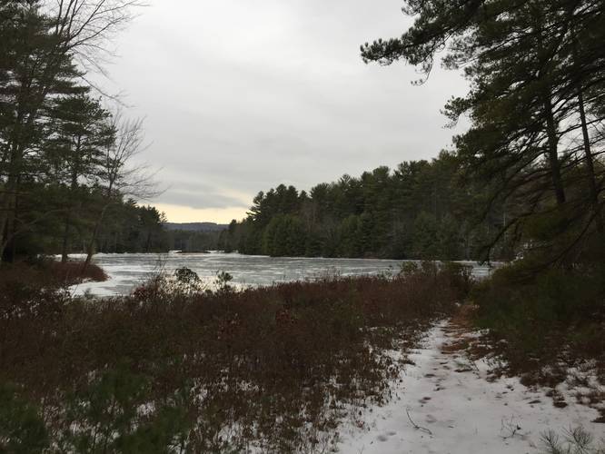
Gate 31 at Quabbin Reservoir in New Salem, Massachusetts is an easy 2.5-mile out-and-back trail located on Regulating Dam Rd off of Route 112.

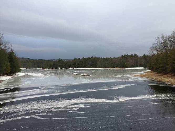
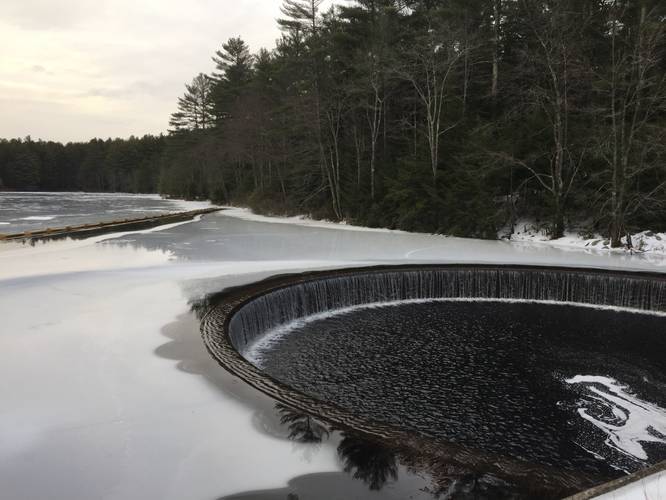
There are several side trails located along this gate - some leading out to the water and some to other gates and long abandoned roads. The road itself leads roughly 1 mile from the gate down to the boat launch, across a small island and to the other side of the tip of Quabbin.

From the opposite shore its a roughly 0.6 mile walk up to Orange-Millington Rd (Gate 29). The Gate 29 entrance on 202 is roughly 1 mile from the intersection.

Parking
Depending on the season, parking is available by the first gate a short distance from Route 112. Additional parking is located by the boat launch depending on access/season.

Pets
Dogs are not allowed on any trails at Quabbin.

Explore 187 trails near New Salem, MA
  1. Parking

    42.522794, -72.288805
  2. Main Trailhead

    42.522794, -72.288805
  3. View of northern Quabbin's waters

    42.5216, -72.290908
    View of northern Quabbin's waters
  4. View of northern Quabbin's waters

    42.520081, -72.295394
    View of northern Quabbin's waters
  5. Water overflow drain

    42.520244, -72.295289
    Water overflow drain
No community routes found. To add your own hike as a Community Route for this Trail guide, leave a Trip Report with an attached GPX file.

Hazards

Ticks - Lyme Disease More Info (CDC)

Seasons

All

Photo Albums

1 Trip Report

No Star-Ratings
Write-up by:
Tocra user profile picture
2.5 miles / 4.0 km
Trail added
January 23, 2020
Hiked on
January 23, 2020
Updated on
April 23, 2020

Weather Forecast

In New Salem, MA

Explore Hiking Trails

New Hikes

Sugar Hill Fire Tower Hike
0.7 Miles
1.1 km
Easy
Out-and-Back
Angel Falls Loop
2.8 Miles
4.5 km
Moderate
Loop
Tibwin Plantation Trail
1.9 Miles
3.1 km
Easy
Out-and-Back
Spencer Pond Loop
0.3 Miles
0.5 km
Easy
Loop

Before you leave...

MyHikes is an indie web platform aimed to make exploring public trails easier for everyone. The site has no investors and is owned and operated by one person, Dave Miller (Founder & Admin). As the Founder, main contributor, and doer-of-all-things for MyHikes, I share my trips with over-detailed write-ups for fun on a volunteer basis and I believe that public trail information should be available to everyone.

It takes a lot of time ๐Ÿ•ฆ, money ๐Ÿ’ฐ, and effort (including espresso shots โ˜•) to run MyHikes, including hiking , mapping , writing , and publishing new trails with high-quality content... along with building new features, moderating, site maintainance, and app development for iOS and Android . I simply ask that if you find MyHikes' trail guides helpful to please consider becoming a Supporter to help keep the site, iOS, and Android apps available to everyone.

Supporters unlock website and in-app perks with a one-time payment of $25 (you renew) ๐Ÿ˜Ž๐Ÿ‘. Or you can simply make a Donation of your choice without a MyHikes user account. Otherwise, telling your friends about MyHikes is the next-best thing - both quick and free ๐ŸŽ‰

Thanks for visiting MyHikes and have a great hike!๏ธ

Admin user profile picture

Dave Miller
MyHikes Founder & Admin