Gate 28 at Quabbin Reservoir in Ware, Massachusetts is an easy 3.4-mile out-and-back trail that leads from Route 9 to Quabbin's spillway dam and features a seasonal waterfall.
The trail starts out by heading north from the parking lot and the trail gives hikers a choice to either hike along the Swift River or hike through the woods up to the spillway dam. This recording follows the banks of the Swift River, so to follow this route, hikers must take the first left-hand turn, which sits approximately 100 to 200 feet from the parking lot. Follow this trail until it reaches another junction with the continuation for Gate 28 - take a right-hand turn here and hike straight until you reach the end of the trail.
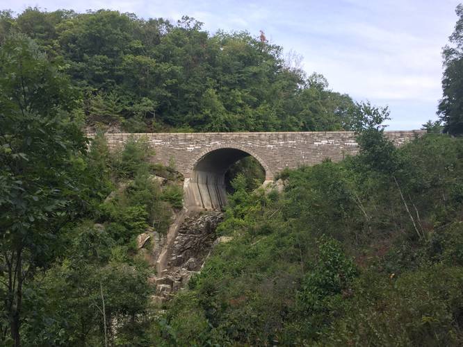
Just before you reach the end of the trail, there will be an uphill climb, which is moderate at best. Along this climb is a nice view high above the Swift River with views of Quabbin's fields that sit behind the Winsor Dam. Here you can also see the waterfall that sits below the walking bridge near the end of the trail; however, this waterfall is seasonal and is usually tried up by the Summer.
Waterfall
This trail has one seasonal waterfall which can be found under the walking bridge, at the northern terminus for this trail. Note that the waterfall generally dries up by the Summer.
Parking
Parking can be found at the coordinates provided at the southern trailhead. The lot is big enough to fit about 10 cars or so. Hikers can also park at the northern trailhead here: 42.285892, -72.336621.
Pets
Dogs are not allowed on any trails at Quabbin.
The trail starts out by heading north from the parking lot and the trail gives hikers a choice to either hike along the Swift River or hike through the woods up to the spillway dam. This recording follows the banks of the Swift River, so to follow this route, hikers must take the first left-hand turn, which sits approximately 100 to 200 feet from the parking lot. Follow this trail until it reaches another junction with the continuation for Gate 28 - take a right-hand turn here and hike straight until you reach the end of the trail.
Just before you reach the end of the trail, there will be an uphill climb, which is moderate at best. Along this climb is a nice view high above the Swift River with views of Quabbin's fields that sit behind the Winsor Dam. Here you can also see the waterfall that sits below the walking bridge near the end of the trail; however, this waterfall is seasonal and is usually tried up by the Summer.
Waterfall
This trail has one seasonal waterfall which can be found under the walking bridge, at the northern terminus for this trail. Note that the waterfall generally dries up by the Summer.
Parking
Parking can be found at the coordinates provided at the southern trailhead. The lot is big enough to fit about 10 cars or so. Hikers can also park at the northern trailhead here: 42.285892, -72.336621.
Pets
Dogs are not allowed on any trails at Quabbin.