Loading...

Distance:
4.4 Miles / 7.1 km
Type:
Out-and-Back
Difficulty:
Moderate
Time to Hike:
2 hours, ~12 minutes
Features:
Surface Type:
Dirt
Park:
Quabbin Reservoir
Town:
Pelham, Massachusetts
Directions:
42.392146, -72.403375
Added:
December 31, 2017
Updated:
April 27, 2020
Loading...
Loading...
635 '

Total Change
881 '

Ascent
872 '

Descent

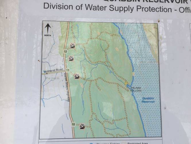
The Gate 11 Trail at Quabbin Reservoir in Pelham, Massachusetts is a moderate 4.4 mile out-and-back hike down to the shores of Quabbin and back. The trail starts at the intersection of Route 202 and Amherst Road in Pelham and runs along Pelham Hollow Road all the way down to the water. Parking can be found directly on Route 202 next to the gate as well.

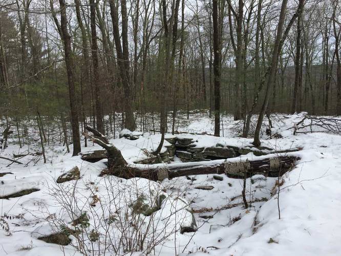
The trail heads downhill gradually for about 1.8 miles before turning into the 11-3 trail. You'll pass Dana Road and another closed down road that's now only used for maintenance vehicles and hiking - labeled 11-1 and 11-2. These old roads once used to connect the old towns that now lie underwater in Quabbin.

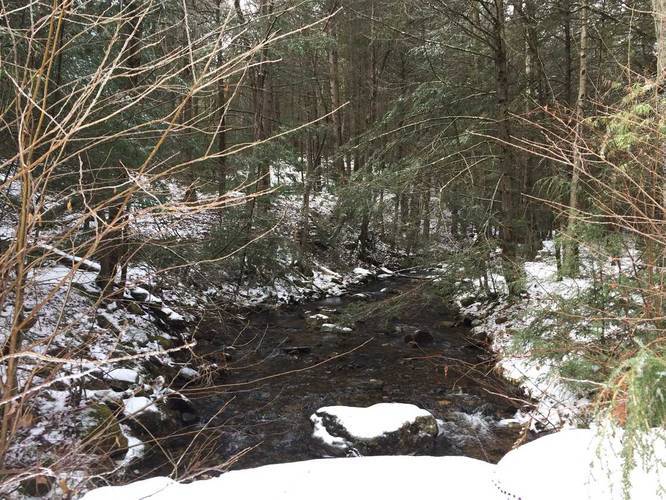
Once you pass the 11-3 sign, you'll cross a small bridge with a 10-foot wide creek below you. Continue following the trail uphill and then the immediate right-hand turn at the top of the hill. Follow this last segment all the way until you reach the shores of Quabbin.
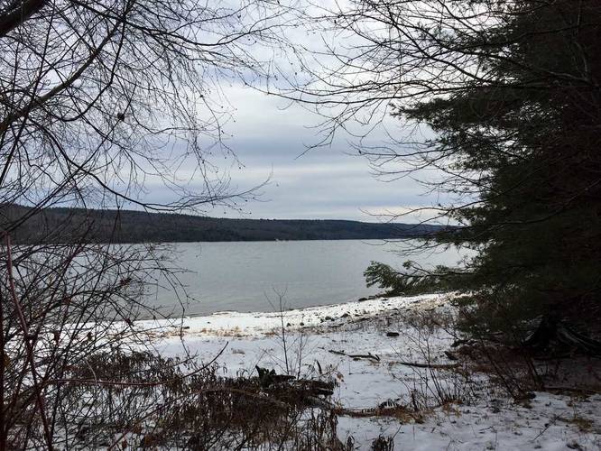
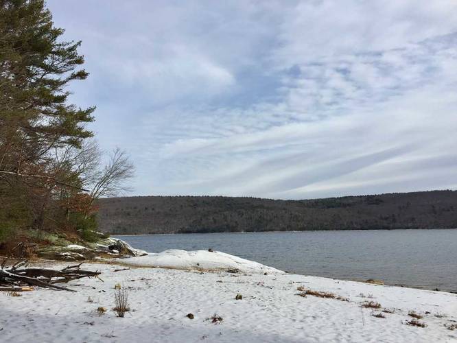
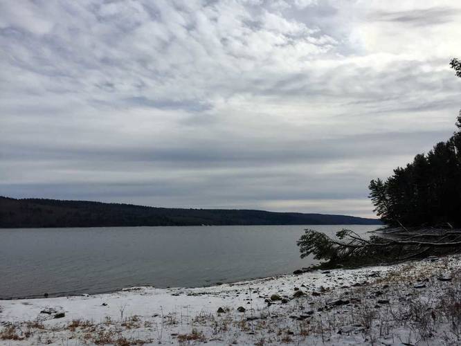
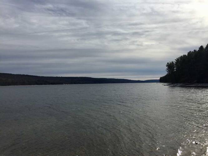
Lookout Point
The shoreline is the destination and lookout point for this trail. You can also see the Quabbin Reservoir Fire tower from the shore as well.

Connecting Trails
There are plenty of other trails in this section like 11-1, and 11-2, along with Gate 12 to the north which this trail connects with close to the water.

Pets
Dogs are not allowed on any trails at Quabbin.

Biking
Biking is not permitted along these trails.

Explore 203 trails near Pelham, MA
  1. Parking

    42.392146, -72.403375
  2. Main Trailhead

    42.392461, -72.402765
  3. Trail map near the trailhead gate

    42.392383, -72.401925
    Trail map near the trailhead gate
  4. Old foundation right off the trail

    42.389764, -72.386725
    Old foundation right off the trail
  5. Creek crossing just before the reservoir

    42.3876, -72.374733
    Creek crossing just before the reservoir
  6. View of Quabbin from the end of the trail

    42.387272, -72.372139
    View of Quabbin from the end of the trail
  7. View of Quabbin from the end of the trail

    42.387183, -72.371994
    View of Quabbin from the end of the trail
  8. View of Quabbin from the end of the trail

    42.387172, -72.371986
    View of Quabbin from the end of the trail
  9. View of Quabbin from the end of the trail

    42.387244, -72.371681
    View of Quabbin from the end of the trail
No community routes found. To add your own hike as a Community Route for this Trail guide, leave a Trip Report with an attached GPX file.

Hazards

Ticks - Lyme Disease More Info (CDC)

Seasons

All

Photo Albums

2 Trip Reports

No Star-Ratings
Write-up by:
Admin user profile picture
4.4 miles / 7.1 km
Trail added
December 31, 2017
Hiked on
December 24, 2017
Updated on
April 27, 2020
4.4 miles / 7.1 km
August 15, 2020
This is a great walk to Quabbin. Brings you to small beach on Quabbin. Really pretty and peaceful. Bug spray needed. But worth it and parking is good.
Hiking

Weather Forecast

In Pelham, MA

Explore Hiking Trails

New Hikes

Bates Ferry Trail and General Greene Tree
2.7 Miles
4.3 km
Easy
Out-and-Back
Tibwin Plantation Trail
1.9 Miles
3.1 km
Easy
Out-and-Back
Sandford Lake Trail
1.3 Miles
2.1 km
Easy
Out-and-Back
Sugar Hill Pond and Twin Lean-Tos Hike
2.3 Miles
3.7 km
Moderate
Out-and-Back

Before you leave...

MyHikes is an indie web platform aimed to make exploring public trails easier for everyone. The site has no investors and is owned and operated by one person, Dave Miller (Founder & Admin). As the Founder, main contributor, and doer-of-all-things for MyHikes, I share my trips with over-detailed write-ups for fun on a volunteer basis and I believe that public trail information should be available to everyone.

It takes a lot of time ๐Ÿ•ฆ, money ๐Ÿ’ฐ, and effort (including espresso shots โ˜•) to run MyHikes, including hiking , mapping , writing , and publishing new trails with high-quality content... along with building new features, moderating, site maintainance, and app development for iOS and Android . I simply ask that if you find MyHikes' trail guides helpful to please consider becoming a Supporter to help keep the site, iOS, and Android apps available to everyone.

Supporters unlock website and in-app perks with a one-time payment of $25 (you renew) ๐Ÿ˜Ž๐Ÿ‘. Or you can simply make a Donation of your choice without a MyHikes user account. Otherwise, telling your friends about MyHikes is the next-best thing - both quick and free ๐ŸŽ‰

Thanks for visiting MyHikes and have a great hike!๏ธ

Admin user profile picture

Dave Miller
MyHikes Founder & Admin