Explore the picturesque Fred's Bog Trail in Adirondack Park near Eagle Bay, New York, offering an easy 0.7-mile out-and-back hike with stunning views of Fred's Bog and the neighboring Cascade Mountain.
Hike
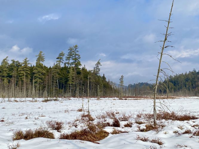
The adventure begins at the main trailhead located on the North side of Browns Tract Road. Be sure to sign in at the trail registry to contribute to New York's annual visitor count. As you begin your hike, the trail gently ascends before descending towards the bog. The trail passes through scenic evergreen forests, with low-growing bushy trees and towering pines that create a mesmerizing backdrop. During our winter hike in February 2024, we were treated to unusually warm temperatures, caused fog to lift through the evergreen forest.
Fred's Bog - Mile 0.3 to 0.35
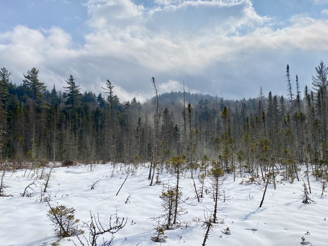
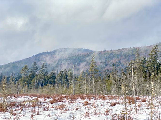
Fred's Bog awaits at approximately mile 0.3, where a boardwalk leads you from the forest into the heart of the bog where it terminates around mile 0.33. From the boardwalk, hikers can take-in the stunning views of the surrounding area like Cascade Mountain towering in the distance or the lush evergreen forests that line the bog’s shores.
After visiting Fred's Bog, hikers will head back uphill to reach the trailhead and parking to complete this 0.7-mile out-and-back hike.
Parking
Hikers will find a small parking lot at the coordinates provided, located on the North side of Browns Tract Road near Eagle Bay, New York. The lot is very small and can only fit a few cars at most (less than 5).
Pets
Dogs are allowed if leashed and must be cleaned up after.
Hike
The adventure begins at the main trailhead located on the North side of Browns Tract Road. Be sure to sign in at the trail registry to contribute to New York's annual visitor count. As you begin your hike, the trail gently ascends before descending towards the bog. The trail passes through scenic evergreen forests, with low-growing bushy trees and towering pines that create a mesmerizing backdrop. During our winter hike in February 2024, we were treated to unusually warm temperatures, caused fog to lift through the evergreen forest.
Fred's Bog - Mile 0.3 to 0.35
Fred's Bog awaits at approximately mile 0.3, where a boardwalk leads you from the forest into the heart of the bog where it terminates around mile 0.33. From the boardwalk, hikers can take-in the stunning views of the surrounding area like Cascade Mountain towering in the distance or the lush evergreen forests that line the bog’s shores.
After visiting Fred's Bog, hikers will head back uphill to reach the trailhead and parking to complete this 0.7-mile out-and-back hike.
Parking
Hikers will find a small parking lot at the coordinates provided, located on the North side of Browns Tract Road near Eagle Bay, New York. The lot is very small and can only fit a few cars at most (less than 5).
Pets
Dogs are allowed if leashed and must be cleaned up after.