The Frankenstein Cliffs and Arethusa Falls Loop at Crawford Notch State Park near Hart's Location, New Hampshire is a moderate to difficult 5.2-mile loop hike that features stunning vistas from the Frankenstein Cliffs and includes a stop at the massive 140-foot tall waterfall, Arethusa Falls.
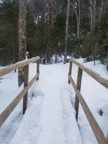
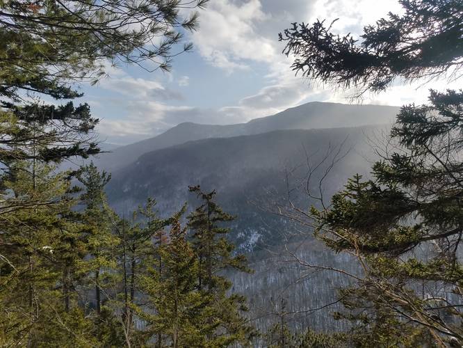
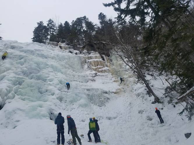
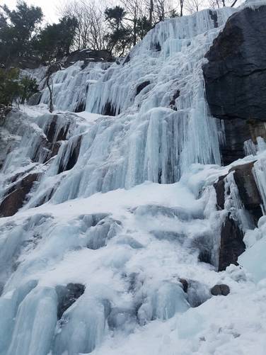
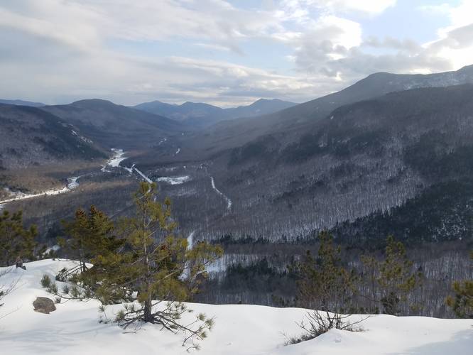
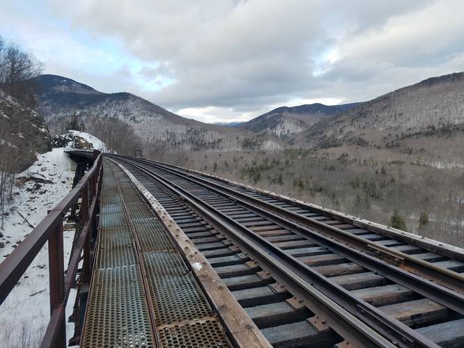
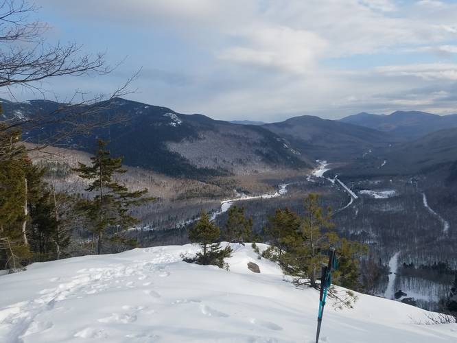
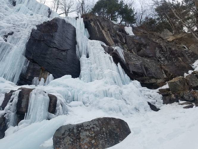
This hike has a little bit of everything, a 140-foot waterfall, great views of the White Mountains, cliffs, and a railroad bridge. In the winter (my favorite time to do this hike) you can check out the frozen waterfall and the ice coming off the cliffs. It's also a popular spot for ice climbing, so I like watching ice climbers scale the frozen waterfall.
You'll get a decent workout hiking up to the falls, then again heading up to the cliffs, but overall there's not a ton of mileage. Hikers should note that hiking this trail clockwise, or as shown in the GPS track here, is easier than counter-clockwise because of the steeper elevation change near the Frankenstein Cliffs.
I would say it's doable for older kids, and I saw plenty on the trail. I would recommend wearing traction if you do this trail in the winter, and unless there's a lot of fresh snow, you won't need snowshoes.
Difficulty
This hike should be considered moderate to difficult depending on your skill level and direction that you hike this trail. If hiked clockwise, the trail is certainly moderate, but if hiked counter-clockwise, the trail will likely be more difficult.
Pets
Dogs are allowed if leashed and their waste must be carried out by the hiker.
Parking
There are two parking areas - a lower one, right next to the main road, and another one further up the hill on Arethusa Falls Road. The coordinates provided will bring you to the lower parking lot.
Railroad Danger
Please note that this trail brings hikers along the Conway Scenic Railroad tracks. During the winter, the scenic train has a very infrequent schedule, but that does not mean that the train does not come barreling down these tracks. Hikers should be aware that there is a trail that runs adjacent to these railroad tracks and hikers should use this trail instead of hiking along the tracks for obvious reasons. Hike at your own risk.
Other Warnings
Hikers should be aware of a few things before heading out to explore the Frankenstein Cliffs and Arethusa Falls. During the winter, ice, snow, and melting water can make this trail dangerous especially near the waterfall and cliff's edge. Hikers should bring ice spikes or some sort of traction for their feet to ensure a safer hike.