The Franconia Ridge Loop at the White Mountain National Forest in Franconia, New Hampshire is a strenuous 8.1-mile loop hike featuring stunning views of the white mountains, mountain summits, and large waterfalls.
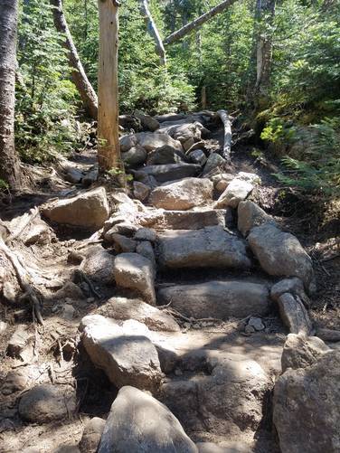
Trails: This hike follows three trails - Falling Waters Trail, Franconia Ridge Trail / Appalachian Trail, and Old Bridle Path in that order. I recommend you do this hike counter-clockwise, taking Falling Waters Trail up, and Old Bridle Path down. Falling Waters Trail tends to be quite wet, and can get slippery if you're coming down the steep terrain.
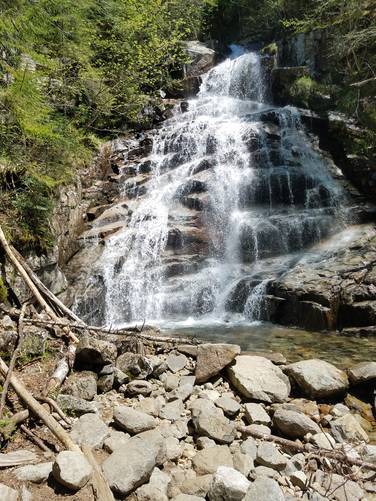
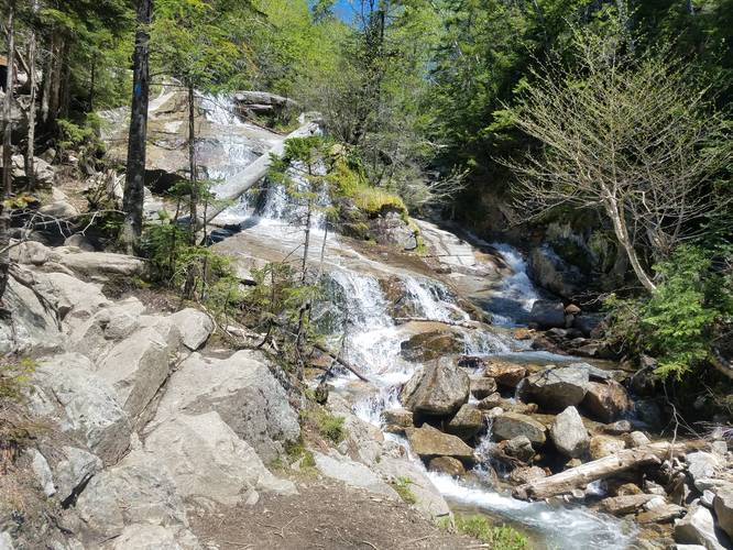
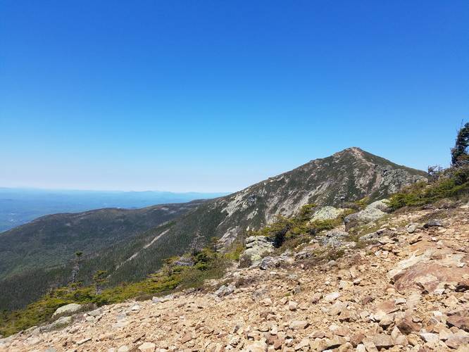
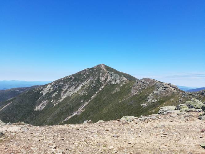
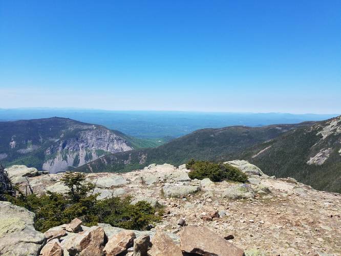
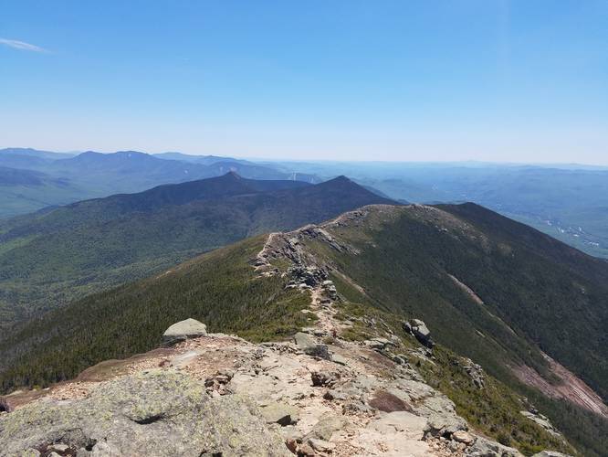
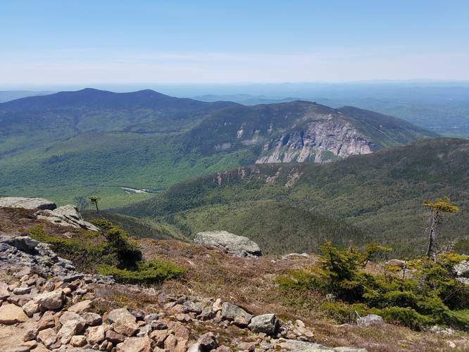
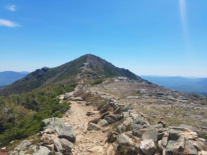
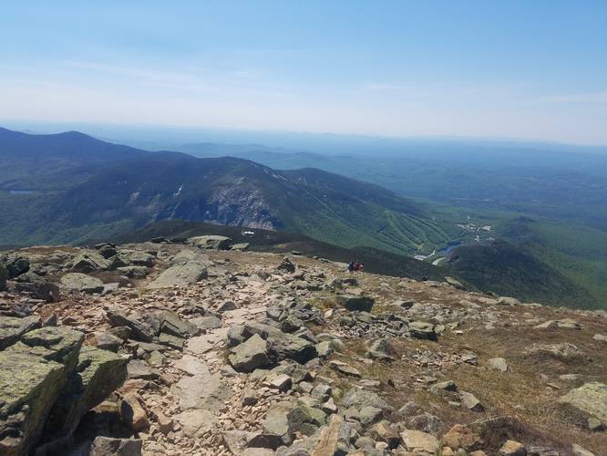
Falling Waters Trail features a number of beautiful waterfalls, which are best viewed at springtime. It's a very steep trail that leads up to the ridge, where it meets up with the Appalachian Trail. After approximately 2.8-miles along the Falling Waters Trail, you'll reach the Appalachian Trail / Franconia Ridge Trail. Here you'll traverse approximately 1.5-miles across the ridge and atop a few 4,000-foot peaks (Little Haystack and Mt. Lincoln) and make your final ascent up Mt. Lafayette. The views are unbelievable along the entire ridge, but it does leave you completely exposed. Remember to wear sunscreen and re-apply if needed.
Elevation: This trail ascends over 4,000-feet of elevation gain and is very strenuous. Only plan to hike this trail if you're an experienced hiker. Always know your limits before heading out to a trail like this.
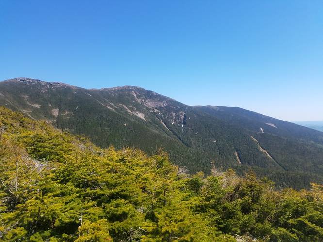
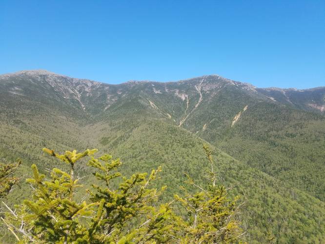
Mountain Summits: Along this hike, you'll tackle Little Haystack, Mt. Lincoln, Mt. Lafayette.
Parking: In the summer you may need to park at the overfill lot, a few exits north of the trailhead parking, and take the hiker shuttle down. It gets very busy on the weekends. The shuttle is $5 per person. You can best avoid this by showing up early in the morning.
Warnings: Wear bugspray, and be aware of the biting black flies. Remember to wear sunscreen and re-apply when necessary. Also, I would bring at least 2 liters of water, and refill at the Greenleaf hut (On the Old Bridle path trail after you summit Lafayette). Greenleaf Hut is displayed using the OpenStreetMap tiles in the trail map.
Trails: This hike follows three trails - Falling Waters Trail, Franconia Ridge Trail / Appalachian Trail, and Old Bridle Path in that order. I recommend you do this hike counter-clockwise, taking Falling Waters Trail up, and Old Bridle Path down. Falling Waters Trail tends to be quite wet, and can get slippery if you're coming down the steep terrain.
Falling Waters Trail features a number of beautiful waterfalls, which are best viewed at springtime. It's a very steep trail that leads up to the ridge, where it meets up with the Appalachian Trail. After approximately 2.8-miles along the Falling Waters Trail, you'll reach the Appalachian Trail / Franconia Ridge Trail. Here you'll traverse approximately 1.5-miles across the ridge and atop a few 4,000-foot peaks (Little Haystack and Mt. Lincoln) and make your final ascent up Mt. Lafayette. The views are unbelievable along the entire ridge, but it does leave you completely exposed. Remember to wear sunscreen and re-apply if needed.
Elevation: This trail ascends over 4,000-feet of elevation gain and is very strenuous. Only plan to hike this trail if you're an experienced hiker. Always know your limits before heading out to a trail like this.
Mountain Summits: Along this hike, you'll tackle Little Haystack, Mt. Lincoln, Mt. Lafayette.
Parking: In the summer you may need to park at the overfill lot, a few exits north of the trailhead parking, and take the hiker shuttle down. It gets very busy on the weekends. The shuttle is $5 per person. You can best avoid this by showing up early in the morning.
Warnings: Wear bugspray, and be aware of the biting black flies. Remember to wear sunscreen and re-apply when necessary. Also, I would bring at least 2 liters of water, and refill at the Greenleaf hut (On the Old Bridle path trail after you summit Lafayette). Greenleaf Hut is displayed using the OpenStreetMap tiles in the trail map.