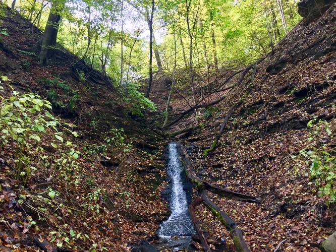
The Falls Trail in Fox Chapel, Pennsylvania is a 0.6 mile out-and-back hike that leads up from Hemlock Hollow Rd up to a 10-foot waterfall that spills into the Stony Camp Run steam.
The trail is mostly all uphill, hence Moderate difficulty, but it's not bad.
Waterfall: Reaching the waterfall, with the best view being at the base of the falls, is not easy. There's a small trail that leads down to the creek and through the gorge, which starts next to the first bench along the trail - just before the staircase that leads uphill. Follow the trail from the bench to a dead end, push past the brush and then then cross fallen trees and the creek itself to reach the base of the waterfall. This section is difficult to navigate, but well worth the payout if you can make it to the base of the falls. For other glimpses of the falls, you can stay on the main trail to get some spotty views of the waterfall from afar. From what I could tell, there might be two tiers to the waterfall and the upper tier is only slightly visible from the main trail.
Pets
Dogs are not allowed along this trail.
Blaze Colors
There are no blazes along this trail.