Loading...

WINTER SALE! 50% OFF Supporter Accounts — now through January 31st. Learn More.

Quarry Trail

The Quarry Trail at Forbes State Forest in Rector, Pennsylvania is a moderate 2.2 mile out-and-back hike that leads from the edge of Linn Run State Park and up to the nearby mountain ridge. The trail starts out in an old quarry, which lies along the trail about 100 feet into the hike. The remaining quarry isn't all that interesting, but you can see the lines in the rock where the miners carved out the mountainside.

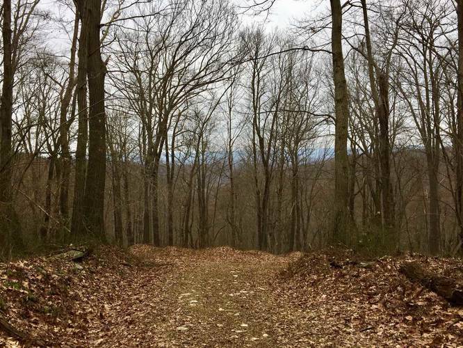
The hike heads uphill the entire time before you reach the ridge of the mountain. On the ridge, the trail flattens out, but can be very wet and muddy during the Spring, late winter, or after a heavy rainfall.

Camping: Dispersed camping, or primitive camping, is allowed on this trail and in other section of Forbes State Forest. Please check out their main site for more dispersed camping information.

Note: This trail is longer than the 2.2 miles out-and-back recorded here, but we did not track any further than 1.1 mile one-way in. The trail continues running through Forbes State Forest before hitting a trail junction and roads about a mile or so further from where this data stops. For more details, check out this Forbes State Forest trail map PDF.
Explore 32 trails near Rector, PA

Know Before You Go

  • Quarry Trail is a 2.2-mile moderate hike (out-and-back) in Rector, PA, starting at an old quarry site.
  • The trail ascends continuously to a mountain ridge, which can be wet and muddy, especially after rain.
  • Dispersed camping is permitted in the area, and the trail continues beyond the recorded 2.2 miles, connecting to other trails and roads.
Interactive topographic map for Quarry Trail located in Rector, PA. Click the "View Map" button to load GPS coordinates and trail markers.
Get directions
Distance
2.2 mi
Difficulty
Moderate
Type
Out-and-Back
Est. Time
1.1 hrs
Elev. Gain
442'
Rating
0.0
Added
February 21, 2018
Updated
June 10, 2018

Weather Forecast

Loading...
Total Change
479'
Ascent
442'
Descent
437'
Loading...

Download the GPX Data for Offline Use

Supporters get exclusive access to download trail routes to the MyHikes app for offline use. Stay prepared on your adventure, even without an internet connection! Become a Supporter today to unlock this feature and hike with confidence.

Download Quarry Trail GPX Data to the MyHikes Mobile App

Features

Dogs
Camping
Biking

Points of interest

  1. Parking

    40.153912, -79.212025
  2. Main Trailhead

    40.153811, -79.212487

Safety information

For your own safety: plan ahead, let someone know where you'll be, and hike at your own risk.

Availability

All seasons

Surface type

Dirt

Trip Reports (Reviews)

Your opinion matters! Be the first to rate this trail.

Ready to help fellow hikers? Add a trip report to share your experience and provide valuable insights for other hikers!

2.2 miles / 3.5 km
February 23, 2018
Dogs Hiking
No community routes found. To add your own hike as a Community Route for this Trail guide, leave a Trip Report with an attached GPX file.

Popular categories

Scenic mountain view representing vista trails
Vista trails
Scenic gorge of cascades representing waterfall trails
Waterfall hikes
Rugged mountain terrain representing summit trails
Summit trails
Scenic mountain view representing dog-friendly trails
Dog-friendly
Scenic campsite with a view representing camping trails
Camping trails
Appalachian Trail logo representing A.T. hikes
A.T. hikes

You May Also Like

New York's Best Waterfalls - Whether you're planning a day hike, roadside stop, or a leisurely short walk, this guide provides hikers, travelers, and locals alike with 63 different locations to over 100 scenic waterfalls to help plan your next adventure!
Explore

New York's Best Waterfalls

Whether you're planning a day hike, roadside stop, or a leisurely short walk, this guide provides hikers, travelers, and locals alike with 63 different locations to over 100 scenic waterfalls to help plan your next adventure!

Read
🍪 We use cookies to learn about site usage and to serve map tiles. You may block cookies manually in the browser. By continuing you agree. Learn more