Loading...

WINTER SALE! 50% OFF Supporter Accounts — now through January 31st. Learn More.

Flax Pond Trail

The Flax Pond Trail at Flax Pond Conservation Lands in Dennis, Massachusetts is a moderate 0.7-mile out-and-back hike that leads to several view points along the banks of Flax Pond.

Hike Description
This hike begins at the main parking lot for Flax Pond, located on Setucket Road at the coordinates provided and follows the main trail as it heads downhill, passing an open area of power lines, before reaching Flax Pond.

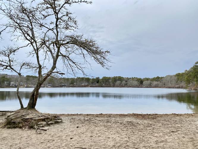
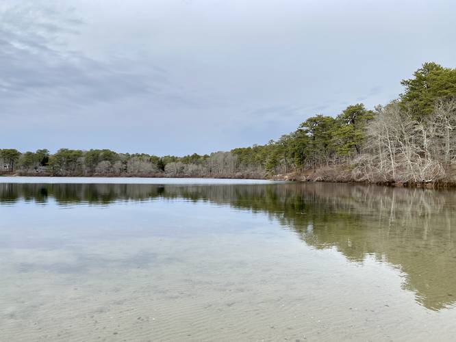
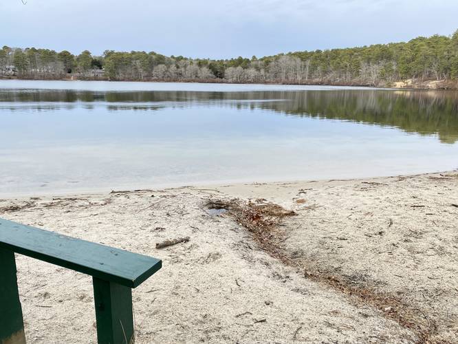
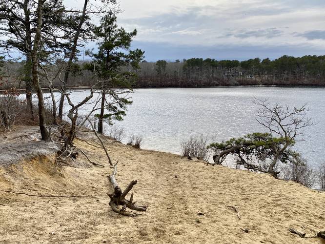
Once at Flax Pond, this GPS track heads west to check out the southern banks of the pond that features views of the water. Next, this hike heads east and then north along Flax Pond to reach an open, sandy sloping bank, that features westward-facing views of the pond. Here is where this hike turns back to parking, but Flax Pond has plenty of more miles of trails to explore beyond this short hike.

Parking
Hikers will find a large parking lot at the coordinates provided - it's large enough to fit over a dozen vehicles.

Pets
Dogs are allowed if leashed and cleaned up after.

Carry-in Carry-out
Hikers should always carry-in and carry-out. Note that there are trash receptacles at the trailhead.
Explore 46 trails near Dennis, MA

Know Before You Go

  • The Flax Pond Trail is a 0.7-mile moderate out-and-back hike in Dennis, MA, offering several scenic viewpoints along Flax Pond.
  • The trail is easily accessible with a large parking lot and includes open areas and sandy banks with westward-facing views of the pond.
  • Dogs are allowed on leash, and hikers should practice carry-in, carry-out, utilizing the provided trash receptacles at the trailhead.
Interactive topographic map for Flax Pond Trail located in Dennis, MA. Click the "View Map" button to load GPS coordinates and trail markers.
Get directions
Distance
0.7 mi
Difficulty
Moderate
Type
Out-and-Back
Est. Time
21 min
Elev. Gain
74'
Rating
0.0
Added
April 04, 2023
Updated
April 04, 2023

Weather Forecast

Today
High 34°F
Mostly Sunny
Tonight
Low 8°F
Partly Cloudy
Saturday
High 18°F
Mostly Sunny
Saturday Night
Low 12°F
Mostly Cloudy then Slight Chance Light Snow
Sunday
High 31°F
Heavy Snow
Sunday Night
Low 23°F
Heavy Snow
Monday
High 34°F
Snow
Monday Night
Low 14°F
Light Snow Likely
Tuesday
High 25°F
Chance Light Snow then Mostly Sunny
Tuesday Night
Low 14°F
Partly Cloudy
Wednesday
High 26°F
Mostly Sunny
Wednesday Night
Low 14°F
Mostly Cloudy
Thursday
High 26°F
Chance Light Snow
Thursday Night
Low 13°F
Chance Light Snow
Loading...
Total Change
51'
Ascent
74'
Descent
74'
Loading...

Download the GPX Data for Offline Use

Supporters get exclusive access to download trail routes to the MyHikes app for offline use. Stay prepared on your adventure, even without an internet connection! Become a Supporter today to unlock this feature and hike with confidence.

Download Flax Pond Trail GPX Data to the MyHikes Mobile App

Features

Vista / Lookout Point
Dogs
Water Source

Points of interest

  1. Parking

    41.713302, -70.18343
  2. Main Trailhead

    41.71363, -70.183757
  3. View of Flax Pond

    41.715214, -70.186219
    View of Flax Pond
  4. View of Flax Pond

    41.715317, -70.186386
    View of Flax Pond

Safety information

For your own safety: plan ahead, let someone know where you'll be, and hike at your own risk.

Hazards

Poison Ivy or Poison Oak

Availability

All seasons

Surface type

Dirt

Trip Reports (Reviews)

Your opinion matters! Be the first to rate this trail.

Ready to help fellow hikers? Add a trip report to share your experience and provide valuable insights for other hikers!

No community routes found. To add your own hike as a Community Route for this Trail guide, leave a Trip Report with an attached GPX file.

Popular categories

Scenic mountain view representing vista trails
Vista trails
Scenic gorge of cascades representing waterfall trails
Waterfall hikes
Rugged mountain terrain representing summit trails
Summit trails
Scenic mountain view representing dog-friendly trails
Dog-friendly
Scenic campsite with a view representing camping trails
Camping trails
Appalachian Trail logo representing A.T. hikes
A.T. hikes

You May Also Like

Colorado's Million Dollar Highway - Plan a day's drive adventure along the iconic Million Dollar Highway in Colorado. Explore the best short trails, roadside stops, waterfalls, vistas, ghost towns, and hot springs within a ~6 hour road trip.
Explore

Colorado's Million Dollar Highway

Plan a day's drive adventure along the iconic Million Dollar Highway in Colorado. Explore the best short trails, roadside stops, waterfalls, vistas, ghost towns, and hot springs within a ~6 hour road trip.

Read
Glacier's Going-to-the-Sun Road - Discover the breathtaking beauty of Glacier National Park along the iconic Going-to-the-Sun Road. From stunning roadside stops to picturesque waterfalls and vistas, this engineering marvel offers endless opportunities for exploration.
Explore

Glacier's Going-to-the-Sun Road

Discover the breathtaking beauty of Glacier National Park along the iconic Going-to-the-Sun Road. From stunning roadside stops to picturesque waterfalls and vistas, this engineering marvel offers endless opportunities for exploration.

Read
🍪 We use cookies to learn about site usage and to serve map tiles. You may block cookies manually in the browser. By continuing you agree. Learn more