Loading...

Distance:
0.4 Miles / 0.6 km
Type:
Out-and-Back
Difficulty:
Easy
Time to Hike:
~12 minutes
Features:
Surface Type:
Dirt
Park:
Highland Farm Preserve
Town:
York, Maine
Directions:
43.171684, -70.716606
Added:
August 05, 2021
Updated:
August 05, 2021
Loading...
Loading...
25 '

Total Change
33 '

Ascent
34 '

Descent

The Field Trail at the Highland Farm Preserve in York, Maine is an easy 0.4-mile out-and-back trail that features field views, leads the hiker further into the park, and features a small cemetery at the norther terminus.

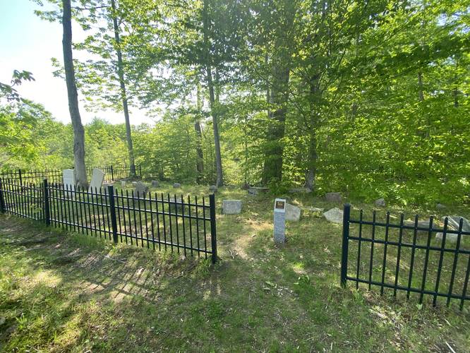
This trail does not have much to see other than the field views on the hike in. At the end of the trail is a small fenced-in cemetery with gravesites from the 1700s (see pictures for some examples). At the end of this trail, hikers can pickup several other trails - like the Barred Owl Trail.

Parking
Hikers will find parking at the coordinates provided.

Pets
Dogs are allowed if leashed and their waste must be carried out by the hiker.

Explore 37 trails near York, ME
  1. Parking

    43.171684, -70.716606
  2. Main Trailhead

    43.172042, -70.716482
  3. Cemetery from the 1700s

    43.173522, -70.714303
    Cemetery from the 1700s
No community routes found. To add your own hike as a Community Route for this Trail guide, leave a Trip Report with an attached GPX file.

Hazards

Ticks - Lyme Disease More Info (CDC)
Poison Ivy/Oak

Seasons

All

Photo Albums

1 Trip Report

No Star-Ratings
Write-up by:
Admin user profile picture
0.4 miles / 0.6 km
Trail added
August 05, 2021
Hiked on
May 26, 2021
Updated on
August 05, 2021

Weather Forecast

In York, ME

Explore Hiking Trails

New Hikes

Sugar Hill Fire Tower Hike
0.7 Miles
1.1 km
Easy
Out-and-Back
Eternal Flame Falls via Eternal Flame Trail
1.2 Miles
1.9 km
Moderate
Out-and-Back
Spencer Pond Loop
0.3 Miles
0.5 km
Easy
Loop
Upper Rattler Run Falls
1.9 Miles
3.1 km
Hard
Out-and-Back

Before you leave...

MyHikes is an indie web platform aimed to make exploring public trails easier for everyone. The site has no investors and is owned and operated by one person, Dave Miller (Founder & Admin). As the Founder, main contributor, and doer-of-all-things for MyHikes, I share my trips with over-detailed write-ups for fun on a volunteer basis and I believe that public trail information should be available to everyone.

It takes a lot of time 🕦, money 💰, and effort (including espresso shots ☕) to run MyHikes, including hiking , mapping , writing , and publishing new trails with high-quality content... along with building new features, moderating, site maintainance, and app development for iOS and Android . I simply ask that if you find MyHikes' trail guides helpful to please consider becoming a Supporter to help keep the site, iOS, and Android apps available to everyone.

Supporters unlock website and in-app perks with a one-time payment of $25 (you renew) 😎👍. Or you can simply make a Donation of your choice without a MyHikes user account. Otherwise, telling your friends about MyHikes is the next-best thing - both quick and free 🎉

Thanks for visiting MyHikes and have a great hike!️

Admin user profile picture

Dave Miller
MyHikes Founder & Admin