Felton Covered Bridge Trail
Hike Description
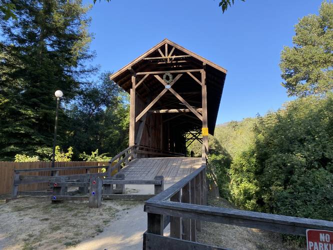
While not necessarily a hike, this short walk begins at the main parking area and ends on the opposite side of the covered bridge. The covered bridge was built in 1892 by the Cotton Bros. & Co. and is maintained by the Santa Cruz Museum of Art & History.
Hours
Park is open from 7AM to sunset.
Pets
Dogs are allowed if leashed.
Know Before You Go
Interactive topographic map for Felton Covered Bridge Trail located in Felton, CA. Click the "View Map" button to load GPS coordinates and trail markers.
View map
Get directions
- Distance
- 0.2 mi
- Difficulty
- Easy
- Type
- Out-and-Back
- Est. Time
- 6 min
- Elev. Gain
- 8'
- Rating
- 0.0
- Added
- May 30, 2022
- Updated
- May 30, 2022
Weather Forecast
Don't let Google decide who you trust.


Loading...
<strong>Trail map and elevation chart not rendering in print mode?</strong> Simply scroll to the trail map section, then try printing again!
Total Change
9 ft.
3 m
3 m
Ascent
8 ft.
2 m
2 m
Descent
8 ft.
2 m
2 m
Loading...
Features
- Dogs
Points of interest
-
Parking
37.051732, -122.070706 -
Main Trailhead
37.051586, -122.070656 -
Felton Covered Bridge
37.051011, -122.070503
Safety information
For your own safety: plan ahead, let someone know where you'll be, and hike at your own risk.
Availability
All seasons
Surface type
Dirt
Trip Reports (Reviews)
Ready to help fellow hikers? Add a trip report to share your experience!
No community routes found. To add your own hike as a Community Route for this Trail guide, leave a Trip Report with an attached GPX file.


You may also like

Explore
Best of the Alps: Hiking, Adventure & Scenery
Plan your ultimate European Alps adventure! Discover the best hiking trails, epic scenery, and villages in the Swiss Alps, Dolomites, Chamonix, and Lake Como.

Explore
Colorado's Million Dollar Highway
Plan a day's drive adventure along the iconic Million Dollar Highway in Colorado. Explore the best short trails, roadside stops, waterfalls, vistas, ghost towns, and hot springs within a ~6 hour road trip.

Explore
Glacier's Going-to-the-Sun Road
Discover the breathtaking beauty of Glacier National Park along the iconic Going-to-the-Sun Road. From stunning roadside stops to picturesque waterfalls and vistas, this engineering marvel offers endless opportunities for exploration.

Explore
Hike Washington's National Parks & Forests
Find the best day hikes in Washington's National Parks and Forests. Explore panoramic alpine vistas, turquoise lakes, and stunning waterfalls.
felton covered bridge county park

