The Felker's Falls via Bruce Trail at Felker's Falls Park in Hamilton, Ontario is an easy 0.9 km out-and-back hike that leads to a view of the 22 m (72-foot) tall waterfall, Felker's Falls.
Hike
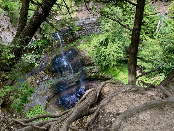
This short and easy hike begins at the main parking entrance for the park, located on Ackland Street. The trail follows a semi-paved, universally-accessible pathway for the first 0.2 km before switching to a universally-accessible dirt trail that leads through the forest. Not long after the trail bends around Davis Creek, it'll reach a cliff high above the gorge where Felker's Falls plunges down. Hikers will find the waterfall located around 0.4 km with a sketchy cliff side view. Hiking just a bit further down the trail provides the best view of the waterfall from the trail, located around 0.44 km. The view of Felker's Falls includes the entire cascade as it plummets in a free-falling cascade over bedrock of the Niagara Escarpment. After exploring the waterfall you can choose to hike further into the park for more kilometers or head out for a short 1 km out-and-back hike.
Universal Accessibility
This trail should be considered universally-accessible up to the Felker's Falls overlook. Note that for the first 0.25 km the trail is paved before switching to a smooth dirt substrate.
Parking
Hikers will find a large parking lot at the coordinates provided, located on the north side of Ackland Street in Hamilton, ON. The lot is large enough to fit over a dozen vehicles as of August 2024.
Pets
Dogs are allowed only if leashed and must be cleaned up after.
Warning
Steep cliffs: This hike leads to very-steep cliffs with sheer drop-offs. Watch your step and hike at your own risk.
Hike
This short and easy hike begins at the main parking entrance for the park, located on Ackland Street. The trail follows a semi-paved, universally-accessible pathway for the first 0.2 km before switching to a universally-accessible dirt trail that leads through the forest. Not long after the trail bends around Davis Creek, it'll reach a cliff high above the gorge where Felker's Falls plunges down. Hikers will find the waterfall located around 0.4 km with a sketchy cliff side view. Hiking just a bit further down the trail provides the best view of the waterfall from the trail, located around 0.44 km. The view of Felker's Falls includes the entire cascade as it plummets in a free-falling cascade over bedrock of the Niagara Escarpment. After exploring the waterfall you can choose to hike further into the park for more kilometers or head out for a short 1 km out-and-back hike.
Universal Accessibility
This trail should be considered universally-accessible up to the Felker's Falls overlook. Note that for the first 0.25 km the trail is paved before switching to a smooth dirt substrate.
Parking
Hikers will find a large parking lot at the coordinates provided, located on the north side of Ackland Street in Hamilton, ON. The lot is large enough to fit over a dozen vehicles as of August 2024.
Pets
Dogs are allowed only if leashed and must be cleaned up after.
Warning
Steep cliffs: This hike leads to very-steep cliffs with sheer drop-offs. Watch your step and hike at your own risk.