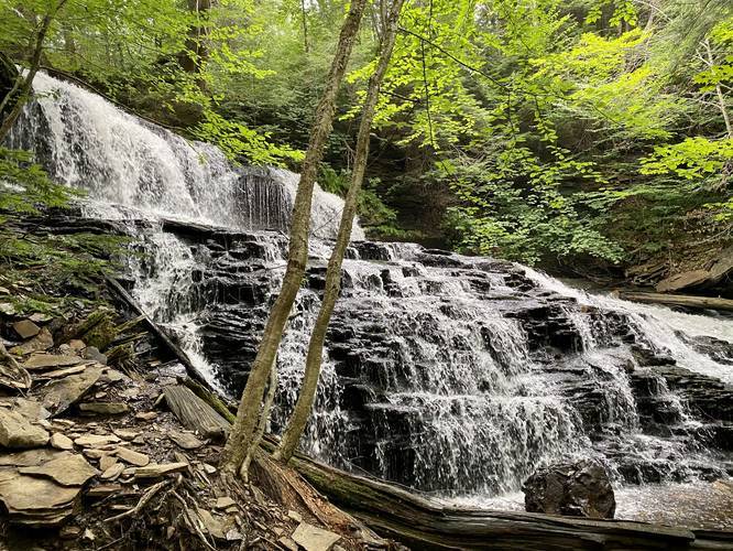
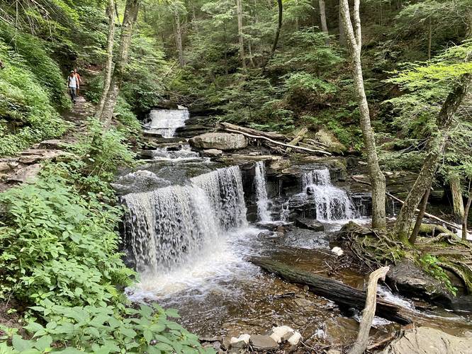
The Falls Trail at Ricketts Glen State Park near Benton, Pennsylvania is a difficult 5.3-mile loop trail that features 21 named waterfalls ranging from 11-feet tall to 94-feet tall (Ganoga Falls) and plenty of other unnamed waterfalls as well. This is by far one of the most popular day hikes in all of Pennsylvania, but it's also one of the most scenic as it boasts almost every type of waterfall that can be found in the state -- from multi-tiered falls to free-fall cascades, and even slide waterfalls.
Partial Trail Closure (10/27/2022)
As of October 27, 2022, there's a partial trail closure on the Glen Leigh side of the trail due to a hazardous rock collapse / landslide. This section of the trail will remain closed for the foreseeable future until the problem can be corrected. Note that the Glen Leigh side of the trail is in the eastern ravine of the loop - from the Highland Trail to Waters Meet.
Trail Description
This hike starts at the Lake Rose trailhead and follows the Falls Trail south. The first trail junction can be found no more than 0.3-miles into the hike, after passing several large boulders among a coniferous forest. Stay right at this first fork to continue heading toward the first waterfall. Not long after the first trail junction, hikers will meet up with another trail junction. Here, stay left to reach the downhill hike along the creek where hikers will find the first waterfall -- Mohawk Falls (37-feet tall).
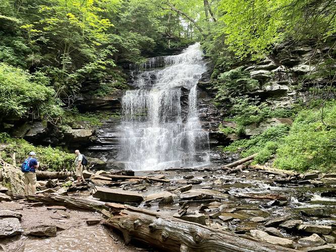
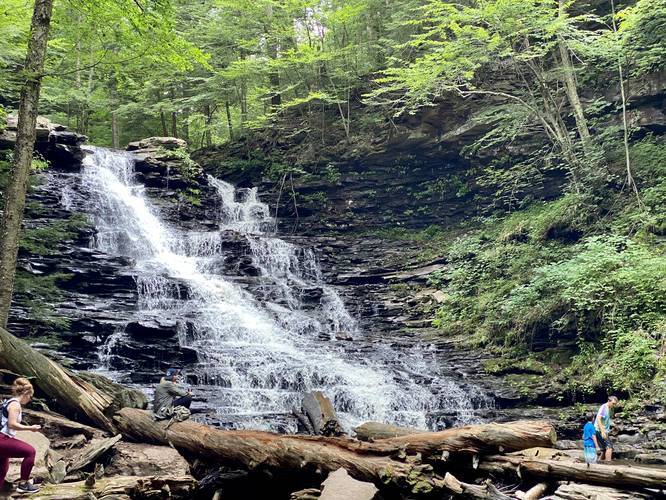
Continuing downhill from Mohawk Falls, hikers will reach Oneida Falls (13-feet tall) around mile 0.6. Cayuga Falls (11-feet tall) can be found not long after reaching Oneida Falls. The trail finally reaches the top of Ganoga Falls (94-feet tall) around mile 0.9, which is the largest waterfall at Ricketts Glen and is one of the main attractions along this trail. From here, the trail will head downhill along a couple of switchbacks to reach the base of Ganoga Falls (94-feet tall), around mile 0.95. Hikers should take in the breathtaking views of Ganoga Falls before continuing onward.
The trail will skirt around a cliff-side between Ganoga Falls and the next waterfall -- Seneca Falls (12-feet tall). Just after visiting Seneca Falls, the trail will skirt alongside Delaware Falls (37-feet tall) where hikers can stop for another view of this large waterfall. Just before the trail starts to head southeast, hikers will pass by Mohican Falls (39-feet tall), which is yet another beautiful large waterfall to stop and take photos at.
After hiking past Mohican Falls (39-feet tall), hikers will pass three more waterfalls before reaching the Waters Meet creek (and trail) junction. These waterfalls are listed in order: Conestoga Falls (17-feet tall), Tuscarora Falls (47-feet tall), and Erie Falls (47-feet tall).
Waters Meet Junction
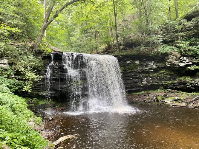
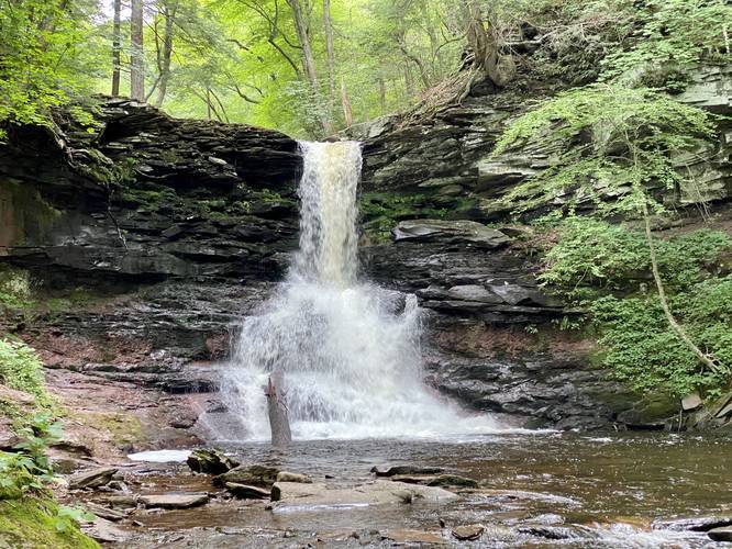
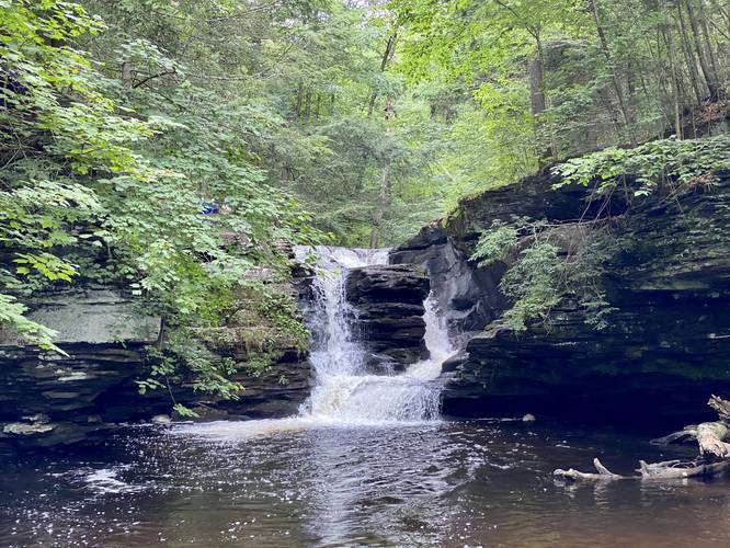
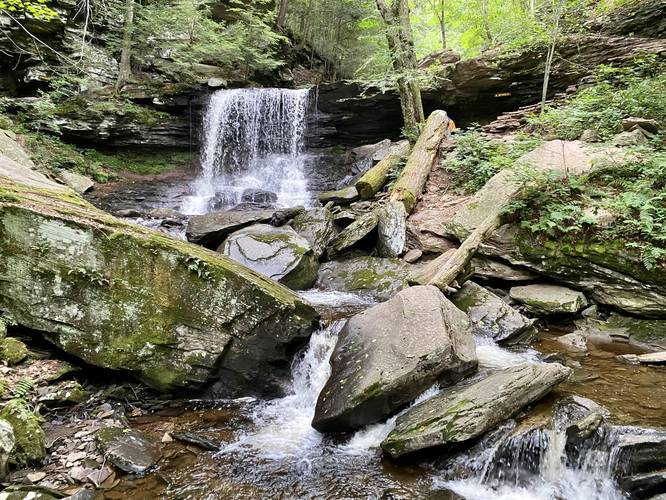
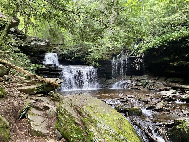
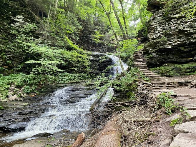
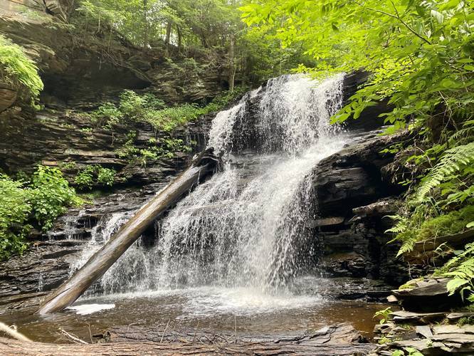
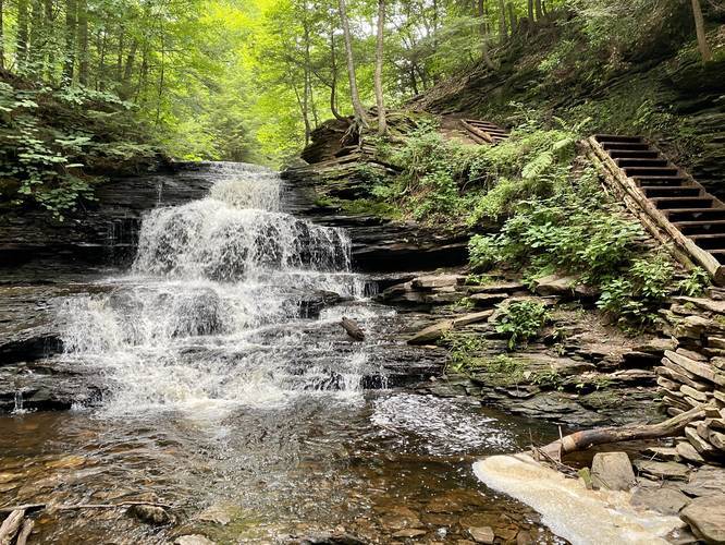
At the Waters Meet junction, there will be a large rock with a metal plaque on it along with a large sign showing hikers their location. Here, the trail heads directly south toward Ricketts Glen and three more waterfalls -- this section of the trail is a lot more quiet as a lot of hikers tend to overlook these three waterfalls. The hike down stream from here is relatively easy despite the rock staircase climbs back; however, hikers will reach Harrison Wright Falls (27-feet tall), Sheldon Reynolds Falls (36-feet tall), and Murray Reynolds Falls (16-feet tall) before turning around and hiking back to Waters Meet. The best waterfall along this section is the free-falling cascade of Sheldon Reynolds Falls where hikers can usually enjoy a nice misty watering downstream from the falls. The most unique waterfall along this section is the Murray Reynolds Falls despite it's shorter height because of how the water has carved away at the rock at the top of the waterfall, making for a "twin falls" effect.
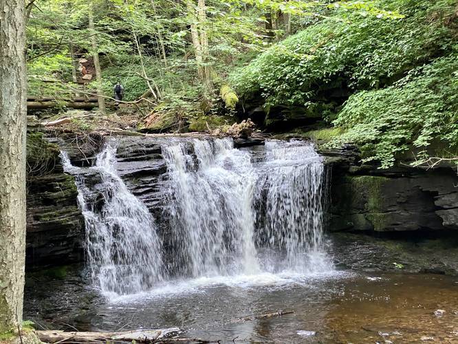
After hiking back to Waters Meet, the trail will head northeast to reach eight more waterfalls. The first waterfall hikers will visit is Wyandot Falls (15-feet tall). Directly after Wyandot Falls is the scenic (often over-photographed) B. Reynolds Falls (40-feet tall) where a beautiful wooden bridge spans the creek giving hikers views of this waterfall.
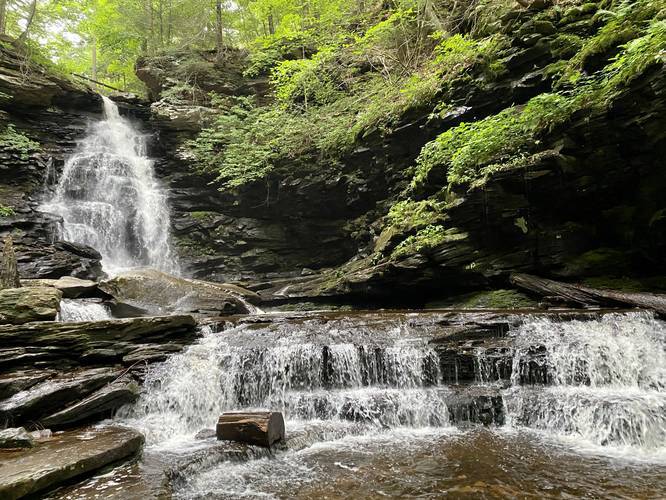
After visiting the B. Reynolds Falls (40-feet tall), hikers will reach the R.B. Ricketts Falls (36-feet tall). Just after R.B. Ricketts Falls is the Ozone Falls (60-feet tall), which is yet another massive waterfall and a beautiful spot to take more scenic pictures; however, Ozone Falls cascades down the hillside for about 100-feet making it difficult to photograph the entire waterfall.
After passing the Ozone Falls, hikers will head upstream for a short while before reaching two waterfalls that sit almost back to back to one another -- Huron Falls (41-feet tall) and Shawnee Falls (30-feet tall). These two waterfalls are beautiful, but there isn't much room to walk to the base of the falls for good photos for these two cascades.
With two waterfalls left to visit, the F.L. Ricketts Falls (38-feet tall) is one of the last large waterfalls that hikers will pass. This waterfall is one of the more popular stops along the trail since it's closer to the eastern parking lot; however, hikers can get a full view of this waterfall. Hiking onward from here, hikers will pass Onondaga Falls (15-feet tall) for the last waterfall along this stunning hike.
Hiking back to Parking
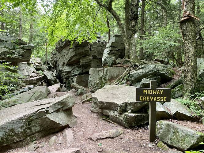
After visiting Onondaga Falls, hikers will reach a trail junction with the Highland Trail. Hike west along this trail, passing the Midway Crevasse (a large boulder field along the trail), to reach the first trail junction along the loop that you initially passed after leaving the parking lot. At this trail junction, take a right-hand turn to reach the parking lot.
Parking
Hikers can find parking at the coordinates provided which will bring you to the Lake Rose parking lot for the Falls Trail trailhead. Please note that this is the shortest hike into the Falls Trail loop and thus this parking lot fills up quickly on weekends. There's an additional parking lot to the east of the Falls Trail loop.
Pets
Dogs are allowed if leashed and their waste must be carried out by the hiker.
Warnings
This trail has numerous slippery rock staircases that run adjacent to steep hillsides along the glen's ravines. Watch your step and bring the proper footwear and trekking poles if necessary.
Difficulty
This trail is considered "Hard" or difficult because of the steep elevation climbs along the numerous staircases. The trail is also littered with rocks and roots and runs along dangerous creek-side cliffs. If hiked slow, the trail can be considered "Moderate" for those in good physical condition.
Popularity
This is one of the most highly-trafficked trails in all of Pennsylvania. Ricketts Glen State Park is open from sunrise to sunset, daily and thus if you wish to see this trail with very few people, hikers must show up extremely early. Midweek, by 9:30AM, the Lake Rose parking lot was 50% full.
21 Ricketts Glen Waterfalls
Waterfalls are listed counter-clockwise following the GPS track provided.
- Mohawk Falls: 37-feet tall near mile 0.45.
- Oneida Falls: 13-feet tall near mile 0.6.
- Cayuga Falls: 11-feet tall near mile 0.75.
- Ganoga Falls (base of falls): 94-feet tall near mile 0.95.
- Seneca Falls: 12-feet tall near mile 1.03.
- Delaware Falls: 37-feet tall near mile 1.1.
- Mohican Falls: 39-feet tall near mile 1.15.
- Conestoga Falls (missing a photo): 17-feet tall near mile 1.3.
- Tuscarora Falls: 47-feet near mile 1.45.
- Erie Falls: 47-feet near mile 1.65.
- Harrison Wright Falls: 27-feet near mile 2.
- Sheldon Reynolds Falls: 36-feet near mile 2.1.
- Murray Reynolds Falls: 16-feet near mile 2.3.
- Wyandot Falls: 15-feet near mile 2.88.
- B. Reynolds Falls: 40-feet near mile 2.9.
- R.B. Ricketts Falls: 36-feet near mile 3.1.
- Ozone Falls: 60-feet near mile 3.3.
- Huron Falls: 41-feet near mile 3.6.
- Shawnee Falls: 30-feet near mile 3.7.
- F.L. Ricketts Falls: 38-feet near mile 3.9.
- Onondaga Falls: 15-feet near mile 4.
Winter Access
This trail is only accessible in the winter for hikers and ice climbers who have signed-in/called-in and out via the park office and who also have ice gear including crampons, an ice axe, rope, a helmet, and experience. Please see the Ricketts Glen site for more info.
Partial Trail Closure (10/27/2022)
As of October 27, 2022, there's a partial trail closure on the Glen Leigh side of the trail due to a hazardous rock collapse / landslide. This section of the trail will remain closed for the foreseeable future until the problem can be corrected. Note that the Glen Leigh side of the trail is in the eastern ravine of the loop - from the Highland Trail to Waters Meet.
Trail Description
This hike starts at the Lake Rose trailhead and follows the Falls Trail south. The first trail junction can be found no more than 0.3-miles into the hike, after passing several large boulders among a coniferous forest. Stay right at this first fork to continue heading toward the first waterfall. Not long after the first trail junction, hikers will meet up with another trail junction. Here, stay left to reach the downhill hike along the creek where hikers will find the first waterfall -- Mohawk Falls (37-feet tall).
Continuing downhill from Mohawk Falls, hikers will reach Oneida Falls (13-feet tall) around mile 0.6. Cayuga Falls (11-feet tall) can be found not long after reaching Oneida Falls. The trail finally reaches the top of Ganoga Falls (94-feet tall) around mile 0.9, which is the largest waterfall at Ricketts Glen and is one of the main attractions along this trail. From here, the trail will head downhill along a couple of switchbacks to reach the base of Ganoga Falls (94-feet tall), around mile 0.95. Hikers should take in the breathtaking views of Ganoga Falls before continuing onward.
The trail will skirt around a cliff-side between Ganoga Falls and the next waterfall -- Seneca Falls (12-feet tall). Just after visiting Seneca Falls, the trail will skirt alongside Delaware Falls (37-feet tall) where hikers can stop for another view of this large waterfall. Just before the trail starts to head southeast, hikers will pass by Mohican Falls (39-feet tall), which is yet another beautiful large waterfall to stop and take photos at.
After hiking past Mohican Falls (39-feet tall), hikers will pass three more waterfalls before reaching the Waters Meet creek (and trail) junction. These waterfalls are listed in order: Conestoga Falls (17-feet tall), Tuscarora Falls (47-feet tall), and Erie Falls (47-feet tall).
Waters Meet Junction
At the Waters Meet junction, there will be a large rock with a metal plaque on it along with a large sign showing hikers their location. Here, the trail heads directly south toward Ricketts Glen and three more waterfalls -- this section of the trail is a lot more quiet as a lot of hikers tend to overlook these three waterfalls. The hike down stream from here is relatively easy despite the rock staircase climbs back; however, hikers will reach Harrison Wright Falls (27-feet tall), Sheldon Reynolds Falls (36-feet tall), and Murray Reynolds Falls (16-feet tall) before turning around and hiking back to Waters Meet. The best waterfall along this section is the free-falling cascade of Sheldon Reynolds Falls where hikers can usually enjoy a nice misty watering downstream from the falls. The most unique waterfall along this section is the Murray Reynolds Falls despite it's shorter height because of how the water has carved away at the rock at the top of the waterfall, making for a "twin falls" effect.
After hiking back to Waters Meet, the trail will head northeast to reach eight more waterfalls. The first waterfall hikers will visit is Wyandot Falls (15-feet tall). Directly after Wyandot Falls is the scenic (often over-photographed) B. Reynolds Falls (40-feet tall) where a beautiful wooden bridge spans the creek giving hikers views of this waterfall.
After visiting the B. Reynolds Falls (40-feet tall), hikers will reach the R.B. Ricketts Falls (36-feet tall). Just after R.B. Ricketts Falls is the Ozone Falls (60-feet tall), which is yet another massive waterfall and a beautiful spot to take more scenic pictures; however, Ozone Falls cascades down the hillside for about 100-feet making it difficult to photograph the entire waterfall.
After passing the Ozone Falls, hikers will head upstream for a short while before reaching two waterfalls that sit almost back to back to one another -- Huron Falls (41-feet tall) and Shawnee Falls (30-feet tall). These two waterfalls are beautiful, but there isn't much room to walk to the base of the falls for good photos for these two cascades.
With two waterfalls left to visit, the F.L. Ricketts Falls (38-feet tall) is one of the last large waterfalls that hikers will pass. This waterfall is one of the more popular stops along the trail since it's closer to the eastern parking lot; however, hikers can get a full view of this waterfall. Hiking onward from here, hikers will pass Onondaga Falls (15-feet tall) for the last waterfall along this stunning hike.
Hiking back to Parking
After visiting Onondaga Falls, hikers will reach a trail junction with the Highland Trail. Hike west along this trail, passing the Midway Crevasse (a large boulder field along the trail), to reach the first trail junction along the loop that you initially passed after leaving the parking lot. At this trail junction, take a right-hand turn to reach the parking lot.
Parking
Hikers can find parking at the coordinates provided which will bring you to the Lake Rose parking lot for the Falls Trail trailhead. Please note that this is the shortest hike into the Falls Trail loop and thus this parking lot fills up quickly on weekends. There's an additional parking lot to the east of the Falls Trail loop.
Pets
Dogs are allowed if leashed and their waste must be carried out by the hiker.
Warnings
This trail has numerous slippery rock staircases that run adjacent to steep hillsides along the glen's ravines. Watch your step and bring the proper footwear and trekking poles if necessary.
Difficulty
This trail is considered "Hard" or difficult because of the steep elevation climbs along the numerous staircases. The trail is also littered with rocks and roots and runs along dangerous creek-side cliffs. If hiked slow, the trail can be considered "Moderate" for those in good physical condition.
Popularity
This is one of the most highly-trafficked trails in all of Pennsylvania. Ricketts Glen State Park is open from sunrise to sunset, daily and thus if you wish to see this trail with very few people, hikers must show up extremely early. Midweek, by 9:30AM, the Lake Rose parking lot was 50% full.
21 Ricketts Glen Waterfalls
Waterfalls are listed counter-clockwise following the GPS track provided.
- Mohawk Falls: 37-feet tall near mile 0.45.
- Oneida Falls: 13-feet tall near mile 0.6.
- Cayuga Falls: 11-feet tall near mile 0.75.
- Ganoga Falls (base of falls): 94-feet tall near mile 0.95.
- Seneca Falls: 12-feet tall near mile 1.03.
- Delaware Falls: 37-feet tall near mile 1.1.
- Mohican Falls: 39-feet tall near mile 1.15.
- Conestoga Falls (missing a photo): 17-feet tall near mile 1.3.
- Tuscarora Falls: 47-feet near mile 1.45.
- Erie Falls: 47-feet near mile 1.65.
- Harrison Wright Falls: 27-feet near mile 2.
- Sheldon Reynolds Falls: 36-feet near mile 2.1.
- Murray Reynolds Falls: 16-feet near mile 2.3.
- Wyandot Falls: 15-feet near mile 2.88.
- B. Reynolds Falls: 40-feet near mile 2.9.
- R.B. Ricketts Falls: 36-feet near mile 3.1.
- Ozone Falls: 60-feet near mile 3.3.
- Huron Falls: 41-feet near mile 3.6.
- Shawnee Falls: 30-feet near mile 3.7.
- F.L. Ricketts Falls: 38-feet near mile 3.9.
- Onondaga Falls: 15-feet near mile 4.
Winter Access
This trail is only accessible in the winter for hikers and ice climbers who have signed-in/called-in and out via the park office and who also have ice gear including crampons, an ice axe, rope, a helmet, and experience. Please see the Ricketts Glen site for more info.