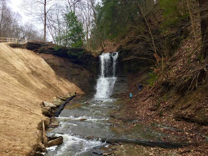
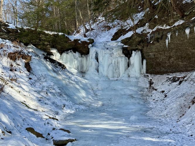
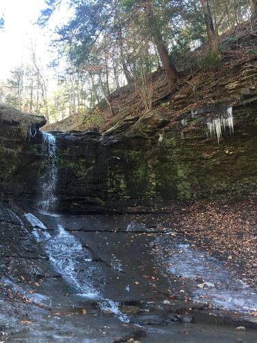
The Fall Run Trail at Fall Run Park in Glenshaw, Pennsylvania, is an easy 1.6 mile out-and-back hike that features a 15 foot waterfall, Fall Run Falls.
Hike Description
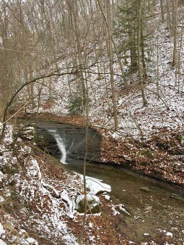
This short hike runs along Fall Run Creek the entire time with scenic views along the way of the ravine/gorge that the trail passes through. There's another waterfall closer to the southern end of the trail, just after you cross the creek the 2nd time - this waterfall is about 5 feet tall and about 5 to 8 feet wide. There's no outcropping overlook for the smaller waterfall, but you can get a glimpse of it right on the side of the trail, especially during the Fall or Winter when the leaves are off of the trees.
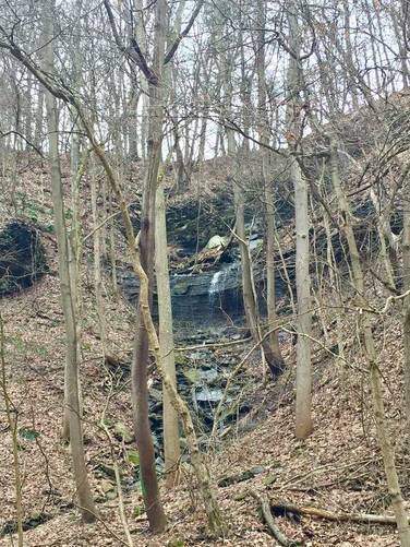
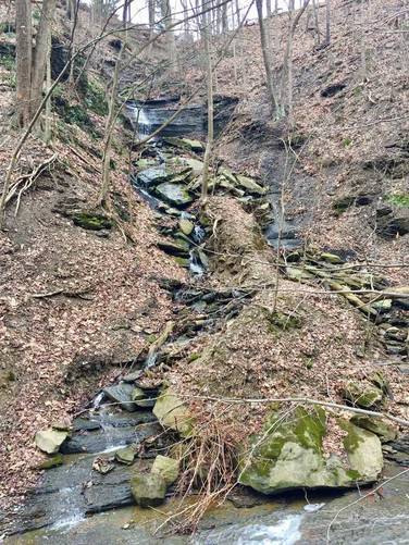
Along the sides of the ravine are seasonal creeks with waterfalls that cascade down into Fall Run Creek during the Spring and wetter months. Most of these additional waterfalls run down the hillside are multi-tiered, but there are a couple of 10 foot falls directly in Fall Run Creek as well. This is definitely one of the best hikes just outside of Pittsburgh, Pennsylvania and is a very unique spot in the winter.
For an additional adventure at Fall Run Park, check out the Hidden Waterfall Trail, which is a difficult hike, but has some two huge waterfalls during heavy-rain seasons.
Parking
Hikers will find parking at the coordinates provided for the southern parking lot. Fall Run Park has two parking lots with one located at the northern end of this trail. Both parking lots are able to fit a dozen vehicles or slightly more.
Pets
Dogs are allowed only if leashed and must be cleaned up after.
Hike Description
This short hike runs along Fall Run Creek the entire time with scenic views along the way of the ravine/gorge that the trail passes through. There's another waterfall closer to the southern end of the trail, just after you cross the creek the 2nd time - this waterfall is about 5 feet tall and about 5 to 8 feet wide. There's no outcropping overlook for the smaller waterfall, but you can get a glimpse of it right on the side of the trail, especially during the Fall or Winter when the leaves are off of the trees.
Along the sides of the ravine are seasonal creeks with waterfalls that cascade down into Fall Run Creek during the Spring and wetter months. Most of these additional waterfalls run down the hillside are multi-tiered, but there are a couple of 10 foot falls directly in Fall Run Creek as well. This is definitely one of the best hikes just outside of Pittsburgh, Pennsylvania and is a very unique spot in the winter.
For an additional adventure at Fall Run Park, check out the Hidden Waterfall Trail, which is a difficult hike, but has some two huge waterfalls during heavy-rain seasons.
Parking
Hikers will find parking at the coordinates provided for the southern parking lot. Fall Run Park has two parking lots with one located at the northern end of this trail. Both parking lots are able to fit a dozen vehicles or slightly more.
Pets
Dogs are allowed only if leashed and must be cleaned up after.