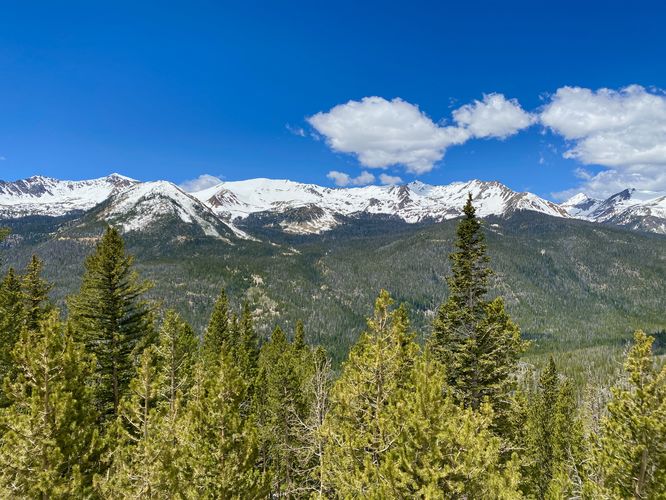
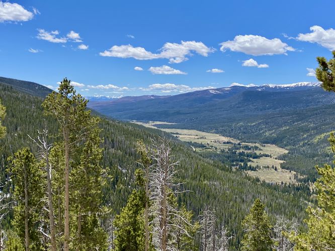
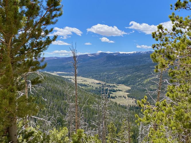
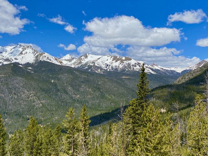
Fairview Lookout at Rocky Mountain National Park
near Grand Lake, Colorado is a universally-accessible roadside view
that features beautiful views of Coyote Valley, the Colorado River, and
snow-capped mountains.
This is not a hike and just barely a walk, but Fairview Lookout deserves its own write-up on MyHikes for visitors who want to explore Rocky Mountain National Park's beauty from the parking lot or sidewalks. Fairview Lookout is the first overlook, lookout, or vista that visitors on the west side of the park hit on their way up Trail Ridge Road. If you've spent any time exploring the Coyote Valley Trail, or simply haven't taken-in any of Rocky Mountain's roadside views yet, this lookout should be considered stopping at to take in the views from this section of the park.
Due to this overlook's altitude at 10,100-feet above sea level, it's a great place for visitors to take-in the natural beauty while also taking short walks to acclimatize.
Paved Path & Universal Access
This short parking lot viewpoint is universally accessible via pavement and a sidewalk.
Pets
Dogs are only allowed at the parking lot and must be cleaned-up after.
Parking
Hikers will find a medium-sized parking turnout at the coordinates provided along Trail Ridge Road. The lot is large enough to fit less than a dozen vehicles as of June 2024. There's also additional roadside parking along Trail Ridge Road on the western side of the lookout. The parking spaces there should fit another half-dozen vehicles or more as of June 2024.
Timed-Entry Reservations
Between the months of late May through early October you must purchase a timed-entry pass to visit Rocky Mountain National Park. If you wish to visitor and hike anything off of the Bear Lake Road, you must purchase a dedicated Bear Lake timed-entry pass. You can find more information about timed entry on the park's website.
Warnings
Elevation sickness: This trail brings hikers through terrain at 10,100-feet above sea level. Around the 7,000-foot mark above sea level, hikers may start to experience symptoms of elevation sickness including headache, muscle aches, shortness of breath, among other warning signs. In order to avoid elevation sickness it's recommended to ascend to higher elevations and take short walks to acclimate over the course of several days before taking a long or physically-demanding hike. At any time you feel elevation sickness kicking in, that's the time to turn back and head for lower altitude or the parking lot.