The Coyote Valley Trail at Rocky Mountain National Park near Grand Lake, Colorado is an easy 0.7-mile out-and-back universally-accessible trail that features views of the Colorado River and surrounding snow-capped mountains.
Hike
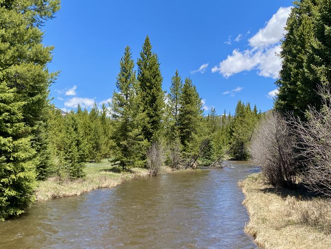
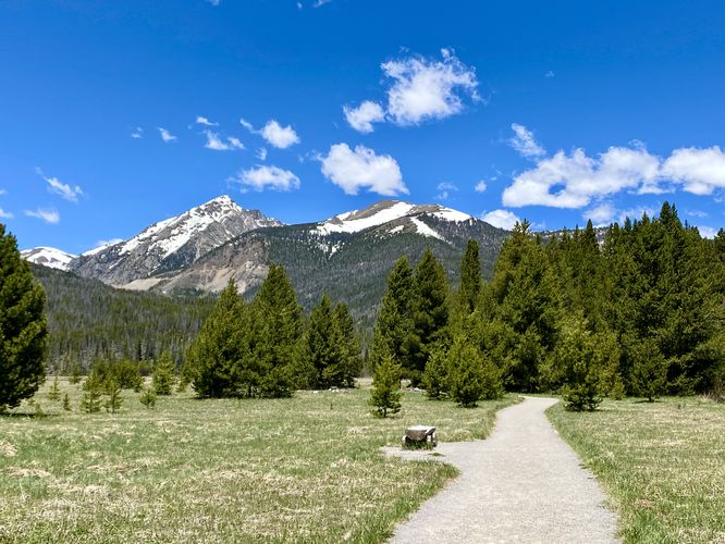
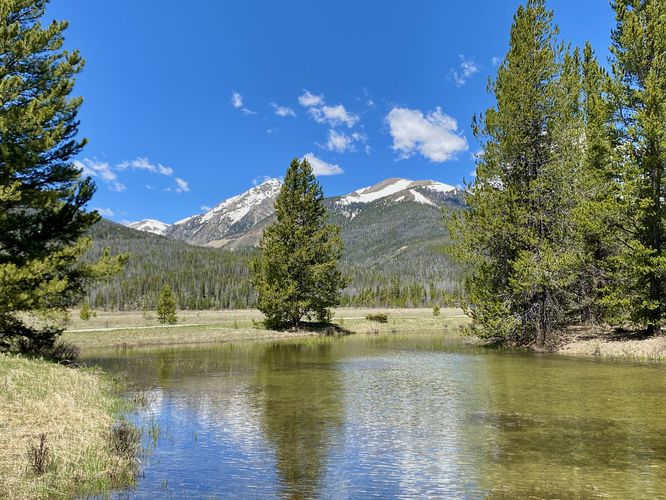
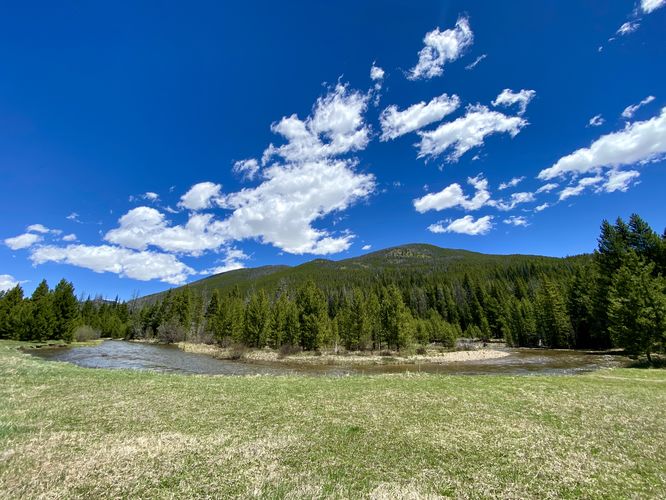
This very short hike follows a mostly-flat, wide, and universally-accessible trail through Coyote Valley in the park. The trail is mostly exposed, so plan to bring sunscreen as there isn't a whole lot of shade that covers the trail. Due to the lack of shade, hikers will find beautiful views of the surrounding mountains which are often found snow-capped. The trail runs along the Colorado River as it cuts its way through the valley. The wide expanse of the valley is due to the river's tendency to flood, so the wide open spaces you see along the trail is technically the Colorado River's floodplain.
This GPS track ends just shy of the true "end" of the Coyote Valley Trail, where there's a short loop that connects back to this out-and-back, forming a lollipop. Due to the extensive sun and lack of preparation, we turned back for parking; however, the views from near the end of the trail - of both the mountains and Colorado River are strikingly similar to those along the hike in toward the loop. Explore as much or as little as you please along this short hike.
Restrooms
There are pit toilets with hand sanitizer located at the trailhead, as of June 2024.
Pets
Dogs are not allowed on this trail.
Parking
Hikers will find a small parking lot at the coordinates provided, located on Trail Ridge Road at the Coyote Valley Trailhead. The lot is large enough to fit no more than about 10 vehicles as of June 2024.
Wildlife Viewing
This trail is great for viewing wildlife, especially deer, elk, and moose due to the lake's water source for drinking. If you wish to spot wildlife, your best chances are in the early morning or in the early evening. Always keep a safe distance while viewing - approx. 75-feet for elk and longhorn sheep; 120-feet for bear and moose.
Timed-Entry Reservations
Between the months of late May through early October you must purchase a timed-entry pass to visit Rocky Mountain National Park. If you wish to visitor and hike anything off of the Bear Lake Road, you must purchase a dedicated Bear Lake timed-entry pass. You can find more information about timed entry on the park's website.
Warnings
Elevation sickness: This trail brings hikers through terrain that ascends up to 8,800-feet above sea level. Around the 7,000-foot mark above sea level, hikers may start to experience symptoms of elevation sickness including headache, muscle aches, shortness of breath, among other warning signs. In order to avoid elevation sickness it's recommended to ascend to higher elevations and take short walks to acclimate over the course of several days before taking a long or physically-demanding hike. At any time you feel elevation sickness kicking in, that's the time to turn back and head for lower altitude or the parking lot.
Wild animals: While rare, hikers may encounter bears or mountain lion along the trail. Again, this is rare due to the insane amount of people who hike these trails each day; however, it's smart to know that these wild animals could be on-trail. Please read-up on how to properly handle a bear or mountain lion encounter before hitting the trails.
Hike
This very short hike follows a mostly-flat, wide, and universally-accessible trail through Coyote Valley in the park. The trail is mostly exposed, so plan to bring sunscreen as there isn't a whole lot of shade that covers the trail. Due to the lack of shade, hikers will find beautiful views of the surrounding mountains which are often found snow-capped. The trail runs along the Colorado River as it cuts its way through the valley. The wide expanse of the valley is due to the river's tendency to flood, so the wide open spaces you see along the trail is technically the Colorado River's floodplain.
This GPS track ends just shy of the true "end" of the Coyote Valley Trail, where there's a short loop that connects back to this out-and-back, forming a lollipop. Due to the extensive sun and lack of preparation, we turned back for parking; however, the views from near the end of the trail - of both the mountains and Colorado River are strikingly similar to those along the hike in toward the loop. Explore as much or as little as you please along this short hike.
Restrooms
There are pit toilets with hand sanitizer located at the trailhead, as of June 2024.
Pets
Dogs are not allowed on this trail.
Parking
Hikers will find a small parking lot at the coordinates provided, located on Trail Ridge Road at the Coyote Valley Trailhead. The lot is large enough to fit no more than about 10 vehicles as of June 2024.
Wildlife Viewing
This trail is great for viewing wildlife, especially deer, elk, and moose due to the lake's water source for drinking. If you wish to spot wildlife, your best chances are in the early morning or in the early evening. Always keep a safe distance while viewing - approx. 75-feet for elk and longhorn sheep; 120-feet for bear and moose.
Timed-Entry Reservations
Between the months of late May through early October you must purchase a timed-entry pass to visit Rocky Mountain National Park. If you wish to visitor and hike anything off of the Bear Lake Road, you must purchase a dedicated Bear Lake timed-entry pass. You can find more information about timed entry on the park's website.
Warnings
Elevation sickness: This trail brings hikers through terrain that ascends up to 8,800-feet above sea level. Around the 7,000-foot mark above sea level, hikers may start to experience symptoms of elevation sickness including headache, muscle aches, shortness of breath, among other warning signs. In order to avoid elevation sickness it's recommended to ascend to higher elevations and take short walks to acclimate over the course of several days before taking a long or physically-demanding hike. At any time you feel elevation sickness kicking in, that's the time to turn back and head for lower altitude or the parking lot.
Wild animals: While rare, hikers may encounter bears or mountain lion along the trail. Again, this is rare due to the insane amount of people who hike these trails each day; however, it's smart to know that these wild animals could be on-trail. Please read-up on how to properly handle a bear or mountain lion encounter before hitting the trails.