The Estes Park Riverwalk in Estes Park, Colorado is an easy 0.9-mile out-and-back walk that runs along Fall River, located in the heart of downtown Estes Park and features river views and opportunities to grab a coffee or a bite to eat.
Walk
This is not a hike but rather a stroll through downtown Estes Park along the Riverwalk Trail. The Riverwalk connects to several different points in Estes Park, including the Lake Estes Trail - if you walk far enough. This section of the trail begins on the east side of Moraine Ave and runs along Fall River until reaching the tunnel at US-34, about a half-mile down. During our walk here, we decided to check out the Riverwalk, but also grab some coffee -- killing two birds with one stone. At the time we grabbed a bite to eat at the River Walk Cafe and then snagged an espresso and ice coffee from Kind Coffee, making for a peaceful 0.9-mile morning walk.
Universal Access
This trail is universally accessible and follows a paved or concrete pathway. Note that there are road crossings with crosswalks - some of which you may need to use additional sidewalks if the trail crossings are not fully accessible.
Parking
Visitors to downtown Estes Park will find plenty of parking lots (paid) around town. The GPS coordinates provided will bring you to one parking lot near the "trailhead" for this track. Note that there are many ways to hop on the Estes Park Riverwalk, so if this parking lot is full, drive around until you find an empty one.
Pets
Dogs are allowed only if leashed and if cleaned up after.
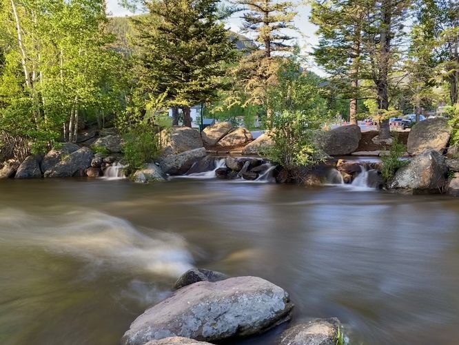
Waterfall
There's a scenic cascade built into the Sensory Garden section of the Riverwalk, located around mile 0.1 in this track data -- or located on the west side of East Riverside Drive. These short cascades are simply a nice change of pace from the rushing river, however, compared to the big waterfalls in Rocky Mountain National Park and elsewhere, they don't compare.
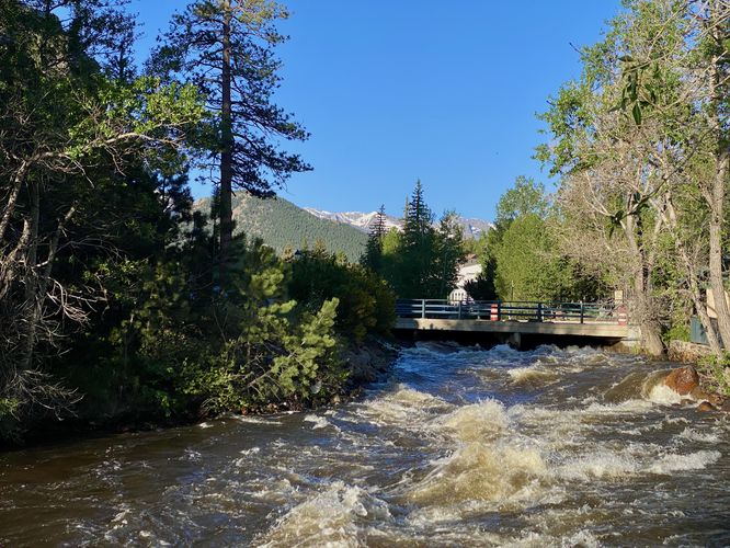
Views
Despite being in downtown Estes Park, walkers will still find views of Fall River and even some of the snow-capped mountains in Rocky Mountain National Park from the trail. A nice view up river can be found around mile 0.2 along this route.
Walk
This is not a hike but rather a stroll through downtown Estes Park along the Riverwalk Trail. The Riverwalk connects to several different points in Estes Park, including the Lake Estes Trail - if you walk far enough. This section of the trail begins on the east side of Moraine Ave and runs along Fall River until reaching the tunnel at US-34, about a half-mile down. During our walk here, we decided to check out the Riverwalk, but also grab some coffee -- killing two birds with one stone. At the time we grabbed a bite to eat at the River Walk Cafe and then snagged an espresso and ice coffee from Kind Coffee, making for a peaceful 0.9-mile morning walk.
Universal Access
This trail is universally accessible and follows a paved or concrete pathway. Note that there are road crossings with crosswalks - some of which you may need to use additional sidewalks if the trail crossings are not fully accessible.
Parking
Visitors to downtown Estes Park will find plenty of parking lots (paid) around town. The GPS coordinates provided will bring you to one parking lot near the "trailhead" for this track. Note that there are many ways to hop on the Estes Park Riverwalk, so if this parking lot is full, drive around until you find an empty one.
Pets
Dogs are allowed only if leashed and if cleaned up after.
Waterfall
There's a scenic cascade built into the Sensory Garden section of the Riverwalk, located around mile 0.1 in this track data -- or located on the west side of East Riverside Drive. These short cascades are simply a nice change of pace from the rushing river, however, compared to the big waterfalls in Rocky Mountain National Park and elsewhere, they don't compare.
Views
Despite being in downtown Estes Park, walkers will still find views of Fall River and even some of the snow-capped mountains in Rocky Mountain National Park from the trail. A nice view up river can be found around mile 0.2 along this route.