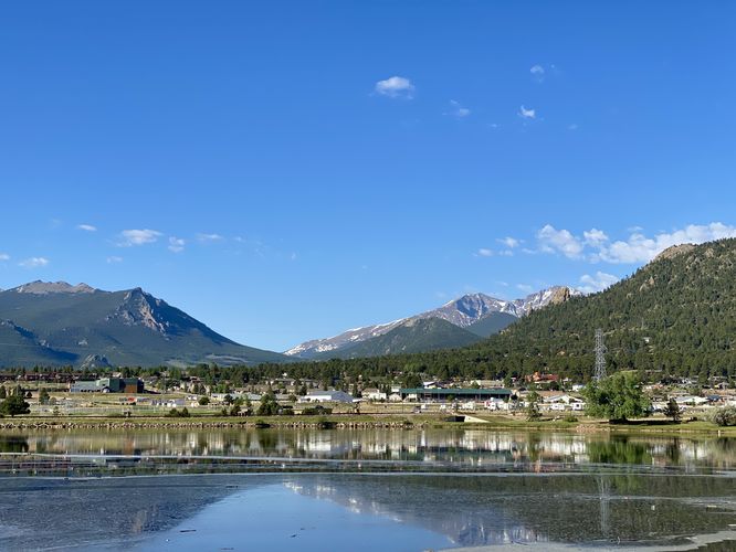
The Lake Estes Trail in Estes Park, Colorado is an easy 0.9-mile out-and-back walk that features views of the snow-capped mountains within Rocky Mountain National Park, Mount Olympus, Mount Pisgah, and of course the scenic Lake Estes.
Universal Access
This trail is universally accessible and follows a paved pathway along the north shore of Lake Estes.
Walk
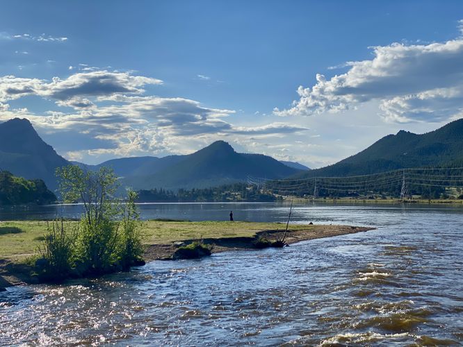
This is not a hike but rather a short section of the much-longer Lake Estes Trail. This route brings visitors from the main parking lot, located at the end of Lakefront Street, to the western section of the lake. During our walk here in early June 2024, there was an aggressive elk nearby, so the trail was closed-off just beyond the footbridge that spans the Big Thompson River. From the footbridge, walkers will find a nice view of the Big Thompson River and spots to fish from the bridge or just off of the main trail along dirt pathways that lead along additional shoreline.
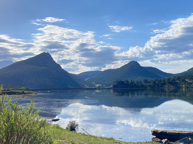
The walk heading east provides stunning views of Mount Olympus and Mount Pisgah as the tower over the eastern side of Lake Estes. Walkers, and more importantly fisherman, will find a lookout platform along this section of the trail that provides access to slightly-deeper waters for casting further into the lake.
While the trail continues onward, beyond the resort area, we turned around just before the main resort building to head back to parking. While on the walk back to parking, you'll be able to enjoy more of the snow-capped mountains that comprise Rocky Mountain National Park.
Fishing
Lake Estes is a very-popular fishing spot for locals and tourists alike.
Parking
Hikers will find a large parking lot at the coordinates provided, located at the end of Lakefront Street in Estes Park. The parking lot is large enough to fit a few dozen vehicles.
Pets
Dogs are allowed only if leashed or under total control through voice command (per rules and regulations as of June 2024). Important: Dogs are not allowed on this trail during elk calving season.
Universal Access
This trail is universally accessible and follows a paved pathway along the north shore of Lake Estes.
Walk
This is not a hike but rather a short section of the much-longer Lake Estes Trail. This route brings visitors from the main parking lot, located at the end of Lakefront Street, to the western section of the lake. During our walk here in early June 2024, there was an aggressive elk nearby, so the trail was closed-off just beyond the footbridge that spans the Big Thompson River. From the footbridge, walkers will find a nice view of the Big Thompson River and spots to fish from the bridge or just off of the main trail along dirt pathways that lead along additional shoreline.
The walk heading east provides stunning views of Mount Olympus and Mount Pisgah as the tower over the eastern side of Lake Estes. Walkers, and more importantly fisherman, will find a lookout platform along this section of the trail that provides access to slightly-deeper waters for casting further into the lake.
While the trail continues onward, beyond the resort area, we turned around just before the main resort building to head back to parking. While on the walk back to parking, you'll be able to enjoy more of the snow-capped mountains that comprise Rocky Mountain National Park.
Fishing
Lake Estes is a very-popular fishing spot for locals and tourists alike.
Parking
Hikers will find a large parking lot at the coordinates provided, located at the end of Lakefront Street in Estes Park. The parking lot is large enough to fit a few dozen vehicles.
Pets
Dogs are allowed only if leashed or under total control through voice command (per rules and regulations as of June 2024). Important: Dogs are not allowed on this trail during elk calving season.