Loading...

🎆 50% off 4th of July sale on Supporter Accounts — now through July 6! Learn More.

Dilworth Trail

Directions
Map
Pictures
Send to App
Distance:
0.6 Miles / 1.0 km
Type:
One-Way
Difficulty:
Moderate
Time to Hike:
~18 minutes
Features:
Surface Type:
Dirt
Park:
Emerald View Park
Town:
Pittsburgh, Pennsylvania
Directions:
40.424833, -80.01512
Added:
March 20, 2018
Updated:
January 25, 2024
Copy Trail Link Hiking this trail? Send a friend or family member a link to this trail guide for your own safety. Hike at your own risk (disclaimer)
Loading...
Loading...
138'

Total Change
132'

Ascent
132'

Descent

Download the Trail Route for Offline Use

Supporters get exclusive access to download trail routes to the MyHikes app for offline use. Stay prepared on your adventure, even without an internet connection! Become a Supporter today to unlock this feature and hike with confidence.

Send to App

Dilworth Trail

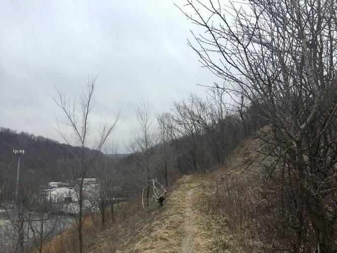
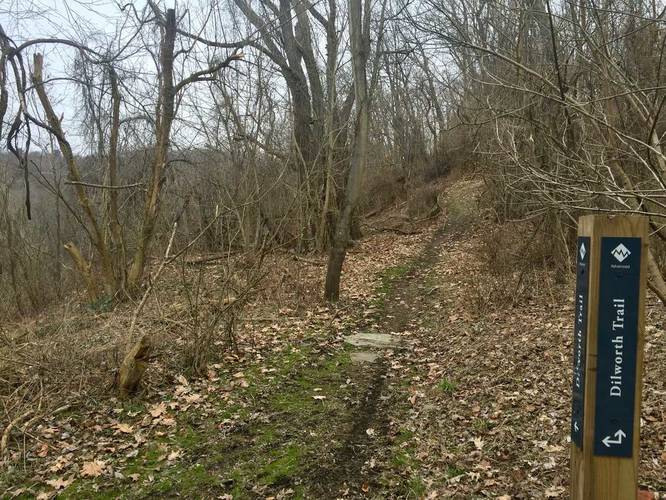
The Dilworth Trail at Emerald View Park in Pittsburgh, Pennsylvania is a moderate 0.6 mile one-way trail that heads down the slopes of Mt Washington Park. The trail starts along the Emerald View Trail and connects back to it. There are various switchbacks on this trail, which make it a moderate hike.

On the flatter ground of the trail, you'll notice a decent amount of old debris, mostly tires. This land was used as a dump for a long time before being cleaned out in about 2006. Over 100,000 tires were removed from the project, but some can still be found. Most noteably, many trees have grown through the tires, leaving whole intact tires resting around the base of tree stumps that are over 20 years old.

Pets
Dogs are allowed only if leashed and must be cleaned up after.

Biking
Biking is permitted but likely a bit difficult on this trail.
Explore 219 trails near Pittsburgh, PA
  1. Parking

    40.424833, -80.01512
  2. Main Trailhead

    40.42538, -80.017469
  3. Obstructed view of the neighborhoods downhill from the trail

    40.425111, -80.018456
    Obstructed view of the neighborhoods downhill from the trail
  4. Trail junction

    40.423356, -80.014031
    Trail junction
No community routes found. To add your own hike as a Community Route for this Trail guide, leave a Trip Report with an attached GPX file.

Hazards

Ticks - Lyme Disease More Info (CDC)

Seasons

All

Photo Albums

Trip Reports

Trail Guide By:
Admin user profile picture
0.6 miles / 1.0 km
0.6 miles / 1.0 km
March 17, 2018
Hiking

Weather Forecast

In Pittsburgh, PA

Explore Hiking Trails

You May Also Like

Colorado's Million Dollar Highway - Plan a day's drive adventure along the iconic Million Dollar Highway in Colorado. Explore the best short trails, roadside stops, waterfalls, vistas, ghost towns, and hot springs within a ~6 hour road trip.
Explore

Colorado's Million Dollar Highway

Plan a day's drive adventure along the iconic Million Dollar Highway in Colorado. Explore the best short trails, roadside stops, waterfalls, vistas, ghost towns, and hot springs within a ~6 hour road trip.

Read
New York's Best Waterfalls - Whether you're planning a day hike, roadside stop, or a leisurely short walk, this guide provides hikers, travelers, and locals alike with 63 different locations to over 100 scenic waterfalls to help plan your next adventure!
Explore

New York's Best Waterfalls

Whether you're planning a day hike, roadside stop, or a leisurely short walk, this guide provides hikers, travelers, and locals alike with 63 different locations to over 100 scenic waterfalls to help plan your next adventure!

Read

Before you boogie...

Find our trail guides useful? Consider becoming a Supporter to unlock perks!

MyHikes is an indie platform that makes exploring public trails easier for everyone. The platform has no investors, no ads, and is owned and operated by one person, Dave Miller. Dave has personally mapped and written over 1,800 trail guides on MyHikes for the public to explore. MyHikes has helped millions outdoor enthusiasts plan their next adventure.

But it takes a lot of time 🕦, money 💰, work, and espresso shots ☕ to run MyHikes, including hiking , mapping , writing , and publishing new trails with high-quality (accurate) information... along with software engineering (coding) the platform like building new features, website and mobile app development (iOS and Android), site maintainance . and much much more.

Supporters unlock website and mobile app perks with an annual one-time payment of $25 (you renew) 😎👍. Or you can simply make a Donation of your choice. Otherwise, you can support us by telling your friends about MyHikes - both quick and free 🎉

Admin user profile picture

Dave Miller
MyHikes Founder