Loading...

Distance:
6.0 Miles / 9.7 km
Type:
Out-and-Back
Difficulty:
Easy
Time to Hike:
3 hours
Features:
Surface Type:
Universal Access
Park:
Three Rivers Heritage Trail
Town:
Pittsburgh, Pennsylvania
Directions:
40.426204, -79.952964
Added:
January 28, 2018
Updated:
January 23, 2020
Loading...
Loading...
95 '

Total Change
319 '

Ascent
319 '

Descent

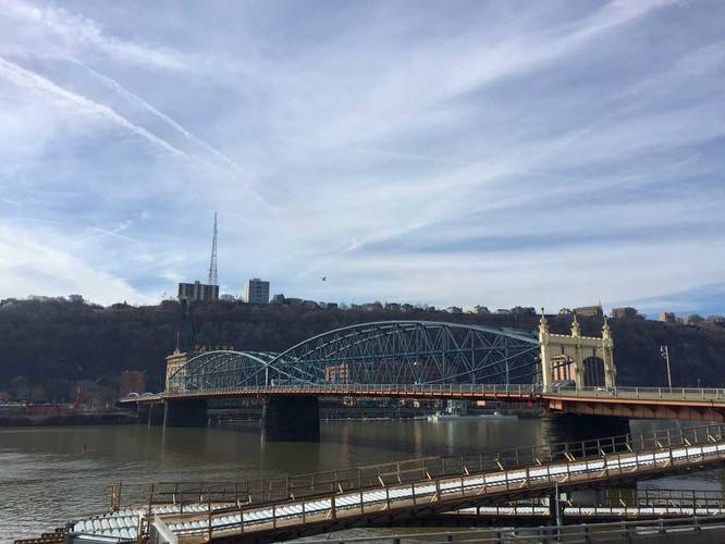
The Eliza Furnace Trail, part of the Three Rivers Heritage Trail in Pittsburgh, Pennsylvania is an easy 6 mile out-and-back hike that leads from the southwest corner of Schenley Park to Point State Park and the Downtown section of the TRHT and back. The trail is flat and paved the entire way. This section of the TRHT is less popular than the North Shore Riverfront Trail or the Station Square Trail since there aren't as many views. The trail runs along the Monongahela River with views of South Side, the Hot Metal Bridge, Liberty Bridge, the Smithfield Street Bridge, and Mount Washington.

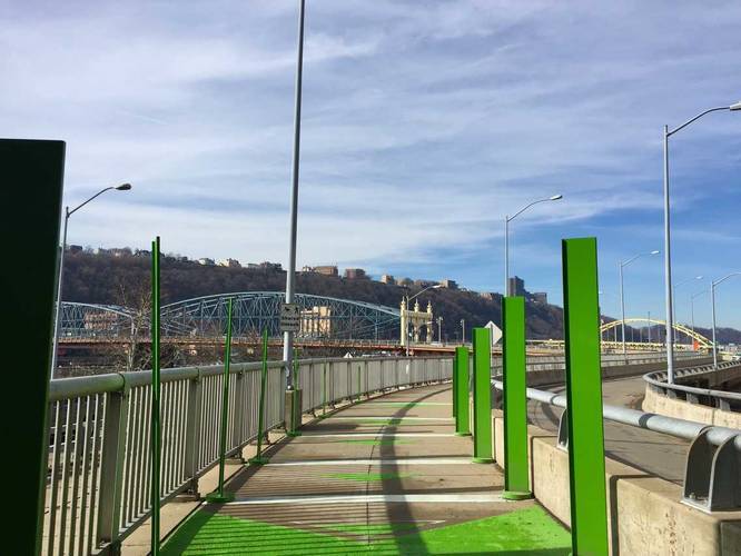
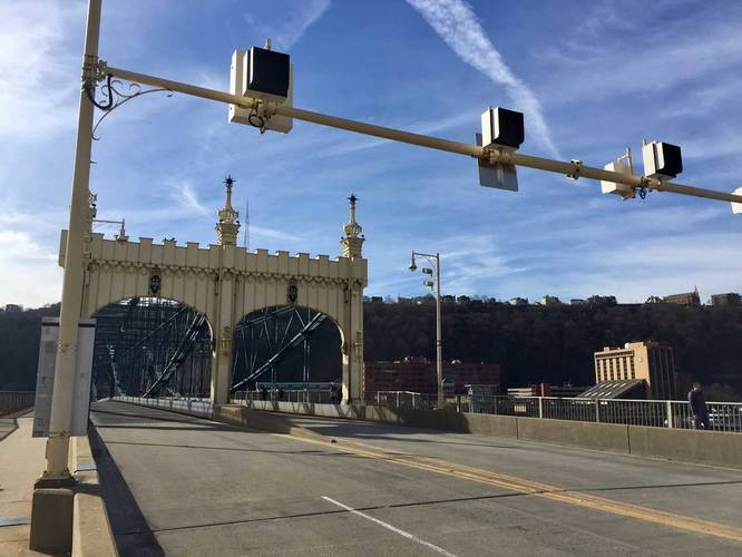
One downside to this trail is that it runs along I-376, so it's noisy throughout almost the entire hike. When you reach the Smithfield Street Bridge, the trail becomes harder to find as it follows sidewalks, but you can follow the green bike signs with arrows to 'Point State Park' to stay on the trail.

Parking: Parking can be found at the parking lot by the coordinates provided. Turn off of Second Ave and onto the dead end road - you'll see signs for trailhead parking. Parking is free and has a 3-hour limit from 8AM to 6PM, except on Sundays.

Explore 219 trails near Pittsburgh, PA
  1. Parking

    40.426204, -79.952964
  2. Main Trailhead

    40.426048, -79.953402
  3. View of the Smithfield Bridge

    40.435936, -79.999336
    View of the Smithfield Bridge
  4. Smithfield Bridge

    40.436103, -80.000153
    Smithfield Bridge
  5. Smithfield Bridge

    40.436153, -80.001197
    Smithfield Bridge
No community routes found. To add your own hike as a Community Route for this Trail guide, leave a Trip Report with an attached GPX file.

Hazards

Ticks - Lyme Disease More Info (CDC)

Seasons

All

Weather Forecast

In Pittsburgh, PA

Explore Hiking Trails

New Hikes

Boulder Falls Trail
0.2 Miles
0.3 km
Moderate
Out-and-Back
Hidden Valley Creek Trail
0.3 Miles
0.5 km
Easy
Out-and-Back
Lake Estes Trail
0.9 Miles
1.4 km
Easy
Out-and-Back
West Rim Trail (Stony Brook)
0.7 Miles
1.1 km
Moderate
One-Way

Before you boogie...

Find our trail guides useful? Consider becoming a Supporter to unlock perks!

MyHikes is an indie platform that makes exploring public trails easier for everyone. The platform has no investors, runs no ads, and is owned and operated by one person, Dave Miller. Dave has personally mapped and written over 1,600 trail guides on MyHikes for the public to explore. As of 2024, MyHikes has helped over 1,300,000 outdoor enthusiasts plan their next adventure.

But it takes a lot of time 🕦, money 💰, and work, and espresso shots ☕ to run MyHikes, including hiking , mapping , writing , and publishing new trails with high-quality (accurate) information... along with software engineering (coding) the platform like building new features, site and mobile app development for iOS and Android, site maintainance . and much much more.

Supporters unlock website and mobile app perks with an annual one-time payment of $25 (you renew) 😎👍. Or you can simply make a Donation of your choice. Otherwise, you can support us by telling your friends about MyHikes - both quick and free 🎉

Admin user profile picture

Dave Miller
MyHikes Founder