The East Point Sanctuary Trail at East Point Sanctuary in Biddeford, Maine is an easy 1.5-mile out-and-back hike that features beautiful views of the Wood Island Lighthouse and Biddeford's rocky coastline.
Hike
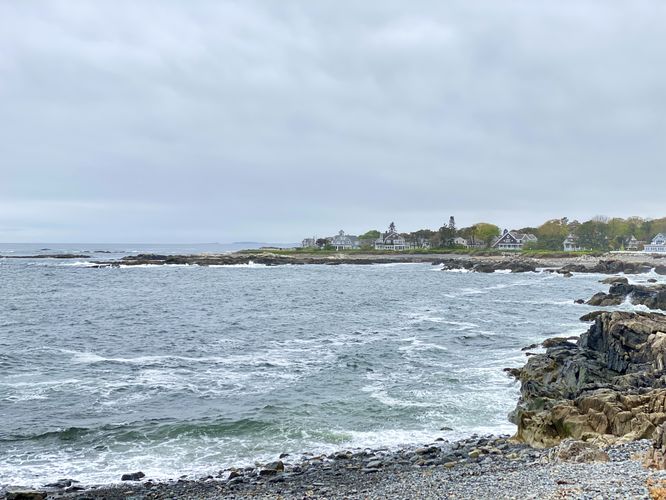
This hike begins at the main trailhead for East Point Sanctuary, located near the eastern end of Lester B Orcutt Blvd. The trail passes between two private residences before it reaches a main information kiosk about the sanctuary before dipping back into the forest, passing a golf course and private houses along the way. Hikers will exit the forest and be presented with an open ocean-side meadow that spans the sanctuary. Here, you'll find southward views of the Atlantic Ocean and Biddeford's coastline. The trail then leads out to the eastern most point within East Point Sanctuary to reach more views of Maine's rocky coastline.
Wood Island Lighthouse Views - Mile 0.4 to 0.7
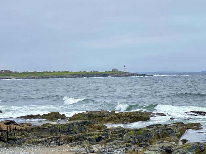
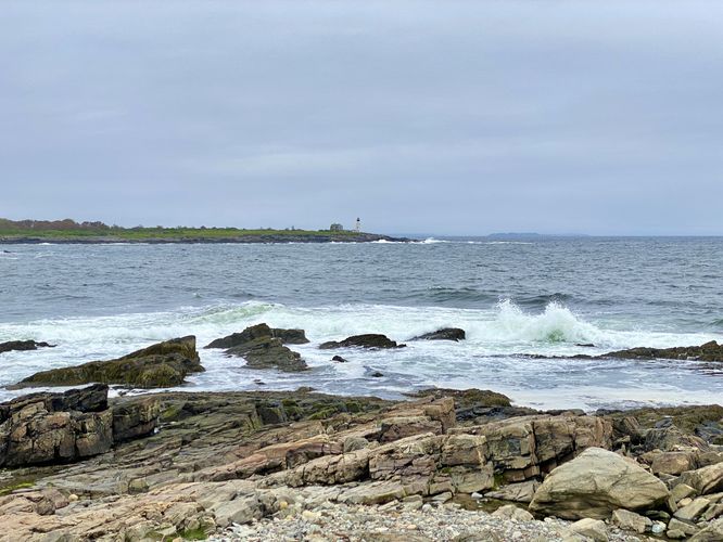
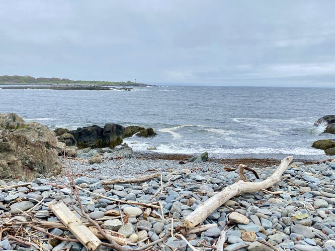
Once you enter the open meadow, you'll find the Wood Island Lighthouse sitting offshore on Wood Island, located to the north; however, if you explore the southern section of the trail first, you'll wind up at the eastern-most point around mile 0.4, where the best views of the lighthouse begin. The views of the Wood Island Lighthouse run from mile 0.4 to 0.7 as the trail skirts the northern boundaries of the sanctuary. Hikers will find several different viewpoints located on offshoot trails that lead to the rocky coastline or to small drop-offs along the coast.
Forest Loop - Mile 0.75 to 0.95
The last section of this trail is a forest loop that lasts for about 0.2 miles, from mile 0.75 to 0.95. The loop has nothing interesting or spectacular to see or find; we ended up hiking this out of curiosity and due to my completionist mindset; however, most visitors will want to skip this part of the trail unless you like overgrown trails with potential opportunities to get poison ivy.
Hike Out - Mile 0.95 to 1.5
After exploring the trail in-full (if you wish) the hike back to parking is short and mostly flat. This route leads from the loop, located at the end of the path, back to parking to complete this beautiful ocean-side hike at 1.5-miles long.
Parking
Hikers will find minimal parking opportunities, located along Lester B Orcutt Blvd. At the coordinates provided, on the south side of the road, are dirt parking turnouts that can fit about 4 - 6 vehicles, max, located along a black fenceline (as of May 2024). At the trailhead, without blocking the gate, 2 small vehicles can fit in the grassy turnout provided. These 5 - 7 parking spaces are the only public parking spots for East Point Sanctuary. During off-season, they fill-up quickly and during the summer it's even worse. Please be respectful of the private community here and only park in the designated spaces.
Pets
Dogs are not allowed on this trail.
Warning
Poison ivy: This trail has a plethora of poison ivy, mostly located on the northern section of the trail with views of the Wood Island Lighthouse. To avoid most of the poison ivy, you can stay within the triangular-loop section of the trail, located on the eastern-most point. You'll get the best views here while avoiding the most offensive sections of poison ivy (as of May 2024).
Hike
This hike begins at the main trailhead for East Point Sanctuary, located near the eastern end of Lester B Orcutt Blvd. The trail passes between two private residences before it reaches a main information kiosk about the sanctuary before dipping back into the forest, passing a golf course and private houses along the way. Hikers will exit the forest and be presented with an open ocean-side meadow that spans the sanctuary. Here, you'll find southward views of the Atlantic Ocean and Biddeford's coastline. The trail then leads out to the eastern most point within East Point Sanctuary to reach more views of Maine's rocky coastline.
Wood Island Lighthouse Views - Mile 0.4 to 0.7
Once you enter the open meadow, you'll find the Wood Island Lighthouse sitting offshore on Wood Island, located to the north; however, if you explore the southern section of the trail first, you'll wind up at the eastern-most point around mile 0.4, where the best views of the lighthouse begin. The views of the Wood Island Lighthouse run from mile 0.4 to 0.7 as the trail skirts the northern boundaries of the sanctuary. Hikers will find several different viewpoints located on offshoot trails that lead to the rocky coastline or to small drop-offs along the coast.
Forest Loop - Mile 0.75 to 0.95
The last section of this trail is a forest loop that lasts for about 0.2 miles, from mile 0.75 to 0.95. The loop has nothing interesting or spectacular to see or find; we ended up hiking this out of curiosity and due to my completionist mindset; however, most visitors will want to skip this part of the trail unless you like overgrown trails with potential opportunities to get poison ivy.
Hike Out - Mile 0.95 to 1.5
After exploring the trail in-full (if you wish) the hike back to parking is short and mostly flat. This route leads from the loop, located at the end of the path, back to parking to complete this beautiful ocean-side hike at 1.5-miles long.
Parking
Hikers will find minimal parking opportunities, located along Lester B Orcutt Blvd. At the coordinates provided, on the south side of the road, are dirt parking turnouts that can fit about 4 - 6 vehicles, max, located along a black fenceline (as of May 2024). At the trailhead, without blocking the gate, 2 small vehicles can fit in the grassy turnout provided. These 5 - 7 parking spaces are the only public parking spots for East Point Sanctuary. During off-season, they fill-up quickly and during the summer it's even worse. Please be respectful of the private community here and only park in the designated spaces.
Pets
Dogs are not allowed on this trail.
Warning
Poison ivy: This trail has a plethora of poison ivy, mostly located on the northern section of the trail with views of the Wood Island Lighthouse. To avoid most of the poison ivy, you can stay within the triangular-loop section of the trail, located on the eastern-most point. You'll get the best views here while avoiding the most offensive sections of poison ivy (as of May 2024).