The East Four Mile Interpretive Site at Canyon Pintado National Historical District south of Rangely, Colorado is an easy 0.2-mile out-and-back walk that features views into the canyon of East Four-Mile Draw.
Walk
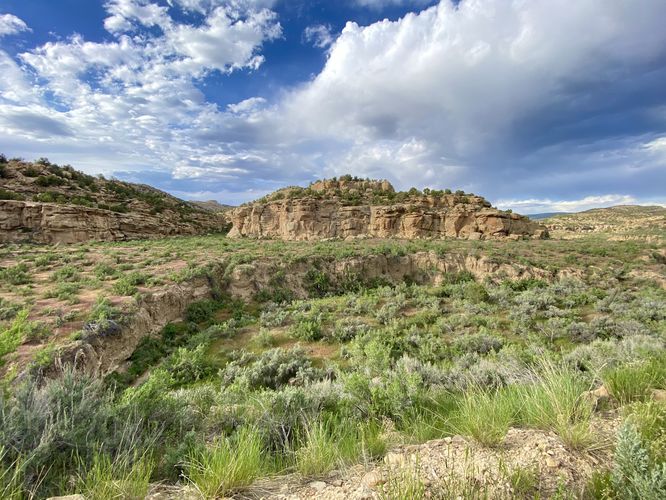
This very short section of the much-longer (1.2-mile loop) East Four-Mile Draw loop leads visitors out toward the edge of the shallow canyon. The trail leads out to several petroglyphs spots and an abandoned cowboy canyon used by the long-forgotten Philadelphia Cattle Company. Note that the mileage in this route is very short as we didn't have enough time or sunlight on a long road trip drive to hike the entire loop. If you wish to complete the loop, check the trail map or interpretive signs at the trailhead for more details.
Parking
Hikers will find a large parking lot at the coordinates provided, located on the east side of CO-139. The lot is large enough to fit about a dozen vehicles.
Pets
Dogs are allowed only if leashed and must be cleaned up after.
Warning
Ancient petroglyphs: This trail leads beyond the recorded route provided to ancient petroglyphs and pictographs that were created hundreds of years ago. Please do not touch or attempt to disturb in any way. Only take photos and appreciate the ancient artwork from behind the barriers.
Sun exposure: This trail has very little shade and no water sources. Pack-in all water and wear sun screen and a hat to protect against sun exposure. It's smart to hike either in the early morning or late afternoon to avoid the intense sun.
No water: This trail has no water sources so you must pack-in all water. A general rule of thumb in the desert is 1 gallon of water per person per day.
Rattlesnakes: This trail leads through rattlesnake territory, so be on the lookout and give any rattlers you find plenty of space.
Rockfall: This trail passes under a rock cliff that can occasionally have rockfall activity.
Walk
This very short section of the much-longer (1.2-mile loop) East Four-Mile Draw loop leads visitors out toward the edge of the shallow canyon. The trail leads out to several petroglyphs spots and an abandoned cowboy canyon used by the long-forgotten Philadelphia Cattle Company. Note that the mileage in this route is very short as we didn't have enough time or sunlight on a long road trip drive to hike the entire loop. If you wish to complete the loop, check the trail map or interpretive signs at the trailhead for more details.
Parking
Hikers will find a large parking lot at the coordinates provided, located on the east side of CO-139. The lot is large enough to fit about a dozen vehicles.
Pets
Dogs are allowed only if leashed and must be cleaned up after.
Warning
Ancient petroglyphs: This trail leads beyond the recorded route provided to ancient petroglyphs and pictographs that were created hundreds of years ago. Please do not touch or attempt to disturb in any way. Only take photos and appreciate the ancient artwork from behind the barriers.
Sun exposure: This trail has very little shade and no water sources. Pack-in all water and wear sun screen and a hat to protect against sun exposure. It's smart to hike either in the early morning or late afternoon to avoid the intense sun.
No water: This trail has no water sources so you must pack-in all water. A general rule of thumb in the desert is 1 gallon of water per person per day.
Rattlesnakes: This trail leads through rattlesnake territory, so be on the lookout and give any rattlers you find plenty of space.
Rockfall: This trail passes under a rock cliff that can occasionally have rockfall activity.