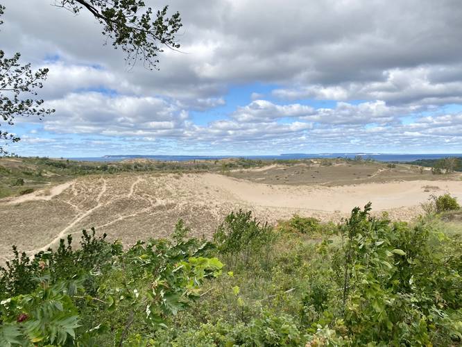
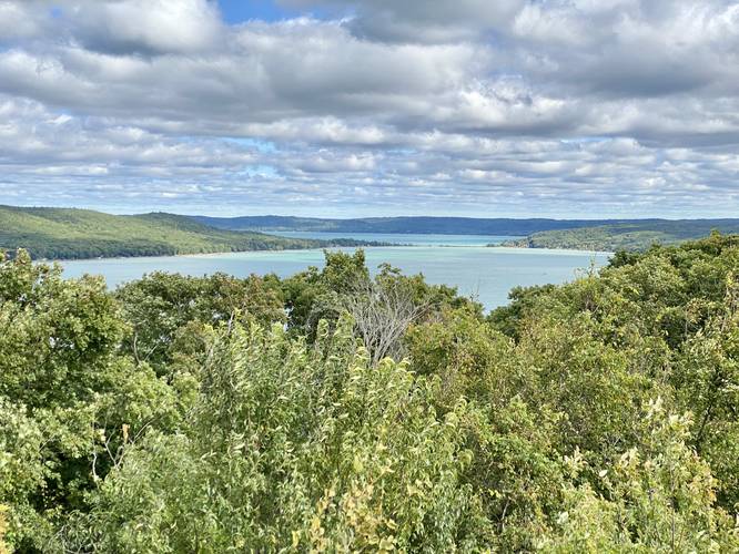
The Dune Overlook at Sleeping Bear Dunes National Lakeshore in Glen Arbor, Michigan is an easy 0.2-mile out-and-back walk that leads to a panoramic vista of the dunes, Lake Michigan, the Manitou Islands, and Little Glen Lake.
Universal Access
This is a universal access trail that follows a paved path.
Walk Description
This is not a hike, but rather a paved walk that leads to the panoramic vista above the Sleeping Bear dunes. From the view, visitors are provided with a scenic overlook that includes views of the turquoise waters of Little Glen Lake, Lake Michigan in the distance, a scenic farm between the two bodies of water, dunes, and finally, the Manitou Islands that sit ~10-miles offshore.
Pierce Stocking Scenic Drive
This walk is part of the Piece Stocking Scenic Drive within the Sleeping Bear Dunes National Lakeshore. An entry fee is required.
Parking & Fees
Hikers will find parking at the coordinates provided. The lot is large enough to fit about a dozen vehicles. As of September 2022, there was a $25 entry fee for the Pierce Stocking Scenic Drive, but also gives hikers access to other trails at the park.
Pets
According to the official site, dogs are not prohibited from trails within the Pierce Stocking Scenic Drive. Please keep your dog on a leash and carry out their waste.