Loading...

🎉 Enjoy a Free 7-Day Supporter Trial and Unlock Exclusive Perks — No Credit Card Required. Learn more.

Dufresne White & Green Loop

Directions
Map
Pictures
Send to App
Distance:
0.8 Miles / 1.3 km
Type:
Loop
Difficulty:
Easy
Time to Hike:
~24 minutes
Features:
Surface Type:
Dirt
Park:
Dufresne Recreation Area
Town:
Granby, Massachusetts
Directions:
42.258375, -72.500963
Added:
October 06, 2021
Updated:
April 04, 2022
Copy Trail Link Hiking this trail? Send a friend or family member a link to this trail guide for your own safety. Hike at your own risk (disclaimer)
Loading...
Loading...
134'

Total Change
247'

Ascent
181'

Descent

Download the Trail Route for Offline Use

Supporters get exclusive access to download trail routes to the MyHikes app for offline use. Stay prepared on your adventure, even without an internet connection! Become a Supporter today to unlock this feature and hike with confidence.

Send to App

Dufresne White & Green Loop

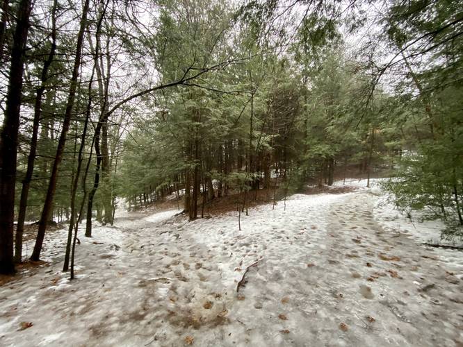
The White & Green Loop at Dufresne Recreation Area / Dufresne Park in Granby, Massachusetts is an easy 0.8-mile loop trail that features a peaceful walk through the woods.

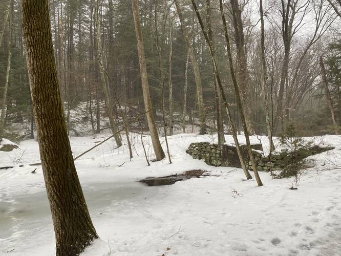
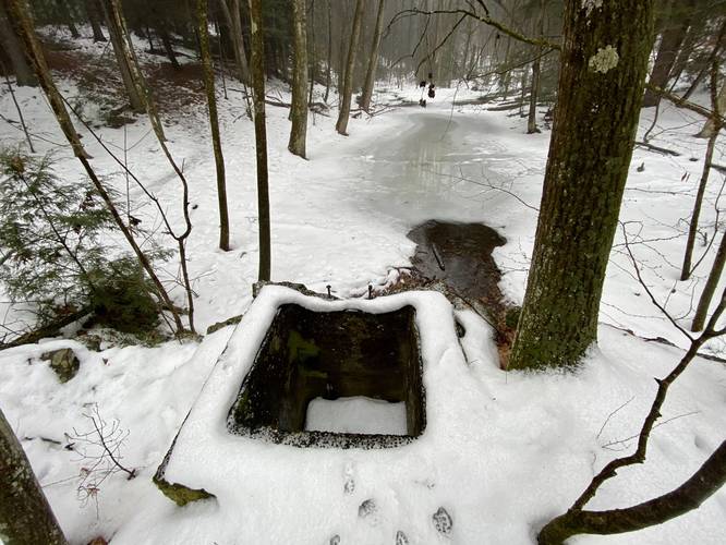
This track begins at the main trailhead and heads south first follow white blazes and then turning to follow green blazes, looping in a clockwise fashion. The trail passes a small pond with a small old concrete foundation that appears to have been used in junction with the pond and culvert at some point in time, but it's difficult to tell why this structure exists.

The green trail then loops back to the white blazed trail to complete the loop.

Parking
Hikers will find parking at the coordinates provided. There's a large parking lot located right next to the trailhead that can accommodate many dozen vehicles.

Pets
Dogs are allowed if leashed and their waste must be carried out by the hiker.

Biking
Biking is allowed on this trail.
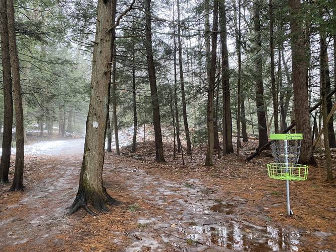
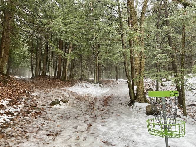
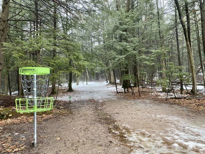
Disc Golf
This trail follows several disc golf courses along the way.
Explore 208 trails near Granby, MA
  1. Parking

    42.258375, -72.500963
  2. Main Trailhead

    42.257747, -72.501
  3. White blaze trail with disc golf course

    42.257733, -72.501
    White blaze trail with disc golf course
  4. White blaze trail with disc golf course

    42.256864, -72.501136
    White blaze trail with disc golf course
  5. Pond with rock wall

    42.254731, -72.501106
    Pond with rock wall
  6. Old concrete structure at pond

    42.254825, -72.501289
    Old concrete structure at pond
  7. Green blaze trail with disc golf course

    42.255906, -72.502128
    Green blaze trail with disc golf course
  8. Stay left

    42.256339, -72.501128
    Stay left
No community routes found. To add your own hike as a Community Route for this Trail guide, leave a Trip Report with an attached GPX file.

Hazards

Ticks - Lyme Disease More Info (CDC)
Poison Ivy/Oak

Seasons

All

Blaze Color

Green

Weather Forecast

In Granby, MA

Explore Hiking Trails

You May Also Like

Colorado's Million Dollar Highway - Plan a day's drive adventure along the iconic Million Dollar Highway in Colorado. Explore the best short trails, roadside stops, waterfalls, vistas, ghost towns, and hot springs within a ~6 hour road trip.
Explore

Colorado's Million Dollar Highway

Plan a day's drive adventure along the iconic Million Dollar Highway in Colorado. Explore the best short trails, roadside stops, waterfalls, vistas, ghost towns, and hot springs within a ~6 hour road trip.

Read
Glacier's Going-to-the-Sun Road - Discover the breathtaking beauty of Glacier National Park along the iconic Going-to-the-Sun Road. From stunning roadside stops to picturesque waterfalls and vistas, this engineering marvel offers endless opportunities for exploration.
Explore

Glacier's Going-to-the-Sun Road

Discover the breathtaking beauty of Glacier National Park along the iconic Going-to-the-Sun Road. From stunning roadside stops to picturesque waterfalls and vistas, this engineering marvel offers endless opportunities for exploration.

Read
New York's Best Waterfalls - Whether you're planning a day hike, roadside stop, or a leisurely short walk, this guide provides hikers, travelers, and locals alike with 63 different locations to over 100 scenic waterfalls to help plan your next adventure!
Explore

New York's Best Waterfalls

Whether you're planning a day hike, roadside stop, or a leisurely short walk, this guide provides hikers, travelers, and locals alike with 63 different locations to over 100 scenic waterfalls to help plan your next adventure!

Read

Before you boogie...

Find our trail guides useful? Consider becoming a Supporter to unlock perks!

MyHikes is an indie platform that makes exploring public trails easier for everyone. The platform has no investors, no ads, and is owned and operated by one person, Dave Miller. Dave has personally mapped and written over 1,800 trail guides on MyHikes for the public to explore. MyHikes has helped millions outdoor enthusiasts plan their next adventure.

But it takes a lot of time 🕦, money 💰, work, and espresso shots ☕ to run MyHikes, including hiking , mapping , writing , and publishing new trails with high-quality (accurate) information... along with software engineering (coding) the platform like building new features, website and mobile app development (iOS and Android), site maintainance . and much much more.

Supporters unlock website and mobile app perks with an annual one-time payment of $25 (you renew) 😎👍. Or you can simply make a Donation of your choice. Otherwise, you can support us by telling your friends about MyHikes - both quick and free 🎉

Admin user profile picture

Dave Miller
MyHikes Founder