This tiny trail at the Dolly Sods Scenic Area in Tucker County, West Virginia is an easy 0.1 mile out-and-back walk to a lookout point along the edge of the Allegheny Plateau and Dolly Sods.
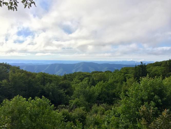
The edge of the Allegheny Plateau, called the Allegheny Front, is a ridge that spans from New York to Tennessee, which influences water flow and climate for a large portion of the east coast. From the end of the trail, you reach the edge of the plateau with views of the North Fork Mountain.
While here, be sure to check out the other Dolly Sods Lookout Trail, which is just a stones-throw longer, but has better views.
Parking: Parking can be found along FR-75 south of the Red Creek Campground and north of FR-19. Look for a brown sign with a lookout symbol.
Warning: Dolly Sods was used for military bombing training during WWII and there are still unexploded ordinances in the ground out in the wilderness. Most of these trails and the areas around them have been combed and searched, but not everything has been found. If you find any strange metal objects, especially bomb-shaped, do not tamper with them. Make a note of where you found it and alert the proper authorities. More information can be found at the wilderness trailheads.
Dolly Sods trail map PDF