The Bell Knob Lookout Tower Trail at the Dolly Sods Scenic Area in the Monongahela National Forest, West Virginia is an easy 1 mile out-and-back hike to an old deteriorating lookout tower and various campsites.
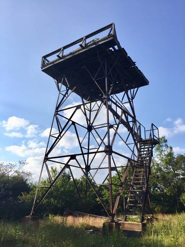
This trail is probably better for camping than it is for any hopes of a scenic view, until the tower is restored. Despite the trail's name, the lookout tower is a metal-framed structure with rotting wooden stairs and a rotting wooden deck platform 30 feet off the ground. Climbing the tower is not recommended - there's no cell phone service for at least a 45+ minute drive from this location, so if something goes wrong, you're on your own.
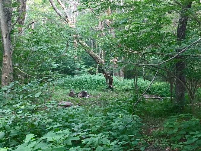
Regardless of the lookout tower itself, the trail is lightly trafficked. You'll find a couple of campsites along the trail and then one large campsite next to the tower itself at the turnaround point.
Warning: Dolly Sods was used for military bombing training during WWII and there are still unexploded ordinances in the ground out in the wilderness. Most of these trails and the areas around them have been combed and searched, but not everything has been found. If you find any strange metal objects, especially bomb-shaped, do not tamper with them. Make a note of where you found it and alert the proper authorities. More information can be found at the wilderness trailheads.
Dolly Sods trail map PDF
This trail is probably better for camping than it is for any hopes of a scenic view, until the tower is restored. Despite the trail's name, the lookout tower is a metal-framed structure with rotting wooden stairs and a rotting wooden deck platform 30 feet off the ground. Climbing the tower is not recommended - there's no cell phone service for at least a 45+ minute drive from this location, so if something goes wrong, you're on your own.
Regardless of the lookout tower itself, the trail is lightly trafficked. You'll find a couple of campsites along the trail and then one large campsite next to the tower itself at the turnaround point.
Warning: Dolly Sods was used for military bombing training during WWII and there are still unexploded ordinances in the ground out in the wilderness. Most of these trails and the areas around them have been combed and searched, but not everything has been found. If you find any strange metal objects, especially bomb-shaped, do not tamper with them. Make a note of where you found it and alert the proper authorities. More information can be found at the wilderness trailheads.
Dolly Sods trail map PDF