The Dixon Cave Trail at Mammoth Cave National Park in Kentucky is an easy 0.7 mile out-and-back trail that leads down to the collapse of the Dixon Cave entrance and the Historic Entrance at the park.
The trail initially starts by heading down a series of stairs before reaching a trail junction - to head towards the Mammoth Cave Historic Entrance, take a left-hand turn at this trail junction.
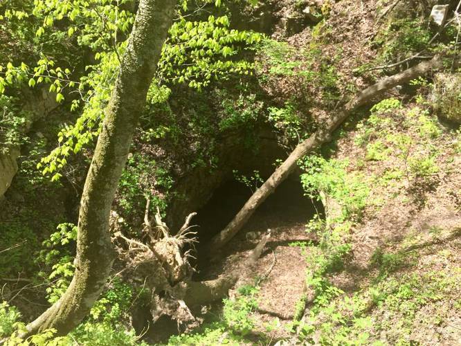
Dixon Cave: Before heading towards the Historic Entrance, head up the second set of stairs adjacent to the trail junction to a viewing platform of the Dixon Cave entrance. The entrance collapsed years ago, so it's mostly a sinkhole with various entrances for bats. There's also a breed of hibernating bats in the cave, which were most likely affected by the white-nose syndrome which wiped out 90% of the hibernating bat species at Mammoth Cave National Park within the last few years.
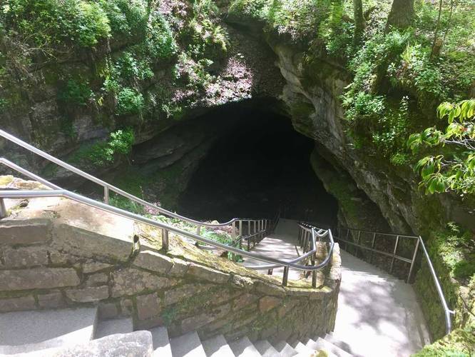
Continue further down the trail and it'll end at the Historic Entrance to Mammoth Cave.
Dogs are allowed on this trail.
Note: most surface trails at Mammoth Cave National Park have poison ivy on the sides of the trails during warmer months.
The trail initially starts by heading down a series of stairs before reaching a trail junction - to head towards the Mammoth Cave Historic Entrance, take a left-hand turn at this trail junction.
Dixon Cave: Before heading towards the Historic Entrance, head up the second set of stairs adjacent to the trail junction to a viewing platform of the Dixon Cave entrance. The entrance collapsed years ago, so it's mostly a sinkhole with various entrances for bats. There's also a breed of hibernating bats in the cave, which were most likely affected by the white-nose syndrome which wiped out 90% of the hibernating bat species at Mammoth Cave National Park within the last few years.
Continue further down the trail and it'll end at the Historic Entrance to Mammoth Cave.
Dogs are allowed on this trail.
Note: most surface trails at Mammoth Cave National Park have poison ivy on the sides of the trails during warmer months.