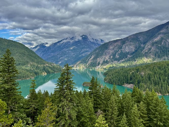
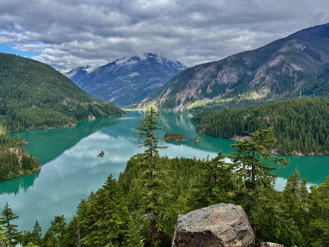
The Diablo Lake Overlook at North Cascades National Park near Diablo, Washington is an easy, universally-accessible 0.2-mile out-and-back walk that features panoramic views of turquoise waters and alpine mountains.
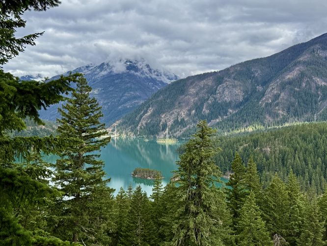
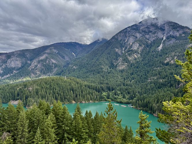
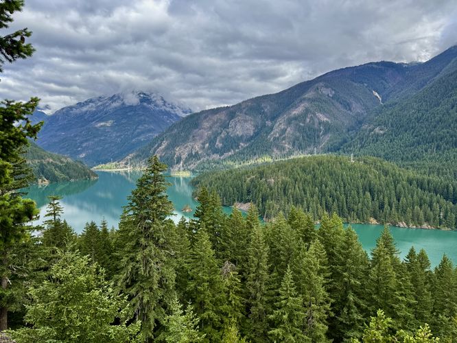
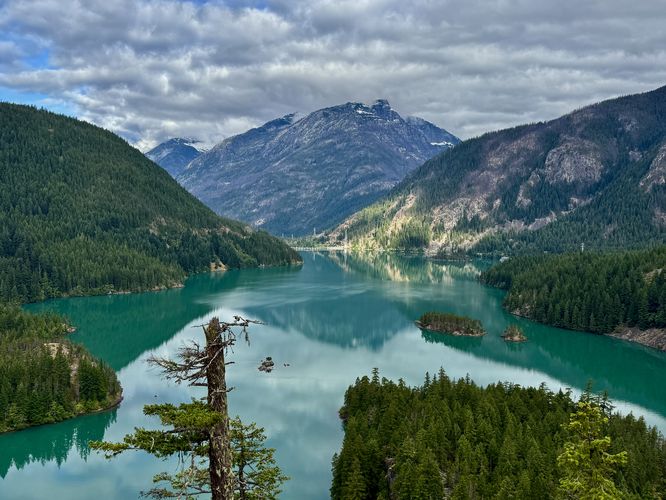
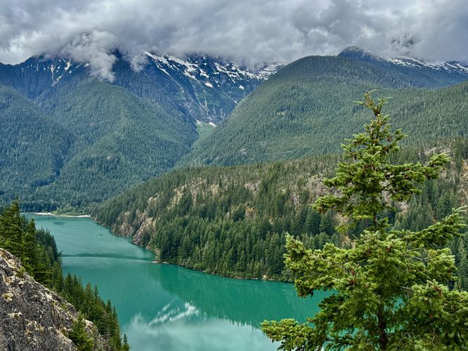
After exploring the eastern views, a walk to the western half of the Diablo Lake Overlook provides visitors with the best views of the lake, Davis Peak, and the alpine mountains that surround the Colonial Glacier. Slowly walk along the path to take in different perspectives and panoramic views of the turquoise water and its surrounding mountains. Located to the southwest are views of the alpine peaks that surround the Colonial Glacier, however, the glacier might be blanketed by clouds if you show up on a cloudy day.
Explore the Diablo Lake Overlook
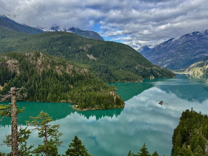
This short and easy walk is one of North Cascades National Park most-popular destinations for tourists and hikers alike. If you plan to visit the park, this overlook is a must-have on your bucket list. Starting on the east end of the overlook, you'll extend your walk a bit by exploring the "lesser" views of Diablo Lake first. While the views from the eastern end of the overlook are a bit less stunning than the westerly views, within just feet from the parking lot you'll be hit with views of turquoise water and alpine peaks that tower overhead. At the end of the eastern section, you'll find an obstructed view upstream of the Skagit River where its flow is blocked by the Ross Lake Dam.After exploring the eastern views, a walk to the western half of the Diablo Lake Overlook provides visitors with the best views of the lake, Davis Peak, and the alpine mountains that surround the Colonial Glacier. Slowly walk along the path to take in different perspectives and panoramic views of the turquoise water and its surrounding mountains. Located to the southwest are views of the alpine peaks that surround the Colonial Glacier, however, the glacier might be blanketed by clouds if you show up on a cloudy day.